Property Record
2945 Silver Dr, Columbus, OH 43224
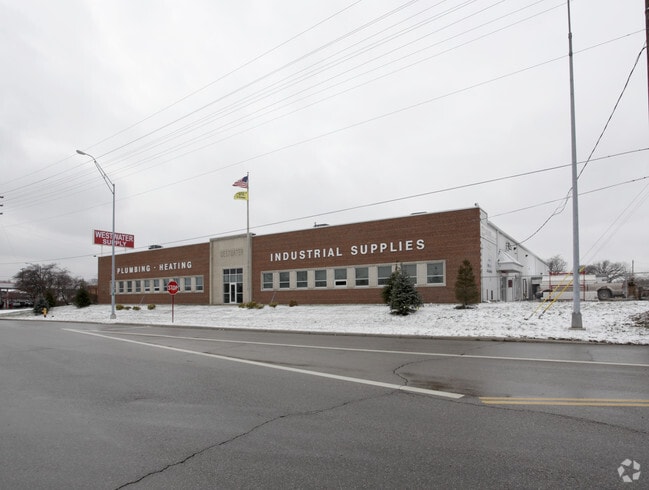


Property Detail
2945 Silver Dr
Columbus, OH
660 WEBER RD R18 T1 1/4T1-2 1.708 AC LOT 4
010-009783
Franklin
Industrialgeneral
Ohio
B and X Area of moderate flood hazard, usually the area between the limits of the 100-year and 500-year floods.
4
2024
2 AC
2025
N Central Columbus
000310
Columbus
27,864 SF
NEARBY LISTINGS FOR SALE OR LEASE
DEMOGRAPHICS near 2945 Silver Dr
1 mile
3 mile
5 mile
2025 Total Population
21,313
174,518
396,523
2030 Population
21,870
180,728
410,179
Pop Growth 2025-2030
+ 2.61%
+ 3.56%
+ 3.44%
Average Age
37
34
36
2025 Total Households
9,404
69,486
170,464
HH Growth 2025-2030
+ 2.72%
+ 3.76%
+ 3.69%
Median Household Inc
$67,011
$51,519
$62,216
Avg Household Size
2.20
2.20
2.20
2025 Avg HH Vehicles
2.00
2.00
2.00
Median Home Value
$278,833
$284,768
$336,322
Median Year Built
1950
1960
1967
Nearby Places
Map Layers
Map Styles
 Street
 Aerial
Layers
 Traffic
 Biking
Places
Listings with unknown addresses are not visible on the map
- Restaurants
- Banks
- Shops
- Fitness
- Groceries
PUBLIC TRANSPORTATION
AIRPORT
John Glenn Columbus International
Drive
Walk
Distance
John Glenn Columbus International
13 min
9.2 mi
Rickenbacker International
Drive
Walk
Distance
Rickenbacker International
27 min
18.3 mi
Freight Ports
Port of Toledo
Drive
Walk
Distance
Port of Toledo
178 min
145.1 mi
Nearby Properties
Address
Land Use
TOTAL SIZE
Lot Size
Zoning
Address
Land Use
TOTAL SIZE
Lot Size
Zoning
1,160,461 SF
328.10 AC
Address
Land Use
TOTAL SIZE
Lot Size
Zoning
3,462,019 SF
54.42 AC
Address
Land Use
TOTAL SIZE
Lot Size
Zoning
344,620 SF
291.96 AC
Address
Land Use
TOTAL SIZE
Lot Size
Zoning
382,270 SF
319.59 AC
Address
Land Use
TOTAL SIZE
Lot Size
Zoning
Address
Land Use
TOTAL SIZE
Lot Size
Zoning
1,099,074 SF
39.47 AC
Address
Land Use
TOTAL SIZE
Lot Size
Zoning
388,082 SF
12.41 AC
Address
Land Use
TOTAL SIZE
Lot Size
Zoning
1.64 AC
Address
Land Use
TOTAL SIZE
Lot Size
Zoning
378,522 SF
41.13 AC
Address
Land Use
TOTAL SIZE
Lot Size
Zoning
747,391 SF
3.15 AC
Address
Land Use
TOTAL SIZE
Lot Size
Zoning
4.90 AC
Address
Land Use
TOTAL SIZE
Lot Size
Zoning
2.25 AC
Address
Land Use
TOTAL SIZE
Lot Size
Zoning
240,144 SF
45.78 AC
Address
Land Use
TOTAL SIZE
Lot Size
Zoning
691,902 SF
12.34 AC
Address
Land Use
TOTAL SIZE
Lot Size
Zoning
767,328 SF
5.10 AC
Address
Land Use
TOTAL SIZE
Lot Size
Zoning
4.46 AC
Address
Land Use
TOTAL SIZE
Lot Size
Zoning
36.42 AC
Address
Land Use
TOTAL SIZE
Lot Size
Zoning
15,968 SF
10 AC
Address
Land Use
TOTAL SIZE
Lot Size
Zoning
34,200 SF
8.10 AC
Address
Land Use
TOTAL SIZE
Lot Size
Zoning
325,684 SF
2 AC
Address
Land Use
TOTAL SIZE
Lot Size
Zoning
24.14 AC
Address
Land Use
TOTAL SIZE
Lot Size
Zoning
10,368 SF
293.98 AC
Address
Land Use
TOTAL SIZE
Lot Size
Zoning
339,332 SF
1.42 AC
Address
Land Use
TOTAL SIZE
Lot Size
Zoning
0.99 AC
Address
Land Use
TOTAL SIZE
Lot Size
Zoning
1.39 AC
Address
Land Use
TOTAL SIZE
Lot Size
Zoning
349,372 SF
3.09 AC
Address
Land Use
TOTAL SIZE
Lot Size
Zoning
29,668 SF
1.32 AC
Address
Land Use
TOTAL SIZE
Lot Size
Zoning
255,831 SF
2.50 AC
Address
Land Use
TOTAL SIZE
Lot Size
Zoning
156,039 SF
4.23 AC
Address
Land Use
TOTAL SIZE
Lot Size
Zoning
230,354 SF
1.05 AC
The World's #1 Commercial Real Estate Marketplace
Connect with us
© 2026 CoStar Group
The information above has been obtained from sources believed reliable. While we do not doubt its accuracy we have not verified it and make no guarantee, warranty or representation about it. It is your responsibility to independently confirm its accuracy and completeness. Any projections, opinions, assumptions, or estimates used are for example only and do not represent the current or future performance of the property. The value of this transaction to you depends on tax and other factors which should be evaluated by your tax, financial, and legal advisors. You and your advisors should conduct a careful, independent investigation of the property to determine to your satisfaction the suitability of the property for your needs.