Property Record
2950 Miller Bottom Rd, Conyers, GA 30012
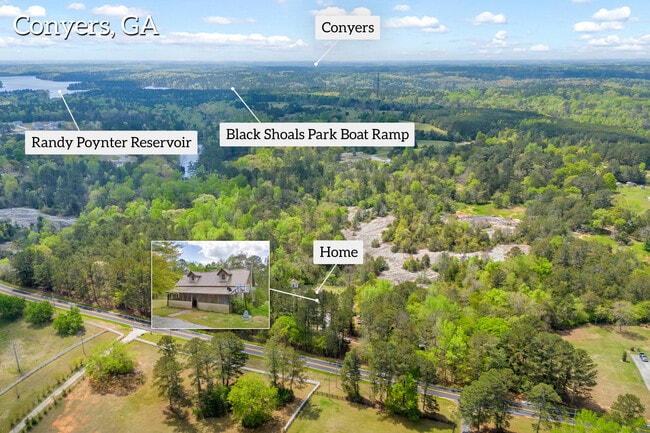


This Property Is For Sale
NEARBY LISTINGS FOR SALE OR LEASE
Property Detail
2950 Miller Bottom Rd
Atlanta-Sandy Springs-Roswell, GA
Walton
C011000000075000
Georgia
Sfr
12.36 AC
A
Walton County
13247C0040D
Atlanta
1,440 SF
DEMOGRAPHICS near 2950 Miller Bottom Rd
1 Mile
3 Mile
5 Mile
2024 Total Population
949
9,948
53,784
2029 Population
1,105
11,202
58,407
Pop Growth 2024-2029
+ 16.44%
+ 12.61%
+ 8.60%
Average Age
40
41
39
2024 Total Households
312
3,291
17,433
HH Growth 2024-2029
+ 16.67%
+ 12.79%
+ 8.83%
Median Household Inc
$100,750
$93,946
$84,880
Avg Household Size
3.00
3.00
3.00
2024 Avg HH Vehicles
3.00
3.00
2.00
Median Home Value
$296,987
$279,128
$258,241
Median Year Built
1998
1997
1998
Nearby Places
Map Layers
Map Styles
 Street
 Aerial
- Restaurants
- Banks
- Shops
- Fitness
- Groceries
PUBLIC TRANSPORTATION
AIRPORT
Hartsfield - Jackson Atlanta International
DRIVE
WALK
Distance
Hartsfield - Jackson Atlanta International
55 min
35.7 mi
Freight Ports
Georgia Ports - Savannah
DRIVE
WALK
Distance
Georgia Ports - Savannah
293 min
244.6 mi
Nearby Properties
Address
Land Use
TOTAL SIZE
Lot Size
Zoning
Address
Land Use
TOTAL SIZE
Lot Size
Zoning
362,852 SF
18.42 AC
RM24
Address
Land Use
TOTAL SIZE
Lot Size
Zoning
96,107 SF
79.63 AC
A2
Address
Land Use
TOTAL SIZE
Lot Size
Zoning
42,183 SF
11.87 AC
C2
Address
Land Use
TOTAL SIZE
Lot Size
Zoning
653.65 AC
WP
Address
Land Use
TOTAL SIZE
Lot Size
Zoning
11,580 SF
11.38 AC
B2
Address
Land Use
TOTAL SIZE
Lot Size
Zoning
2,400 SF
10.77 AC
R100
Address
Land Use
TOTAL SIZE
Lot Size
Zoning
35,000 SF
8.27 AC
M1
Address
Land Use
TOTAL SIZE
Lot Size
Zoning
3,800 SF
1.70 AC
C2
Address
Land Use
TOTAL SIZE
Lot Size
Zoning
6,000 SF
53.59 AC
A2 B3
Address
Land Use
TOTAL SIZE
Lot Size
Zoning
2,856 SF
14.36 AC
A1
Address
Land Use
TOTAL SIZE
Lot Size
Zoning
16,994 SF
18.85 AC
B2 B3
Address
Land Use
TOTAL SIZE
Lot Size
Zoning
2,072 SF
15.86 AC
A1 MH
Address
Land Use
TOTAL SIZE
Lot Size
Zoning
1,216 SF
209.58 AC
A1
Address
Land Use
TOTAL SIZE
Lot Size
Zoning
127 AC
R1OSC
Address
Land Use
TOTAL SIZE
Lot Size
Zoning
19,500 SF
2.03 AC
B2
Address
Land Use
TOTAL SIZE
Lot Size
Zoning
550 SF
51.57 AC
B3
Address
Land Use
TOTAL SIZE
Lot Size
Zoning
6,099 SF
2.04 AC
C2
Address
Land Use
TOTAL SIZE
Lot Size
Zoning
3,500 SF
13.41 AC
A2
Address
Land Use
TOTAL SIZE
Lot Size
Zoning
160 AC
WP
Address
Land Use
TOTAL SIZE
Lot Size
Zoning
10,200 SF
17.56 AC
A1
Address
Land Use
TOTAL SIZE
Lot Size
Zoning
221.84 AC
WP
Address
Land Use
TOTAL SIZE
Lot Size
Zoning
8,933 SF
2.75 AC
B1
Address
Land Use
TOTAL SIZE
Lot Size
Zoning
32.36 AC
RA200
Address
Land Use
TOTAL SIZE
Lot Size
Zoning
8,977 SF
3 AC
R100
Address
Land Use
TOTAL SIZE
Lot Size
Zoning
4,822 SF
15.17 AC
WP
Address
Land Use
TOTAL SIZE
Lot Size
Zoning
4,800 SF
3 AC
B1
Address
Land Use
TOTAL SIZE
Lot Size
Zoning
117 AC
WP
Address
Land Use
TOTAL SIZE
Lot Size
Zoning
120.71 AC
WP
Address
Land Use
TOTAL SIZE
Lot Size
Zoning
58.17 AC
WP
Address
Land Use
TOTAL SIZE
Lot Size
Zoning
11,622 SF
7.77 AC
A1
The World's #1 Commercial Real Estate Marketplace
Connect with us
© 2025 CoStar Group
The information above has been obtained from sources believed reliable. While we do not doubt its accuracy we have not verified it and make no guarantee, warranty or representation about it. It is your responsibility to independently confirm its accuracy and completeness. Any projections, opinions, assumptions, or estimates used are for example only and do not represent the current or future performance of the property. The value of this transaction to you depends on tax and other factors which should be evaluated by your tax, financial, and legal advisors. You and your advisors should conduct a careful, independent investigation of the property to determine to your satisfaction the suitability of the property for your needs.