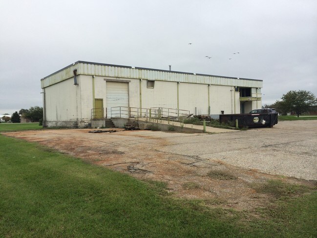
Property Record
2950 W Airline Hwy, Waterloo, IA 50703


NEARBY LISTINGS FOR SALE OR LEASE
Property Detail
2950 W Airline Hwy
Waterloo-Cedar Falls, IA
UNPLATTED WLOO EAST PART OF SW SW SEC 4 T 89 R 13 DESC AS FOL COM AT SW COR SW SW TH N 60 FT TO N ROW W AIRLINE HWY ALSO POB
8913-04-354-001
Black Hawk
Lightindustrial
Iowa
2024
1.07 AC
2025
Iowa City/Waterloo
001600
Other Market Areas
7,770 SF
DEMOGRAPHICS near 2950 W Airline Hwy
1 Mile
3 Mile
5 Mile
2024 Total Population
185
18,035
72,265
2029 Population
184
17,784
71,757
Pop Growth 2024-2029
(0.54%)
(1.39%)
(0.70%)
Average Age
39
40
38
2024 Total Households
77
8,044
29,851
HH Growth 2024-2029
0.00%
(1.42%)
(0.71%)
Median Household Inc
$34,999
$63,480
$55,737
Avg Household Size
2.40
2.20
2.30
2024 Avg HH Vehicles
2.00
2.00
2.00
Median Home Value
$59,302
$152,426
$162,809
Median Year Built
1949
1959
1964
Nearby Places
Map Layers
Map Styles
 Street
 Aerial
- Restaurants
- Banks
- Shops
- Fitness
- Groceries
Nearby Properties
Address
Land Use
TOTAL SIZE
Lot Size
Zoning
Address
Land Use
TOTAL SIZE
Lot Size
Zoning
9,719 SF
42.81 AC
Address
Land Use
TOTAL SIZE
Lot Size
Zoning
1,355.76 AC
Address
Land Use
TOTAL SIZE
Lot Size
Zoning
9,000 SF
21.25 AC
Address
Land Use
TOTAL SIZE
Lot Size
Zoning
173,435 SF
20 AC
Address
Land Use
TOTAL SIZE
Lot Size
Zoning
49,360 SF
0.80 AC
Address
Land Use
TOTAL SIZE
Lot Size
Zoning
55,078 SF
1.39 AC
Address
Land Use
TOTAL SIZE
Lot Size
Zoning
1,600 SF
28.74 AC
Address
Land Use
TOTAL SIZE
Lot Size
Zoning
42,844 SF
0.65 AC
Address
Land Use
TOTAL SIZE
Lot Size
Zoning
106,032 SF
8.22 AC
Address
Land Use
TOTAL SIZE
Lot Size
Zoning
41,999 SF
10.74 AC
Address
Land Use
TOTAL SIZE
Lot Size
Zoning
18,000 SF
141.74 AC
Address
Land Use
TOTAL SIZE
Lot Size
Zoning
1,600 SF
9.51 AC
Address
Land Use
TOTAL SIZE
Lot Size
Zoning
80,352 SF
1.88 AC
Address
Land Use
TOTAL SIZE
Lot Size
Zoning
105,224 SF
4.59 AC
Address
Land Use
TOTAL SIZE
Lot Size
Zoning
98,711 SF
7.91 AC
Address
Land Use
TOTAL SIZE
Lot Size
Zoning
88,064 SF
6.86 AC
Address
Land Use
TOTAL SIZE
Lot Size
Zoning
65,473 SF
6.04 AC
Address
Land Use
TOTAL SIZE
Lot Size
Zoning
3.27 AC
Address
Land Use
TOTAL SIZE
Lot Size
Zoning
30,500 SF
3.49 AC
Address
Land Use
TOTAL SIZE
Lot Size
Zoning
15,912 SF
2.50 AC
Address
Land Use
TOTAL SIZE
Lot Size
Zoning
26.27 AC
Address
Land Use
TOTAL SIZE
Lot Size
Zoning
74,115 SF
10.60 AC
Address
Land Use
TOTAL SIZE
Lot Size
Zoning
162,000 SF
16.20 AC
Address
Land Use
TOTAL SIZE
Lot Size
Zoning
18,380 SF
0.80 AC
Address
Land Use
TOTAL SIZE
Lot Size
Zoning
1,560 SF
13.92 AC
Address
Land Use
TOTAL SIZE
Lot Size
Zoning
210,788 SF
23.55 AC
Address
Land Use
TOTAL SIZE
Lot Size
Zoning
67,604 SF
7.24 AC
Address
Land Use
TOTAL SIZE
Lot Size
Zoning
8.14 AC
Address
Land Use
TOTAL SIZE
Lot Size
Zoning
2,800 SF
3.56 AC
Address
Land Use
TOTAL SIZE
Lot Size
Zoning
2,800 SF
3.42 AC
The World's #1 Commercial Real Estate Marketplace
Connect with us
© 2026 CoStar Group
The information above has been obtained from sources believed reliable. While we do not doubt its accuracy we have not verified it and make no guarantee, warranty or representation about it. It is your responsibility to independently confirm its accuracy and completeness. Any projections, opinions, assumptions, or estimates used are for example only and do not represent the current or future performance of the property. The value of this transaction to you depends on tax and other factors which should be evaluated by your tax, financial, and legal advisors. You and your advisors should conduct a careful, independent investigation of the property to determine to your satisfaction the suitability of the property for your needs.