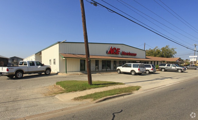
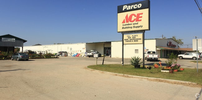
Property Record
2950 Williams Dr, Georgetown, TX 78628

Property Detail
2950 Williams Dr
R040368
AW0497 AW0497 - PORTER, N. SUR., ACRES 5.22
Commercialnec
Williamson
3-C-3
Texas
B and X Area of moderate flood hazard, usually the area between the limits of the 100-year and 500-year floods.
59
2024
5.22 AC
2025
Georgetown
020111
Austin
15,466 SF
Austin-Round Rock-San Marcos, TX
NEARBY LISTINGS FOR SALE OR LEASE
DEMOGRAPHICS near 2950 Williams Dr
1 mile
3 mile
5 mile
2025 Total Population
10,994
48,998
93,855
2030 Population
12,704
56,636
108,656
Pop Growth 2025-2030
+ 15.55%
+ 15.59%
+ 15.77%
Average Age
42
42
45
2025 Total Households
4,631
20,041
38,535
HH Growth 2025-2030
+ 16.07%
+ 16.18%
+ 16.14%
Median Household Inc
$82,349
$96,064
$102,297
Avg Household Size
2.30
2.30
2.40
2025 Avg HH Vehicles
2.00
2.00
2.00
Median Home Value
$454,086
$465,708
$457,912
Median Year Built
2002
2005
2006
Nearby Places
Map Layers
Map Styles
 Street
 Aerial
Transit
 Traffic
 Biking
Places
Listings with unknown addresses are not visible on the map
- Restaurants
- Banks
- Shops
- Fitness
- Groceries
PUBLIC TRANSPORTATION
AIRPORT
Austin-Bergstrom International
Drive
Walk
Distance
Austin-Bergstrom International
55 min
39.8 mi
Killeen Municipal
Drive
Walk
Distance
Killeen Municipal
54 min
41.1 mi
Robert Gray AAF
Drive
Walk
Distance
Robert Gray AAF
57 min
42.2 mi
Nearby Properties
Address
Land Use
TOTAL SIZE
Lot Size
Zoning
Address
Land Use
TOTAL SIZE
Lot Size
Zoning
71.65 AC
1-RS
Address
Land Use
TOTAL SIZE
Lot Size
Zoning
413,418 SF
50.48 AC
3-C-3
Address
Land Use
TOTAL SIZE
Lot Size
Zoning
431,200 SF
53.60 AC
3-C-3
Address
Land Use
TOTAL SIZE
Lot Size
Zoning
389,888 SF
30 AC
1-MF
Address
Land Use
TOTAL SIZE
Lot Size
Zoning
200,200 SF
34.02 AC
Address
Land Use
TOTAL SIZE
Lot Size
Zoning
453,015 SF
22.62 AC
Address
Land Use
TOTAL SIZE
Lot Size
Zoning
393,202 SF
15.42 AC
Address
Land Use
TOTAL SIZE
Lot Size
Zoning
495,688 SF
20.31 AC
1-MF
Address
Land Use
TOTAL SIZE
Lot Size
Zoning
344,529 SF
14.07 AC
Address
Land Use
TOTAL SIZE
Lot Size
Zoning
326,646 SF
19.33 AC
Address
Land Use
TOTAL SIZE
Lot Size
Zoning
425,144 SF
32.97 AC
Address
Land Use
TOTAL SIZE
Lot Size
Zoning
439,044 SF
32.68 AC
Address
Land Use
TOTAL SIZE
Lot Size
Zoning
272,531 SF
14.97 AC
Address
Land Use
TOTAL SIZE
Lot Size
Zoning
233,173 SF
9.89 AC
Address
Land Use
TOTAL SIZE
Lot Size
Zoning
307,473 SF
14.16 AC
Address
Land Use
TOTAL SIZE
Lot Size
Zoning
282,472 SF
11.79 AC
Address
Land Use
TOTAL SIZE
Lot Size
Zoning
294,214 SF
18.34 AC
Address
Land Use
TOTAL SIZE
Lot Size
Zoning
213,599 SF
5.01 AC
Address
Land Use
TOTAL SIZE
Lot Size
Zoning
268,556 SF
19.67 AC
Address
Land Use
TOTAL SIZE
Lot Size
Zoning
316,931 SF
3.02 AC
Address
Land Use
TOTAL SIZE
Lot Size
Zoning
520,121 SF
56.73 AC
Address
Land Use
TOTAL SIZE
Lot Size
Zoning
314,240 SF
16.03 AC
Address
Land Use
TOTAL SIZE
Lot Size
Zoning
241,804 SF
17.57 AC
3-C-3
Address
Land Use
TOTAL SIZE
Lot Size
Zoning
205,554 SF
12.13 AC
3-C-3
Address
Land Use
TOTAL SIZE
Lot Size
Zoning
120,653 SF
12.83 AC
Address
Land Use
TOTAL SIZE
Lot Size
Zoning
8,727 SF
89.67 AC
Address
Land Use
TOTAL SIZE
Lot Size
Zoning
186,337 SF
8.39 AC
Address
Land Use
TOTAL SIZE
Lot Size
Zoning
298,302 SF
20.96 AC
Address
Land Use
TOTAL SIZE
Lot Size
Zoning
610,222 SF
10.16 AC
Address
Land Use
TOTAL SIZE
Lot Size
Zoning
176,875 SF
14.75 AC
3-C-1
The World's #1 Commercial Real Estate Marketplace
Connect with us
© 2026 CoStar Group
The information above has been obtained from sources believed reliable. While we do not doubt its accuracy we have not verified it and make no guarantee, warranty or representation about it. It is your responsibility to independently confirm its accuracy and completeness. Any projections, opinions, assumptions, or estimates used are for example only and do not represent the current or future performance of the property. The value of this transaction to you depends on tax and other factors which should be evaluated by your tax, financial, and legal advisors. You and your advisors should conduct a careful, independent investigation of the property to determine to your satisfaction the suitability of the property for your needs.