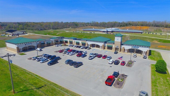
Property Record
2951 N Pp Blvd, Poplar Bluff, MO 63901

NEARBY LISTINGS FOR SALE OR LEASE
Property Detail
2951 N Pp Blvd
109-08-09-32-0-000-000-011-140
PT SE1/4 SW1/4: COMM S COR SEC 32 & 33: NW 1335.55': NW 108.69' TO N R/W HWY PP: SW 100.27': SW 377.06': NW 873.53': NW 182 .
Storesoffices
Butler
X
Missouri
29023C0190E
2.93 AC
2024
Missouri South Area
2024
Other Market Areas
950302
Poplar Bluff, MO
25,926 SF
DEMOGRAPHICS near 2951 N Pp Blvd
1 Mile
3 Mile
5 Mile
2024 Total Population
1,336
20,634
27,576
2029 Population
1,326
20,573
27,505
Pop Growth 2024-2029
(0.75%)
(0.30%)
(0.26%)
Average Age
40
40
40
2024 Total Households
502
8,339
11,204
HH Growth 2024-2029
(1.00%)
(0.31%)
(0.26%)
Median Household Inc
$49,270
$43,800
$42,999
Avg Household Size
2.30
2.40
2.40
2024 Avg HH Vehicles
2.00
2.00
2.00
Median Home Value
$152,051
$131,778
$130,951
Median Year Built
1983
1979
1979
Nearby Places
Map Layers
Map Styles
 Street
 Aerial
- Restaurants
- Banks
- Shops
- Fitness
- Groceries
PUBLIC TRANSPORTATION
COMMUTER RAIL
Poplar Bluff Amtrak Station (Texas Eagle - Amtrak)
DRIVE
WALK
Distance
Poplar Bluff Amtrak Station (Texas Eagle - Amtrak)
6 min
3.2 mi
Freight Ports
Tulsa Port of Inola
DRIVE
WALK
Distance
Tulsa Port of Inola
404 min
355.2 mi
SALE & LEASE HISTORY
LISTING DATE
SALE/LEASE

Sep 25, 2016
For Lease
Sep 23, 2016
For Sale
Jul 20, 2017
For Lease
Jul 20, 2017
For Sale
Jul 12, 2017
For Sale
Nearby Properties
Address
Land Use
TOTAL SIZE
Lot Size
Zoning
Address
Land Use
TOTAL SIZE
Lot Size
Zoning
Address
Land Use
TOTAL SIZE
Lot Size
Zoning
205,593 SF
72.86 AC
Address
Land Use
TOTAL SIZE
Lot Size
Zoning
4.53 AC
Address
Land Use
TOTAL SIZE
Lot Size
Zoning
28,537 SF
29.88 AC
Address
Land Use
TOTAL SIZE
Lot Size
Zoning
72,348 SF
7.13 AC
Address
Land Use
TOTAL SIZE
Lot Size
Zoning
10,612 SF
30 AC
Address
Land Use
TOTAL SIZE
Lot Size
Zoning
138,085 SF
13.50 AC
Address
Land Use
TOTAL SIZE
Lot Size
Zoning
69,606 SF
10 AC
Address
Land Use
TOTAL SIZE
Lot Size
Zoning
6,068 SF
17.73 AC
Address
Land Use
TOTAL SIZE
Lot Size
Zoning
31,780 SF
4.07 AC
Address
Land Use
TOTAL SIZE
Lot Size
Zoning
176,910 SF
17.10 AC
Address
Land Use
TOTAL SIZE
Lot Size
Zoning
11,688 SF
22.30 AC
Address
Land Use
TOTAL SIZE
Lot Size
Zoning
30.60 AC
Address
Land Use
TOTAL SIZE
Lot Size
Zoning
27,670 SF
4.03 AC
Address
Land Use
TOTAL SIZE
Lot Size
Zoning
71,641 SF
0.98 AC
Address
Land Use
TOTAL SIZE
Lot Size
Zoning
223,315 SF
28.61 AC
Address
Land Use
TOTAL SIZE
Lot Size
Zoning
41,250 SF
62.62 AC
Address
Land Use
TOTAL SIZE
Lot Size
Zoning
Address
Land Use
TOTAL SIZE
Lot Size
Zoning
Address
Land Use
TOTAL SIZE
Lot Size
Zoning
Address
Land Use
TOTAL SIZE
Lot Size
Zoning
35,150 SF
4.66 AC
Address
Land Use
TOTAL SIZE
Lot Size
Zoning
101,306 SF
17.93 AC
Address
Land Use
TOTAL SIZE
Lot Size
Zoning
16,900 SF
4.32 AC
Address
Land Use
TOTAL SIZE
Lot Size
Zoning
63,512 SF
4.58 AC
Address
Land Use
TOTAL SIZE
Lot Size
Zoning
67,368 SF
5.29 AC
Address
Land Use
TOTAL SIZE
Lot Size
Zoning
18,108 SF
Address
Land Use
TOTAL SIZE
Lot Size
Zoning
28,144 SF
3.74 AC
Address
Land Use
TOTAL SIZE
Lot Size
Zoning
42,799 SF
11.12 AC
Address
Land Use
TOTAL SIZE
Lot Size
Zoning
27,325 SF
24.69 AC
Address
Land Use
TOTAL SIZE
Lot Size
Zoning
36,228 SF
1.01 AC
The World's #1 Commercial Real Estate Marketplace
Connect with us
© 2025 CoStar Group
The information above has been obtained from sources believed reliable. While we do not doubt its accuracy we have not verified it and make no guarantee, warranty or representation about it. It is your responsibility to independently confirm its accuracy and completeness. Any projections, opinions, assumptions, or estimates used are for example only and do not represent the current or future performance of the property. The value of this transaction to you depends on tax and other factors which should be evaluated by your tax, financial, and legal advisors. You and your advisors should conduct a careful, independent investigation of the property to determine to your satisfaction the suitability of the property for your needs.