Property Record
2951 W Loop 820 S, Fort Worth, TX 76116


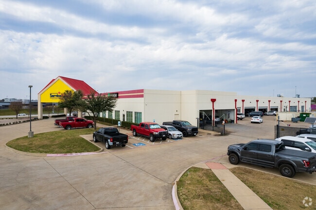
Property Detail
2951 W Loop 820 S
Dallas-Fort Worth-Arlington, TX
SATURN OF FORT WORTH ADDITION BLOCK 1 LOT 1R-1
42185236
Tarrant
Commercialnec
Texas
B and X Area of moderate flood hazard, usually the area between the limits of the 100-year and 500-year floods.
1r-1
2025
4 AC
2025
West Fort Worth
105204
Dallas/Ft Worth
35,537 SF
NEARBY LISTINGS FOR SALE OR LEASE
DEMOGRAPHICS near 2951 W Loop 820 S
1 mile
3 mile
5 mile
2025 Total Population
14,870
78,498
159,124
2030 Population
15,697
83,214
170,115
Pop Growth 2025-2030
+ 5.56%
+ 6.01%
+ 6.91%
Average Age
35
37
38
2025 Total Households
6,466
30,418
64,149
HH Growth 2025-2030
+ 5.63%
+ 6.12%
+ 6.75%
Median Household Inc
$40,119
$61,327
$69,767
Avg Household Size
2.20
2.50
2.40
2025 Avg HH Vehicles
1.00
2.00
2.00
Median Home Value
$248,364
$268,663
$319,395
Median Year Built
1981
1984
1985
Nearby Places
Map Layers
Map Styles
 Street
 Aerial
Layers
 Traffic
 Biking
Places
Listings with unknown addresses are not visible on the map
- Restaurants
- Banks
- Shops
- Fitness
- Groceries
PUBLIC TRANSPORTATION
AIRPORT
Dallas-Fort Worth International
Drive
Walk
Distance
Dallas-Fort Worth International
46 min
35.7 mi
Nearby Properties
Address
Land Use
TOTAL SIZE
Lot Size
Zoning
Address
Land Use
TOTAL SIZE
Lot Size
Zoning
314,284 SF
26.29 AC
Address
Land Use
TOTAL SIZE
Lot Size
Zoning
242,244 SF
27.01 AC
Address
Land Use
TOTAL SIZE
Lot Size
Zoning
244,918 SF
15.52 AC
Address
Land Use
TOTAL SIZE
Lot Size
Zoning
209,682 SF
56.25 AC
Address
Land Use
TOTAL SIZE
Lot Size
Zoning
315,552 SF
14.84 AC
Address
Land Use
TOTAL SIZE
Lot Size
Zoning
352,999 SF
12.63 AC
Address
Land Use
TOTAL SIZE
Lot Size
Zoning
136,717 SF
12.07 AC
Address
Land Use
TOTAL SIZE
Lot Size
Zoning
284,418 SF
15.86 AC
Address
Land Use
TOTAL SIZE
Lot Size
Zoning
238,580 SF
11.56 AC
Address
Land Use
TOTAL SIZE
Lot Size
Zoning
222,000 SF
12 AC
Address
Land Use
TOTAL SIZE
Lot Size
Zoning
245,043 SF
13.10 AC
Address
Land Use
TOTAL SIZE
Lot Size
Zoning
217,500 SF
7.34 AC
Address
Land Use
TOTAL SIZE
Lot Size
Zoning
230,766 SF
9.24 AC
Address
Land Use
TOTAL SIZE
Lot Size
Zoning
186,818 SF
103.53 AC
Address
Land Use
TOTAL SIZE
Lot Size
Zoning
177,726 SF
8.15 AC
Address
Land Use
TOTAL SIZE
Lot Size
Zoning
104,831 SF
13.50 AC
Address
Land Use
TOTAL SIZE
Lot Size
Zoning
103,270 SF
13.01 AC
Address
Land Use
TOTAL SIZE
Lot Size
Zoning
95,481 SF
8.18 AC
Address
Land Use
TOTAL SIZE
Lot Size
Zoning
237,447 SF
12.95 AC
Address
Land Use
TOTAL SIZE
Lot Size
Zoning
161,746 SF
9.43 AC
Address
Land Use
TOTAL SIZE
Lot Size
Zoning
236,934 SF
51.75 AC
Address
Land Use
TOTAL SIZE
Lot Size
Zoning
179,340 SF
1.02 AC
Address
Land Use
TOTAL SIZE
Lot Size
Zoning
32,060 SF
34.15 AC
Address
Land Use
TOTAL SIZE
Lot Size
Zoning
60,842 SF
9.61 AC
Address
Land Use
TOTAL SIZE
Lot Size
Zoning
176,346 SF
7.78 AC
Address
Land Use
TOTAL SIZE
Lot Size
Zoning
194,922 SF
11.26 AC
Address
Land Use
TOTAL SIZE
Lot Size
Zoning
190,013 SF
11.24 AC
Address
Land Use
TOTAL SIZE
Lot Size
Zoning
142,328 SF
8.02 AC
Address
Land Use
TOTAL SIZE
Lot Size
Zoning
220,539 SF
10.86 AC
Address
Land Use
TOTAL SIZE
Lot Size
Zoning
156,405 SF
8.20 AC
The World's #1 Commercial Real Estate Marketplace
Connect with us
© 2026 CoStar Group
The information above has been obtained from sources believed reliable. While we do not doubt its accuracy we have not verified it and make no guarantee, warranty or representation about it. It is your responsibility to independently confirm its accuracy and completeness. Any projections, opinions, assumptions, or estimates used are for example only and do not represent the current or future performance of the property. The value of this transaction to you depends on tax and other factors which should be evaluated by your tax, financial, and legal advisors. You and your advisors should conduct a careful, independent investigation of the property to determine to your satisfaction the suitability of the property for your needs.