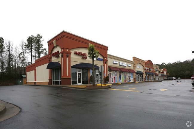
Property Record
2953 Cobb Pkwy Nw, Kennesaw, GA 30152

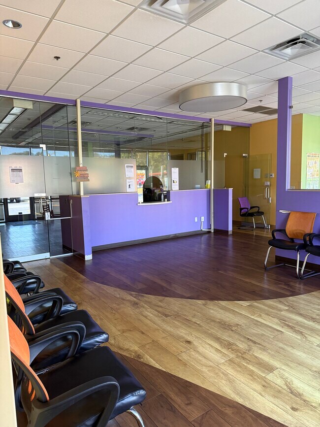
Current Lease Availabilities
NEARBY LISTINGS FOR SALE OR LEASE
Property Detail
2953 Cobb Pkwy Nw
20-0141-0-180-0
Celestino Venturi
Stripcommercialcenter
Cobb
X
Georgia
13057C0325E
141
2025
2.91 AC
2025
Kennesaw/NW Cobb
030242
Atlanta
24,160 SF
Atlanta-Sandy Springs-Roswell, GA
DEMOGRAPHICS near 2953 Cobb Pkwy Nw
1 Mile
3 Mile
5 Mile
2024 Total Population
9,924
68,859
163,701
2029 Population
10,039
69,849
167,755
Pop Growth 2024-2029
+ 1.16%
+ 1.44%
+ 2.48%
Average Age
38
39
39
2024 Total Households
3,622
25,048
59,665
HH Growth 2024-2029
+ 1.19%
+ 1.54%
+ 2.49%
Median Household Inc
$92,668
$90,294
$91,799
Avg Household Size
2.70
2.70
2.60
2024 Avg HH Vehicles
2.00
2.00
2.00
Median Home Value
$262,876
$290,369
$315,166
Median Year Built
1994
1995
1996
Nearby Places
Map Layers
Map Styles
 Street
 Aerial
- Restaurants
- Banks
- Shops
- Fitness
- Groceries
PUBLIC TRANSPORTATION
AIRPORT
Hartsfield - Jackson Atlanta International
DRIVE
WALK
Distance
Hartsfield - Jackson Atlanta International
50 min
35.7 mi
Freight Ports
Georgia Ports - Savannah
DRIVE
WALK
Distance
Georgia Ports - Savannah
313 min
275.0 mi
Nearby Properties
Address
Land Use
TOTAL SIZE
Lot Size
Zoning
Address
Land Use
TOTAL SIZE
Lot Size
Zoning
497,466 SF
40.63 AC
RM-12
Address
Land Use
TOTAL SIZE
Lot Size
Zoning
95,228 SF
12.97 AC
CBD
Address
Land Use
TOTAL SIZE
Lot Size
Zoning
342,443 SF
19.15 AC
NRC/RM12
Address
Land Use
TOTAL SIZE
Lot Size
Zoning
1,120 SF
42.20 AC
HI
Address
Land Use
TOTAL SIZE
Lot Size
Zoning
269,464 SF
2.61 AC
CBD
Address
Land Use
TOTAL SIZE
Lot Size
Zoning
69,476 SF
8.11 AC
PVC
Address
Land Use
TOTAL SIZE
Lot Size
Zoning
13.43 AC
OI
Address
Land Use
TOTAL SIZE
Lot Size
Zoning
7.53 AC
OI
Address
Land Use
TOTAL SIZE
Lot Size
Zoning
375,544 SF
27.82 AC
RM-12
Address
Land Use
TOTAL SIZE
Lot Size
Zoning
288,926 SF
75 AC
LI
Address
Land Use
TOTAL SIZE
Lot Size
Zoning
212,038 SF
24.96 AC
RM-8
Address
Land Use
TOTAL SIZE
Lot Size
Zoning
198,423 SF
15.31 AC
OI
Address
Land Use
TOTAL SIZE
Lot Size
Zoning
347,298 SF
30.41 AC
GC/HI/WS
Address
Land Use
TOTAL SIZE
Lot Size
Zoning
316,088 SF
18.27 AC
GC
Address
Land Use
TOTAL SIZE
Lot Size
Zoning
218,433 SF
26.38 AC
C2/R-8
Address
Land Use
TOTAL SIZE
Lot Size
Zoning
458,760 SF
37.30 AC
LI
Address
Land Use
TOTAL SIZE
Lot Size
Zoning
2,925 SF
1.25 AC
CBD
Address
Land Use
TOTAL SIZE
Lot Size
Zoning
216,248 SF
15.31 AC
RM-12
Address
Land Use
TOTAL SIZE
Lot Size
Zoning
227,675 SF
16.98 AC
PVC
Address
Land Use
TOTAL SIZE
Lot Size
Zoning
35.02 AC
LI
Address
Land Use
TOTAL SIZE
Lot Size
Zoning
653,408 SF
20.16 AC
HI
Address
Land Use
TOTAL SIZE
Lot Size
Zoning
147,079 SF
16.90 AC
C2/R-7
Address
Land Use
TOTAL SIZE
Lot Size
Zoning
972 SF
4.21 AC
CBD
Address
Land Use
TOTAL SIZE
Lot Size
Zoning
204,948 SF
15 AC
RM-8
Address
Land Use
TOTAL SIZE
Lot Size
Zoning
5.50 AC
CBD
Address
Land Use
TOTAL SIZE
Lot Size
Zoning
332,534 SF
33.74 AC
LI
Address
Land Use
TOTAL SIZE
Lot Size
Zoning
405,105 SF
32.38 AC
HI
Address
Land Use
TOTAL SIZE
Lot Size
Zoning
115,210 SF
9.66 AC
RM-8
Address
Land Use
TOTAL SIZE
Lot Size
Zoning
295,518 SF
18.83 AC
LI
Address
Land Use
TOTAL SIZE
Lot Size
Zoning
120,715 SF
14.60 AC
SLC
The World's #1 Commercial Real Estate Marketplace
Connect with us
© 2026 CoStar Group
The information above has been obtained from sources believed reliable. While we do not doubt its accuracy we have not verified it and make no guarantee, warranty or representation about it. It is your responsibility to independently confirm its accuracy and completeness. Any projections, opinions, assumptions, or estimates used are for example only and do not represent the current or future performance of the property. The value of this transaction to you depends on tax and other factors which should be evaluated by your tax, financial, and legal advisors. You and your advisors should conduct a careful, independent investigation of the property to determine to your satisfaction the suitability of the property for your needs.