Property Record
2953 Oley Turnpike Rd, Reading, PA 19606
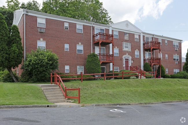

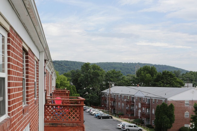
Property Detail
2953 Oley Turnpike Rd
81-5326-09-27-3401
BERKS
Apartment
Pennsylvania
B and X Area of moderate flood hazard, usually the area between the limits of the 100-year and 500-year floods.
5.04 AC
2025
St Lawrence
2025
Philadelphia
012101
Reading, PA
26,076 SF
NEARBY LISTINGS FOR SALE OR LEASE
DEMOGRAPHICS near 2953 Oley Turnpike Rd
1 mile
3 mile
5 mile
2025 Total Population
9,746
92,318
171,381
2030 Population
9,974
94,108
174,570
Pop Growth 2025-2030
+ 2.34%
+ 1.94%
+ 1.86%
Average Age
41
37
38
2025 Total Households
3,899
32,903
62,764
HH Growth 2025-2030
+ 2.39%
+ 1.96%
+ 1.89%
Median Household Inc
$81,045
$58,199
$60,463
Avg Household Size
2.50
2.70
2.60
2025 Avg HH Vehicles
2.00
1.00
2.00
Median Home Value
$222,041
$191,587
$192,378
Median Year Built
1957
1953
1954
Nearby Places
Map Layers
Map Styles
 Street
 Aerial
Layers
 Traffic
 Biking
Places
Listings with unknown addresses are not visible on the map
- Restaurants
- Banks
- Shops
- Fitness
- Groceries
Nearby Properties
Address
Land Use
TOTAL SIZE
Lot Size
Zoning
Address
Land Use
TOTAL SIZE
Lot Size
Zoning
47,512 SF
43.18 AC
Address
Land Use
TOTAL SIZE
Lot Size
Zoning
142,239 SF
12.30 AC
Address
Land Use
TOTAL SIZE
Lot Size
Zoning
88,576 SF
1.80 AC
Address
Land Use
TOTAL SIZE
Lot Size
Zoning
139,377 SF
12.99 AC
Address
Land Use
TOTAL SIZE
Lot Size
Zoning
270,030 SF
34.56 AC
Address
Land Use
TOTAL SIZE
Lot Size
Zoning
71,271 SF
1.42 AC
Address
Land Use
TOTAL SIZE
Lot Size
Zoning
310,014 SF
15.02 AC
Address
Land Use
TOTAL SIZE
Lot Size
Zoning
188,801 SF
14.41 AC
Address
Land Use
TOTAL SIZE
Lot Size
Zoning
220,294 SF
25.86 AC
Address
Land Use
TOTAL SIZE
Lot Size
Zoning
41,449 SF
6.38 AC
Address
Land Use
TOTAL SIZE
Lot Size
Zoning
204,844 SF
16.33 AC
Address
Land Use
TOTAL SIZE
Lot Size
Zoning
133,430 SF
10.43 AC
Address
Land Use
TOTAL SIZE
Lot Size
Zoning
83,740 SF
3.64 AC
Address
Land Use
TOTAL SIZE
Lot Size
Zoning
270,520 SF
7.34 AC
Address
Land Use
TOTAL SIZE
Lot Size
Zoning
36,568 SF
2.99 AC
Address
Land Use
TOTAL SIZE
Lot Size
Zoning
10,376 SF
5.11 AC
Address
Land Use
TOTAL SIZE
Lot Size
Zoning
47,593 SF
9.27 AC
Address
Land Use
TOTAL SIZE
Lot Size
Zoning
38,272 SF
16.16 AC
Address
Land Use
TOTAL SIZE
Lot Size
Zoning
135,196 SF
22.41 AC
Address
Land Use
TOTAL SIZE
Lot Size
Zoning
109,674 SF
Address
Land Use
TOTAL SIZE
Lot Size
Zoning
78,648 SF
6.73 AC
Address
Land Use
TOTAL SIZE
Lot Size
Zoning
47,633 SF
4.81 AC
Address
Land Use
TOTAL SIZE
Lot Size
Zoning
37,517 SF
0.68 AC
Address
Land Use
TOTAL SIZE
Lot Size
Zoning
50,932 SF
4.57 AC
Address
Land Use
TOTAL SIZE
Lot Size
Zoning
34,628 SF
0.54 AC
Address
Land Use
TOTAL SIZE
Lot Size
Zoning
148,088 SF
24.34 AC
Address
Land Use
TOTAL SIZE
Lot Size
Zoning
36,505 SF
9.65 AC
Address
Land Use
TOTAL SIZE
Lot Size
Zoning
34,172 SF
12.09 AC
Address
Land Use
TOTAL SIZE
Lot Size
Zoning
138,398 SF
10.43 AC
Address
Land Use
TOTAL SIZE
Lot Size
Zoning
71,686 SF
7.48 AC
The World's #1 Commercial Real Estate Marketplace
Connect with us
© 2026 CoStar Group
The information above has been obtained from sources believed reliable. While we do not doubt its accuracy we have not verified it and make no guarantee, warranty or representation about it. It is your responsibility to independently confirm its accuracy and completeness. Any projections, opinions, assumptions, or estimates used are for example only and do not represent the current or future performance of the property. The value of this transaction to you depends on tax and other factors which should be evaluated by your tax, financial, and legal advisors. You and your advisors should conduct a careful, independent investigation of the property to determine to your satisfaction the suitability of the property for your needs.