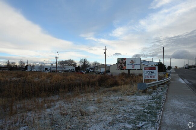
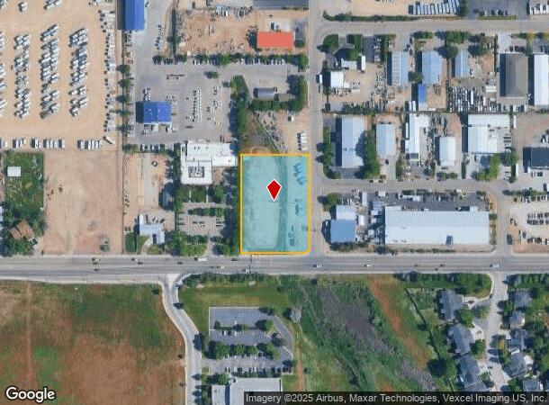
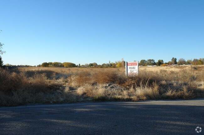
Property Record
2959 S Saturn Way, Boise, ID 83709

NEARBY LISTINGS FOR SALE OR LEASE
Property Detail
2959 S Saturn Way
Boise City, ID
Vala Hala Industrial Park No 03
R8954120020
LOT 68 BLK 1 VALA HALA INDUSTRIAL PARK NO 3
Industrialacreage
Ada
AE
Idaho
16001C0258H
68
2025
1.53 AC
2025
Southwest Boise
002229
Boise City/Nampa
DEMOGRAPHICS near 2959 S Saturn Way
1 mile
3 mile
5 mile
2024 Total Population
4,297
81,098
210,672
2029 Population
4,867
91,767
238,946
Pop Growth 2024-2029
+ 13.27%
+ 13.16%
+ 13.42%
Average Age
40
39
39
2024 Total Households
1,539
30,974
83,574
HH Growth 2024-2029
+ 13.58%
+ 13.44%
+ 13.81%
Median Household Inc
$74,499
$70,604
$67,409
Avg Household Size
2.70
2.50
2.40
2024 Avg HH Vehicles
2.00
2.00
2.00
Median Home Value
$474,345
$426,115
$422,187
Median Year Built
1993
1991
1991
Nearby Places
Map Layers
Map Styles
 Street
 Aerial
Transit
 Traffic
 Biking
Places
Listings with unknown addresses are not visible on the map
- Restaurants
- Banks
- Shops
- Fitness
- Groceries
PUBLIC TRANSPORTATION
AIRPORT
Boise Air Trml/Gowen Field
Drive
Walk
Distance
Boise Air Trml/Gowen Field
22 min
7.5 mi
Freight Ports
Port of Portland
Drive
Walk
Distance
Port of Portland
476 min
430.5 mi
Nearby Properties
Address
Land Use
TOTAL SIZE
Lot Size
Zoning
Address
Land Use
TOTAL SIZE
Lot Size
Zoning
646,787 SF
27.37 AC
C-2D
Address
Land Use
TOTAL SIZE
Lot Size
Zoning
225,032 SF
12.75 AC
R-3D
Address
Land Use
TOTAL SIZE
Lot Size
Zoning
249,800 SF
12.99 AC
C-2D
Address
Land Use
TOTAL SIZE
Lot Size
Zoning
319,052 SF
24.33 AC
C-2D
Address
Land Use
TOTAL SIZE
Lot Size
Zoning
164,981 SF
7.47 AC
R20
Address
Land Use
TOTAL SIZE
Lot Size
Zoning
162,432 SF
8.31 AC
R-3D
Address
Land Use
TOTAL SIZE
Lot Size
Zoning
72,579 SF
4.48 AC
M-1D
Address
Land Use
TOTAL SIZE
Lot Size
Zoning
290,239 SF
4.73 AC
ZC-243
Address
Land Use
TOTAL SIZE
Lot Size
Zoning
136,244 SF
8.56 AC
R-3D/DA
Address
Land Use
TOTAL SIZE
Lot Size
Zoning
118,345 SF
5.20 AC
R-2D
Address
Land Use
TOTAL SIZE
Lot Size
Zoning
137,752 SF
5.13 AC
ZC-268
Address
Land Use
TOTAL SIZE
Lot Size
Zoning
91,740 SF
3.63 AC
C-4D
Address
Land Use
TOTAL SIZE
Lot Size
Zoning
161,259 SF
13.30 AC
C-2D
Address
Land Use
TOTAL SIZE
Lot Size
Zoning
164,141 SF
24.32 AC
M-1D
Address
Land Use
TOTAL SIZE
Lot Size
Zoning
323,236 SF
14.77 AC
M-1D
Address
Land Use
TOTAL SIZE
Lot Size
Zoning
93,112 SF
2.73 AC
C-2D
Address
Land Use
TOTAL SIZE
Lot Size
Zoning
218,215 SF
17.11 AC
C-4D
Address
Land Use
TOTAL SIZE
Lot Size
Zoning
70,705 SF
0.63 AC
H-SD
Address
Land Use
TOTAL SIZE
Lot Size
Zoning
130,560 SF
7.72 AC
R-2
Address
Land Use
TOTAL SIZE
Lot Size
Zoning
49,821 SF
5.45 AC
C-1D/DA
Address
Land Use
TOTAL SIZE
Lot Size
Zoning
196,326 SF
M-1
Address
Land Use
TOTAL SIZE
Lot Size
Zoning
116,756 SF
11.17 AC
C-2D/DA
Address
Land Use
TOTAL SIZE
Lot Size
Zoning
37.86 AC
R-2
Address
Land Use
TOTAL SIZE
Lot Size
Zoning
135,679 SF
3.11 AC
R-2D
Address
Land Use
TOTAL SIZE
Lot Size
Zoning
116,821 SF
6.19 AC
R-3D
Address
Land Use
TOTAL SIZE
Lot Size
Zoning
174,878 SF
13.03 AC
C-1D
Address
Land Use
TOTAL SIZE
Lot Size
Zoning
108,695 SF
15.52 AC
C-2D
Address
Land Use
TOTAL SIZE
Lot Size
Zoning
108,463 SF
6.15 AC
R-3D
Address
Land Use
TOTAL SIZE
Lot Size
Zoning
2.08 AC
L-OD/DA
Address
Land Use
TOTAL SIZE
Lot Size
Zoning
95,762 SF
5.02 AC
C-2D
The World's #1 Commercial Real Estate Marketplace
Connect with us
© 2026 CoStar Group
The information above has been obtained from sources believed reliable. While we do not doubt its accuracy we have not verified it and make no guarantee, warranty or representation about it. It is your responsibility to independently confirm its accuracy and completeness. Any projections, opinions, assumptions, or estimates used are for example only and do not represent the current or future performance of the property. The value of this transaction to you depends on tax and other factors which should be evaluated by your tax, financial, and legal advisors. You and your advisors should conduct a careful, independent investigation of the property to determine to your satisfaction the suitability of the property for your needs.