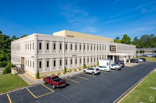
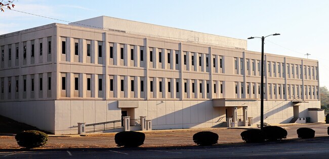
Property Record
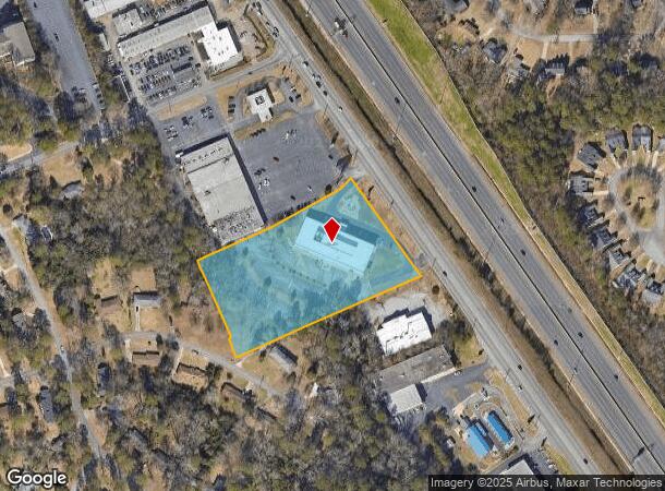
2960 Riverside Dr, Macon, GA 31204
NEARBY LISTINGS FOR SALE OR LEASE
Property Detail
2960 Riverside Dr
O051-0079
Pio Nono Place
Officebuilding
Bibb
X
Georgia
13169C0220E
357
2025
4.30 AC
2025
Suburban Macon
012000
Atlanta
40,680 SF
Macon-Bibb County, GA
DEMOGRAPHICS near 2960 Riverside Dr
1 Mile
3 Mile
5 Mile
2024 Total Population
3,793
29,373
83,793
2029 Population
3,658
28,912
83,178
Pop Growth 2024-2029
(3.56%)
(1.57%)
(0.73%)
Average Age
41
39
39
2024 Total Households
1,607
12,801
35,556
HH Growth 2024-2029
(3.55%)
(1.59%)
(0.66%)
Median Household Inc
$74,488
$61,884
$46,401
Avg Household Size
2.30
2.20
2.20
2024 Avg HH Vehicles
2.00
2.00
1.00
Median Home Value
$150,893
$169,783
$161,120
Median Year Built
1967
1972
1973
Nearby Places
Map Layers
Map Styles
 Street
 Aerial
- Restaurants
- Banks
- Shops
- Fitness
- Groceries
SALE & LEASE HISTORY
LISTING DATE
SALE/LEASE

Sep 25, 2016
For Lease
Sep 15, 2021
For Lease
Apr 16, 2021
For Sale
Nearby Properties
Address
Land Use
TOTAL SIZE
Lot Size
Zoning
Address
Land Use
TOTAL SIZE
Lot Size
Zoning
Address
Land Use
TOTAL SIZE
Lot Size
Zoning
196,702 SF
37.72 AC
PDE
Address
Land Use
TOTAL SIZE
Lot Size
Zoning
4,671 SF
22.66 AC
R-3
Address
Land Use
TOTAL SIZE
Lot Size
Zoning
194,734 SF
6.37 AC
C-2
Address
Land Use
TOTAL SIZE
Lot Size
Zoning
71,021 SF
8.94 AC
PDC
Address
Land Use
TOTAL SIZE
Lot Size
Zoning
231,774 SF
21.27 AC
R-1AAA
Address
Land Use
TOTAL SIZE
Lot Size
Zoning
1,039 SF
14.79 AC
PDR
Address
Land Use
TOTAL SIZE
Lot Size
Zoning
1,452 SF
12.16 AC
R-3
Address
Land Use
TOTAL SIZE
Lot Size
Zoning
6,720 SF
16.69 AC
PDR
Address
Land Use
TOTAL SIZE
Lot Size
Zoning
4,000 SF
2,887.63 AC
001
Address
Land Use
TOTAL SIZE
Lot Size
Zoning
141,816 SF
16.44 AC
C-2
Address
Land Use
TOTAL SIZE
Lot Size
Zoning
2,366 SF
14.46 AC
PDE
Address
Land Use
TOTAL SIZE
Lot Size
Zoning
110,745 SF
4.99 AC
PDE
Address
Land Use
TOTAL SIZE
Lot Size
Zoning
143,280 SF
5.06 AC
HR-3
Address
Land Use
TOTAL SIZE
Lot Size
Zoning
63,654 SF
14.67 AC
C-2
Address
Land Use
TOTAL SIZE
Lot Size
Zoning
23,520 SF
12.78 AC
R-3
Address
Land Use
TOTAL SIZE
Lot Size
Zoning
3,600 SF
24.71 AC
R-1AAA
Address
Land Use
TOTAL SIZE
Lot Size
Zoning
20,518 SF
19.58 AC
R-3
Address
Land Use
TOTAL SIZE
Lot Size
Zoning
2,816 SF
12.46 AC
R-2
Address
Land Use
TOTAL SIZE
Lot Size
Zoning
16,320 SF
8.60 AC
R-3
Address
Land Use
TOTAL SIZE
Lot Size
Zoning
48,524 SF
1.80 AC
C-2
Address
Land Use
TOTAL SIZE
Lot Size
Zoning
50,918 SF
2 AC
C-2
Address
Land Use
TOTAL SIZE
Lot Size
Zoning
117,083 SF
8.32 AC
PDR
Address
Land Use
TOTAL SIZE
Lot Size
Zoning
26,865 SF
6.60 AC
R-3
Address
Land Use
TOTAL SIZE
Lot Size
Zoning
20,572 SF
16.08 AC
R-3
Address
Land Use
TOTAL SIZE
Lot Size
Zoning
16,180 SF
9.52 AC
C-1
Address
Land Use
TOTAL SIZE
Lot Size
Zoning
76,578 SF
13.60 AC
R-1AAA
Address
Land Use
TOTAL SIZE
Lot Size
Zoning
47,952 SF
2.14 AC
C-2
Address
Land Use
TOTAL SIZE
Lot Size
Zoning
13,344 SF
10.83 AC
R-3
Address
Land Use
TOTAL SIZE
Lot Size
Zoning
44,720 SF
6.33 AC
C-2
The World's #1 Commercial Real Estate Marketplace
Connect with us
© 2025 CoStar Group
The information above has been obtained from sources believed reliable. While we do not doubt its accuracy we have not verified it and make no guarantee, warranty or representation about it. It is your responsibility to independently confirm its accuracy and completeness. Any projections, opinions, assumptions, or estimates used are for example only and do not represent the current or future performance of the property. The value of this transaction to you depends on tax and other factors which should be evaluated by your tax, financial, and legal advisors. You and your advisors should conduct a careful, independent investigation of the property to determine to your satisfaction the suitability of the property for your needs.