Property Record
29605 N Cave Creek Rd, Cave Creek, AZ 85331


NEARBY LISTINGS FOR SALE OR LEASE
-
-
View all Cave Creek listings for sale on LoopNet.com
Property Detail
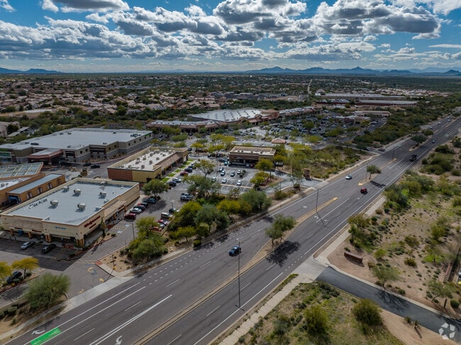
29605 N Cave Creek Rd
Phoenix-Mesa-Scottsdale, AZ
Tatum And Cave Creek Retail Center
211-38-179
TATUM AND CAVE CREEK RETAIL CENTER MCR 478-26
Storebuilding
Maricopa
X
Arizona
04013C0888M
1
2025
2.18 AC
2025
Carefree
612800
Phoenix
14,990 SF
DEMOGRAPHICS near 29605 N Cave Creek Rd
1 Mile
3 Mile
5 Mile
2024 Total Population
6,948
27,259
64,531
2029 Population
7,501
29,414
70,306
Pop Growth 2024-2029
+ 7.96%
+ 7.91%
+ 8.95%
Average Age
44
44
44
2024 Total Households
2,829
10,404
25,051
HH Growth 2024-2029
+ 8.02%
+ 7.96%
+ 9.15%
Median Household Inc
$115,242
$122,696
$135,133
Avg Household Size
2.40
2.60
2.50
2024 Avg HH Vehicles
2.00
2.00
2.00
Median Home Value
$483,213
$558,942
$658,094
Median Year Built
1995
1996
1998
Nearby Places
Map Layers
Map Styles
 Street
 Aerial
- Restaurants
- Banks
- Shops
- Fitness
- Groceries
PUBLIC TRANSPORTATION
AIRPORT
Phoenix Sky Harbor International
DRIVE
WALK
Distance
Phoenix Sky Harbor International
40 min
27.1 mi
Phoenix-Mesa Gateway
DRIVE
WALK
Distance
Phoenix-Mesa Gateway
67 min
48.8 mi
Nearby Properties
Address
Land Use
TOTAL SIZE
Lot Size
Zoning
Address
Land Use
TOTAL SIZE
Lot Size
Zoning
557,887 SF
163.54 AC
R-43
Address
Land Use
TOTAL SIZE
Lot Size
Zoning
328 SF
96.24 AC
R-43AG
Address
Land Use
TOTAL SIZE
Lot Size
Zoning
108,124 SF
26.19 AC
R-35
Address
Land Use
TOTAL SIZE
Lot Size
Zoning
10 SF
13.75 AC
R-35
Address
Land Use
TOTAL SIZE
Lot Size
Zoning
79,429 SF
17.76 AC
R-35
Address
Land Use
TOTAL SIZE
Lot Size
Zoning
30,172 SF
14.13 AC
S1
Address
Land Use
TOTAL SIZE
Lot Size
Zoning
70.35 AC
R-35
Address
Land Use
TOTAL SIZE
Lot Size
Zoning
34,576 SF
23 AC
R-43
Address
Land Use
TOTAL SIZE
Lot Size
Zoning
15.34 AC
PAD
Address
Land Use
TOTAL SIZE
Lot Size
Zoning
13,960 SF
33.20 AC
R-35
Address
Land Use
TOTAL SIZE
Lot Size
Zoning
65,728 SF
12.07 AC
C-C
Address
Land Use
TOTAL SIZE
Lot Size
Zoning
74,132 SF
7.93 AC
PAD
Address
Land Use
TOTAL SIZE
Lot Size
Zoning
43,674 SF
9.26 AC
C-C
Address
Land Use
TOTAL SIZE
Lot Size
Zoning
135,578 SF
2.85 AC
C-C
Address
Land Use
TOTAL SIZE
Lot Size
Zoning
600 SF
38.67 AC
R-43
Address
Land Use
TOTAL SIZE
Lot Size
Zoning
116,269 SF
5.01 AC
C-N
Address
Land Use
TOTAL SIZE
Lot Size
Zoning
68,338 SF
16.15 AC
R-43
Address
Land Use
TOTAL SIZE
Lot Size
Zoning
45,425 SF
22.94 AC
R-43AG
Address
Land Use
TOTAL SIZE
Lot Size
Zoning
34,693 SF
5.73 AC
R-35
Address
Land Use
TOTAL SIZE
Lot Size
Zoning
52,022 SF
10.01 AC
R-43
Address
Land Use
TOTAL SIZE
Lot Size
Zoning
55,478 SF
5.24 AC
C-C
Address
Land Use
TOTAL SIZE
Lot Size
Zoning
1,010.34 AC
R-35
Address
Land Use
TOTAL SIZE
Lot Size
Zoning
102,591 SF
3.81 AC
C-C
Address
Land Use
TOTAL SIZE
Lot Size
Zoning
40,743 SF
6.90 AC
C-N
Address
Land Use
TOTAL SIZE
Lot Size
Zoning
12.17 AC
R-6
Address
Land Use
TOTAL SIZE
Lot Size
Zoning
34,888 SF
4.69 AC
S-1
Address
Land Use
TOTAL SIZE
Lot Size
Zoning
27,015 SF
3.14 AC
C-2
Address
Land Use
TOTAL SIZE
Lot Size
Zoning
13,982 SF
5.34 AC
R-43AG
Address
Land Use
TOTAL SIZE
Lot Size
Zoning
25,217 SF
1.43 AC
R-35
Address
Land Use
TOTAL SIZE
Lot Size
Zoning
7,276 SF
6.09 AC
R-43
The World's #1 Commercial Real Estate Marketplace
Connect with us
© 2026 CoStar Group
The information above has been obtained from sources believed reliable. While we do not doubt its accuracy we have not verified it and make no guarantee, warranty or representation about it. It is your responsibility to independently confirm its accuracy and completeness. Any projections, opinions, assumptions, or estimates used are for example only and do not represent the current or future performance of the property. The value of this transaction to you depends on tax and other factors which should be evaluated by your tax, financial, and legal advisors. You and your advisors should conduct a careful, independent investigation of the property to determine to your satisfaction the suitability of the property for your needs.