Property Record
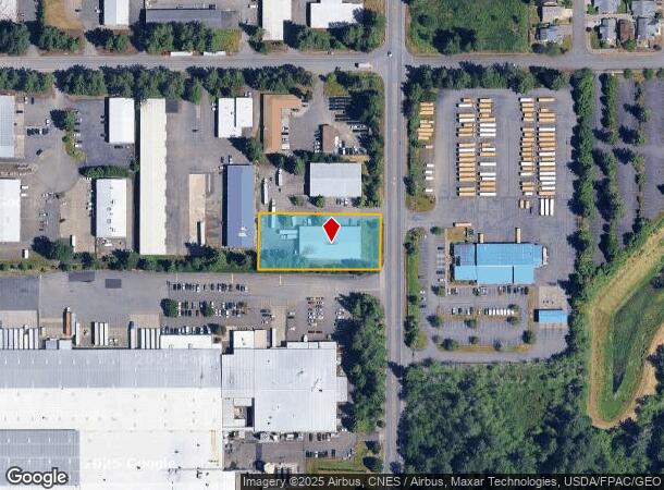
2963 R W Johnson Blvd Sw, Tumwater, WA 98512


NEARBY LISTINGS FOR SALE OR LEASE
Property Detail
2963 R W Johnson Blvd Sw
Olympia-Tumwater, WA
Mottman Industrial Park
63050002800
SECTION 28 TOWNSHIP 18 RANGE 2W QUARTER SE NW PLAT MOTTMAN INDUSTRIAL PARK DIV 1 LT 28 DOCUMENT 019/036
Commercialnec
Thurston
X
Washington
53067C0164F
28
2024
0.95 AC
2024
Tumwater/S Olympia
010910
Olympia
11,840 SF
DEMOGRAPHICS near 2963 R W Johnson Blvd Sw
1 Mile
3 Mile
5 Mile
2024 Total Population
5,615
55,640
104,706
2029 Population
5,933
58,888
110,606
Pop Growth 2024-2029
+ 5.66%
+ 5.84%
+ 5.63%
Average Age
38
41
41
2024 Total Households
2,381
24,687
44,332
HH Growth 2024-2029
+ 5.67%
+ 6.02%
+ 5.77%
Median Household Inc
$68,963
$68,662
$76,062
Avg Household Size
2.30
2.20
2.30
2024 Avg HH Vehicles
2.00
2.00
2.00
Median Home Value
$427,594
$410,372
$420,225
Median Year Built
1993
1986
1986
Nearby Places
Map Layers
Map Styles
 Street
 Aerial
- Restaurants
- Banks
- Shops
- Fitness
- Groceries
PUBLIC TRANSPORTATION
COMMUTER RAIL
DRIVE
WALK
Distance
20 min
9.0 mi
Freight Ports
Port of Tacoma
DRIVE
WALK
Distance
Port of Tacoma
47 min
34.0 mi
Nearby Properties
Address
Land Use
TOTAL SIZE
Lot Size
Zoning
Address
Land Use
TOTAL SIZE
Lot Size
Zoning
1,446,648 SF
8.29 AC
CAP
Address
Land Use
TOTAL SIZE
Lot Size
Zoning
830,626 SF
21.53 AC
CAP
Address
Land Use
TOTAL SIZE
Lot Size
Zoning
523,407 SF
86.49 AC
R-4-8
Address
Land Use
TOTAL SIZE
Lot Size
Zoning
485,918 SF
6.64 AC
CAP
Address
Land Use
TOTAL SIZE
Lot Size
Zoning
6,928 SF
1.33 AC
UW
Address
Land Use
TOTAL SIZE
Lot Size
Zoning
395,355 SF
35.74 AC
TC
Address
Land Use
TOTAL SIZE
Lot Size
Zoning
784,559 SF
13.09 AC
CAP
Address
Land Use
TOTAL SIZE
Lot Size
Zoning
98,652 SF
95.43 AC
UW
Address
Land Use
TOTAL SIZE
Lot Size
Zoning
288,270 SF
11.88 AC
CAP
Address
Land Use
TOTAL SIZE
Lot Size
Zoning
179,860 SF
1.28 AC
CAP
Address
Land Use
TOTAL SIZE
Lot Size
Zoning
353,503 SF
36.94 AC
MFM
Address
Land Use
TOTAL SIZE
Lot Size
Zoning
213,177 SF
1.28 AC
CAP
Address
Land Use
TOTAL SIZE
Lot Size
Zoning
184,887 SF
41 AC
SFM1
Address
Land Use
TOTAL SIZE
Lot Size
Zoning
602,509 SF
49.48 AC
HDC-4
Address
Land Use
TOTAL SIZE
Lot Size
Zoning
151,657 SF
2.62 AC
MS
Address
Land Use
TOTAL SIZE
Lot Size
Zoning
235,042 SF
17.16 AC
MFM
Address
Land Use
TOTAL SIZE
Lot Size
Zoning
226,221 SF
Address
Land Use
TOTAL SIZE
Lot Size
Zoning
175,178 SF
36.69 AC
R-4-8
Address
Land Use
TOTAL SIZE
Lot Size
Zoning
114,331 SF
1.43 AC
CAP
Address
Land Use
TOTAL SIZE
Lot Size
Zoning
243,845 SF
12.58 AC
RM-24
Address
Land Use
TOTAL SIZE
Lot Size
Zoning
273,091 SF
17.87 AC
PO/RM
Address
Land Use
TOTAL SIZE
Lot Size
Zoning
163,487 SF
34.49 AC
CS
Address
Land Use
TOTAL SIZE
Lot Size
Zoning
94,349 SF
6.02 AC
CAP
Address
Land Use
TOTAL SIZE
Lot Size
Zoning
217,366 SF
10.88 AC
RM-24
Address
Land Use
TOTAL SIZE
Lot Size
Zoning
155,495 SF
1.06 AC
UWH
Address
Land Use
TOTAL SIZE
Lot Size
Zoning
102,698 SF
14.81 AC
LI
Address
Land Use
TOTAL SIZE
Lot Size
Zoning
197,571 SF
52.35 AC
R-4-8
Address
Land Use
TOTAL SIZE
Lot Size
Zoning
147,418 SF
11.74 AC
MFH
Address
Land Use
TOTAL SIZE
Lot Size
Zoning
266,887 SF
1.38 AC
UW
Address
Land Use
TOTAL SIZE
Lot Size
Zoning
241,689 SF
10.75 AC
RM-24
The World's #1 Commercial Real Estate Marketplace
Connect with us
© 2025 CoStar Group
The information above has been obtained from sources believed reliable. While we do not doubt its accuracy we have not verified it and make no guarantee, warranty or representation about it. It is your responsibility to independently confirm its accuracy and completeness. Any projections, opinions, assumptions, or estimates used are for example only and do not represent the current or future performance of the property. The value of this transaction to you depends on tax and other factors which should be evaluated by your tax, financial, and legal advisors. You and your advisors should conduct a careful, independent investigation of the property to determine to your satisfaction the suitability of the property for your needs.