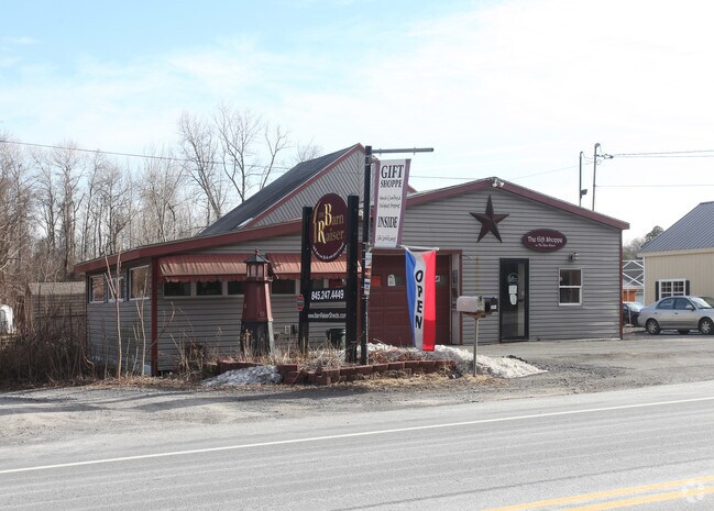
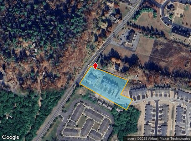
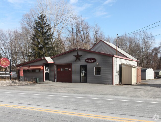
Property Record
2964 Route 9W, Saugerties, NY 12477

NEARBY LISTINGS FOR SALE OR LEASE
Property Detail
2964 Route 9W
4889-029.009-0006-007.000-0000
Ulster
Commercialacreage
New York
X
7.000
36111C0315E
2 AC
2025
Hudson Valley Area
2024
Other Market Areas
950300
Kingston, NY
1,584 SF
DEMOGRAPHICS near 2964 Route 9W
1 Mile
3 Mile
5 Mile
2024 Total Population
3,490
13,307
24,568
2029 Population
3,439
13,228
24,465
Pop Growth 2024-2029
(1.46%)
(0.59%)
(0.42%)
Average Age
44
44
45
2024 Total Households
1,538
5,834
10,199
HH Growth 2024-2029
(1.37%)
(0.57%)
(0.43%)
Median Household Inc
$69,801
$67,647
$77,473
Avg Household Size
2.20
2.20
2.30
2024 Avg HH Vehicles
2.00
2.00
2.00
Median Home Value
$259,431
$285,767
$307,213
Median Year Built
1977
1962
1966
Nearby Places
- Restaurants
- Banks
- Shops
- Fitness
- Groceries
Nearby Properties
Address
Land Use
TOTAL SIZE
Lot Size
Zoning
Address
Land Use
TOTAL SIZE
Lot Size
Zoning
2,688 SF
301.70 AC
I
Address
Land Use
TOTAL SIZE
Lot Size
Zoning
183,246 SF
42.20 AC
02 - SINGL
Address
Land Use
TOTAL SIZE
Lot Size
Zoning
12,489 SF
15.10 AC
02 - SINGL
Address
Land Use
TOTAL SIZE
Lot Size
Zoning
19.70 AC
04
Address
Land Use
TOTAL SIZE
Lot Size
Zoning
78.11 AC
WC
Address
Land Use
TOTAL SIZE
Lot Size
Zoning
7.90 AC
03 - MULTI
Address
Land Use
TOTAL SIZE
Lot Size
Zoning
7,994 SF
13.70 AC
23
Address
Land Use
TOTAL SIZE
Lot Size
Zoning
54,461 SF
2.50 AC
03 - MULTI
Address
Land Use
TOTAL SIZE
Lot Size
Zoning
45,441 SF
4.80 AC
05 - COMME
Address
Land Use
TOTAL SIZE
Lot Size
Zoning
77,033 SF
7.40 AC
05 - COMME
Address
Land Use
TOTAL SIZE
Lot Size
Zoning
41,213 SF
7.90 AC
02
Address
Land Use
TOTAL SIZE
Lot Size
Zoning
56,845 SF
17.70 AC
02 - SINGL
Address
Land Use
TOTAL SIZE
Lot Size
Zoning
21.70 AC
LC
Address
Land Use
TOTAL SIZE
Lot Size
Zoning
36,004 SF
7.10 AC
05 - COMME
Address
Land Use
TOTAL SIZE
Lot Size
Zoning
47,688 SF
5.55 AC
05 - COMME
Address
Land Use
TOTAL SIZE
Lot Size
Zoning
13.90 AC
WC
Address
Land Use
TOTAL SIZE
Lot Size
Zoning
47,679 SF
14 AC
02 - SINGL
Address
Land Use
TOTAL SIZE
Lot Size
Zoning
5,225 SF
432.29 AC
RD5
Address
Land Use
TOTAL SIZE
Lot Size
Zoning
117,450 SF
14.20 AC
02 - SINGL
Address
Land Use
TOTAL SIZE
Lot Size
Zoning
5,664 SF
5.30 AC
WC
Address
Land Use
TOTAL SIZE
Lot Size
Zoning
37,032 SF
0.89 AC
07 - MIXED
Address
Land Use
TOTAL SIZE
Lot Size
Zoning
9,524 SF
3.30 AC
02 - SINGL
Address
Land Use
TOTAL SIZE
Lot Size
Zoning
13,066 SF
149 AC
Address
Land Use
TOTAL SIZE
Lot Size
Zoning
37,172 SF
10.10 AC
06 - INDUS
Address
Land Use
TOTAL SIZE
Lot Size
Zoning
18,225 SF
29.30 AC
02 - SINGL
Address
Land Use
TOTAL SIZE
Lot Size
Zoning
6,144 SF
3.30 AC
02 - SINGL
Address
Land Use
TOTAL SIZE
Lot Size
Zoning
17,736 SF
1.40 AC
02 - SINGL
Address
Land Use
TOTAL SIZE
Lot Size
Zoning
8,064 SF
3.20 AC
05 - COMME
Address
Land Use
TOTAL SIZE
Lot Size
Zoning
2.55 AC
R3A
Address
Land Use
TOTAL SIZE
Lot Size
Zoning
11,404 SF
11.04 AC
03 - MULTI
The World's #1 Commercial Real Estate Marketplace
Connect with us
© 2025 CoStar Group
The information above has been obtained from sources believed reliable. While we do not doubt its accuracy we have not verified it and make no guarantee, warranty or representation about it. It is your responsibility to independently confirm its accuracy and completeness. Any projections, opinions, assumptions, or estimates used are for example only and do not represent the current or future performance of the property. The value of this transaction to you depends on tax and other factors which should be evaluated by your tax, financial, and legal advisors. You and your advisors should conduct a careful, independent investigation of the property to determine to your satisfaction the suitability of the property for your needs.