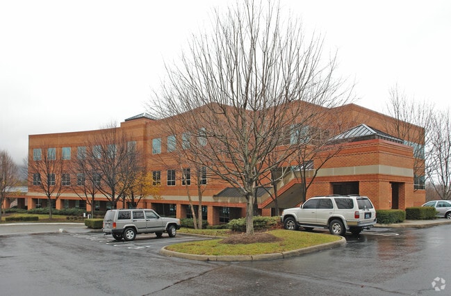
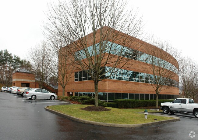
Property Record
2965 Colonnade Dr, Roanoke, VA 24018

Property Detail
2965 Colonnade Dr
076.16-01-38
COLONNADE CORPORATE CENTER II- PHASE I
Officebuilding
Roanoke
C1C
Virginia
AE The base floodplain where base flood elevations are provided. AE Zones are now used on new format FIRMs instead of A1-A30 Zones.
7.17 AC
2025
Southwest Roanoke
2025
Roanoke
030702
Roanoke, VA
70,482 SF
NEARBY LISTINGS FOR SALE OR LEASE
DEMOGRAPHICS near 2965 Colonnade Dr
1 mile
3 mile
5 mile
2025 Total Population
8,971
49,761
109,314
2030 Population
9,036
49,778
109,474
Pop Growth 2025-2030
+ 0.72%
+ 0.03%
+ 0.15%
Average Age
42
43
42
2025 Total Households
3,908
22,136
48,274
HH Growth 2025-2030
+ 0.77%
0.00%
+ 0.13%
Median Household Inc
$72,575
$81,425
$67,681
Avg Household Size
2.30
2.20
2.20
2025 Avg HH Vehicles
2.00
2.00
2.00
Median Home Value
$301,606
$329,533
$307,575
Median Year Built
1973
1972
1967
Nearby Places
Map Layers
Map Styles
 Street
 Aerial
Layers
 Traffic
 Biking
Places
Listings with unknown addresses are not visible on the map
- Restaurants
- Banks
- Shops
- Fitness
- Groceries
PUBLIC TRANSPORTATION
COMMUTER RAIL
Roanoke (Northeast Regional - Amtrak)
Drive
Walk
Distance
Roanoke (Northeast Regional - Amtrak)
13 min
6.6 mi
AIRPORT
Roanoke/Blacksburg Regional (Woodrum Field)
Drive
Walk
Distance
Roanoke/Blacksburg Regional (Woodrum Field)
23 min
12.2 mi
Freight Ports
Virginia Port Authority - Richmond
Drive
Walk
Distance
Virginia Port Authority - Richmond
229 min
198.1 mi
Nearby Properties
Address
Land Use
TOTAL SIZE
Lot Size
Zoning
Address
Land Use
TOTAL SIZE
Lot Size
Zoning
160 AC
RSF
Address
Land Use
TOTAL SIZE
Lot Size
Zoning
41,443 SF
96.33 AC
INPUD
Address
Land Use
TOTAL SIZE
Lot Size
Zoning
421,634 SF
15.99 AC
HBD
Address
Land Use
TOTAL SIZE
Lot Size
Zoning
47,181 SF
33.94 AC
INPUD
Address
Land Use
TOTAL SIZE
Lot Size
Zoning
19,734 SF
34.83 AC
INPUD
Address
Land Use
TOTAL SIZE
Lot Size
Zoning
177,095 SF
18.55 AC
RMF
Address
Land Use
TOTAL SIZE
Lot Size
Zoning
136,331 SF
29.73 AC
C1
Address
Land Use
TOTAL SIZE
Lot Size
Zoning
180,301 SF
56.16 AC
R1S
Address
Land Use
TOTAL SIZE
Lot Size
Zoning
149,370 SF
40 AC
R1
Address
Land Use
TOTAL SIZE
Lot Size
Zoning
7,279 SF
24.35 AC
R3C
Address
Land Use
TOTAL SIZE
Lot Size
Zoning
32,814 SF
18.14 AC
C1
Address
Land Use
TOTAL SIZE
Lot Size
Zoning
6.29 AC
MXPUD
Address
Land Use
TOTAL SIZE
Lot Size
Zoning
10,143 SF
25.30 AC
R3
Address
Land Use
TOTAL SIZE
Lot Size
Zoning
2.75 AC
Address
Land Use
TOTAL SIZE
Lot Size
Zoning
6,298 SF
43.38 AC
C2
Address
Land Use
TOTAL SIZE
Lot Size
Zoning
42,128 SF
32.68 AC
INPUD
Address
Land Use
TOTAL SIZE
Lot Size
Zoning
331,365 SF
61.27 AC
I-2
Address
Land Use
TOTAL SIZE
Lot Size
Zoning
118,647 SF
1.88 AC
IN
Address
Land Use
TOTAL SIZE
Lot Size
Zoning
122,462 SF
40.92 AC
INPUD
Address
Land Use
TOTAL SIZE
Lot Size
Zoning
28,221 SF
20.18 AC
RMF
Address
Land Use
TOTAL SIZE
Lot Size
Zoning
56,496 SF
19.14 AC
I2C
Address
Land Use
TOTAL SIZE
Lot Size
Zoning
10,713 SF
12.44 AC
R3
Address
Land Use
TOTAL SIZE
Lot Size
Zoning
159,727 SF
13.32 AC
C1
Address
Land Use
TOTAL SIZE
Lot Size
Zoning
11,529 SF
9.78 AC
R4
Address
Land Use
TOTAL SIZE
Lot Size
Zoning
32,286 SF
3.62 AC
RMF
Address
Land Use
TOTAL SIZE
Lot Size
Zoning
11,529 SF
9.75 AC
R4
Address
Land Use
TOTAL SIZE
Lot Size
Zoning
7.75 AC
Address
Land Use
TOTAL SIZE
Lot Size
Zoning
10,944 SF
18.21 AC
RMF
Address
Land Use
TOTAL SIZE
Lot Size
Zoning
71,400 SF
10.24 AC
R1
Address
Land Use
TOTAL SIZE
Lot Size
Zoning
9,360 SF
20.34 AC
R4
The World's #1 Commercial Real Estate Marketplace
Connect with us
© 2026 CoStar Group
The information above has been obtained from sources believed reliable. While we do not doubt its accuracy we have not verified it and make no guarantee, warranty or representation about it. It is your responsibility to independently confirm its accuracy and completeness. Any projections, opinions, assumptions, or estimates used are for example only and do not represent the current or future performance of the property. The value of this transaction to you depends on tax and other factors which should be evaluated by your tax, financial, and legal advisors. You and your advisors should conduct a careful, independent investigation of the property to determine to your satisfaction the suitability of the property for your needs.