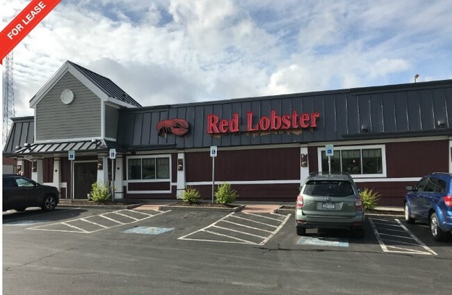
Property Record
2965 Erie Blvd E, Syracuse, NY 13224

NEARBY LISTINGS FOR SALE OR LEASE
Property Detail
2965 Erie Blvd E
311500-033-000-0001-010-000-0000
LOT 3009 FL ML 41 175X403.16 MAS REST
Restaurantbuilding
Onondaga
X
New York
36067C0237F
10.000
2025
1.62 AC
2024
Greater Syracuse
003602
Syracuse
7,176 SF
Syracuse, NY
DEMOGRAPHICS near 2965 Erie Blvd E
1 Mile
3 Mile
5 Mile
2024 Total Population
10,637
87,001
190,750
2029 Population
10,407
84,805
186,835
Pop Growth 2024-2029
(2.16%)
(2.52%)
(2.05%)
Average Age
38
37
38
2024 Total Households
4,316
34,886
77,316
HH Growth 2024-2029
(2.04%)
(2.63%)
(2.10%)
Median Household Inc
$56,134
$51,947
$48,637
Avg Household Size
2.10
2.10
2.20
2024 Avg HH Vehicles
1.00
1.00
1.00
Median Home Value
$123,323
$155,859
$146,288
Median Year Built
1953
1952
1953
Nearby Places
- Restaurants
- Banks
- Shops
- Fitness
- Groceries
PUBLIC TRANSPORTATION
COMMUTER RAIL
DRIVE
WALK
Distance
11 min
5.8 mi
DRIVE
WALK
Distance
11 min
5.8 mi
AIRPORT
Syracuse Hancock International
DRIVE
WALK
Distance
Syracuse Hancock International
17 min
10.4 mi
SALE & LEASE HISTORY
LISTING DATE
SALE/LEASE

Sep 20, 2018
For Sale
Mar 16, 2023
For Lease
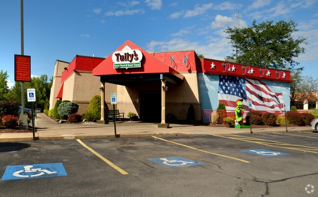
Nearby Properties
Address
Land Use
TOTAL SIZE
Lot Size
Zoning
Address
Land Use
TOTAL SIZE
Lot Size
Zoning
70,284 SF
74.57 AC
25
Address
Land Use
TOTAL SIZE
Lot Size
Zoning
459,040 SF
4.71 AC
06 - INDUS
Address
Land Use
TOTAL SIZE
Lot Size
Zoning
826,528 SF
2.28 AC
06 - INDUS
Address
Land Use
TOTAL SIZE
Lot Size
Zoning
269,030 SF
11.90 AC
05 - COMME
Address
Land Use
TOTAL SIZE
Lot Size
Zoning
348,998 SF
65.59 AC
25
Address
Land Use
TOTAL SIZE
Lot Size
Zoning
72,200 SF
12.39 AC
06 - INDUS
Address
Land Use
TOTAL SIZE
Lot Size
Zoning
354,492 SF
6.90 AC
25
Address
Land Use
TOTAL SIZE
Lot Size
Zoning
72,800 SF
1.89 AC
06 - INDUS
Address
Land Use
TOTAL SIZE
Lot Size
Zoning
409,062 SF
10
Address
Land Use
TOTAL SIZE
Lot Size
Zoning
218,051 SF
2.32 AC
25
Address
Land Use
TOTAL SIZE
Lot Size
Zoning
38,693 SF
102.34 AC
05 - COMME
Address
Land Use
TOTAL SIZE
Lot Size
Zoning
24,360 SF
3.99 AC
10
Address
Land Use
TOTAL SIZE
Lot Size
Zoning
414,700 SF
1.94 AC
07 - MIXED
Address
Land Use
TOTAL SIZE
Lot Size
Zoning
2,709 SF
39.74 AC
06 - INDUS
Address
Land Use
TOTAL SIZE
Lot Size
Zoning
1.67 AC
06 - INDUS
Address
Land Use
TOTAL SIZE
Lot Size
Zoning
224,736 SF
2.48 AC
10
Address
Land Use
TOTAL SIZE
Lot Size
Zoning
165,800 SF
1.27 AC
25
Address
Land Use
TOTAL SIZE
Lot Size
Zoning
164,837 SF
0.66 AC
10
Address
Land Use
TOTAL SIZE
Lot Size
Zoning
105,004 SF
2.81 AC
25
Address
Land Use
TOTAL SIZE
Lot Size
Zoning
569,463 SF
94.77 AC
06 - INDUS
Address
Land Use
TOTAL SIZE
Lot Size
Zoning
307,860 SF
1.17 AC
25
Address
Land Use
TOTAL SIZE
Lot Size
Zoning
12,836 SF
148.95 AC
06 - INDUS
Address
Land Use
TOTAL SIZE
Lot Size
Zoning
50,472 SF
4.89 AC
10
Address
Land Use
TOTAL SIZE
Lot Size
Zoning
278,208 SF
1.92 AC
25
Address
Land Use
TOTAL SIZE
Lot Size
Zoning
134,400 SF
1.18 AC
25
Address
Land Use
TOTAL SIZE
Lot Size
Zoning
168,067 SF
25
Address
Land Use
TOTAL SIZE
Lot Size
Zoning
876,645 SF
51.07 AC
05 - COMME
Address
Land Use
TOTAL SIZE
Lot Size
Zoning
92,724 SF
2.98 AC
25
Address
Land Use
TOTAL SIZE
Lot Size
Zoning
217,709 SF
34.53 AC
01 - NOT Z
Address
Land Use
TOTAL SIZE
Lot Size
Zoning
432,246 SF
37.21 AC
05 - COMME
The World's #1 Commercial Real Estate Marketplace
Connect with us
© 2025 CoStar Group
The information above has been obtained from sources believed reliable. While we do not doubt its accuracy we have not verified it and make no guarantee, warranty or representation about it. It is your responsibility to independently confirm its accuracy and completeness. Any projections, opinions, assumptions, or estimates used are for example only and do not represent the current or future performance of the property. The value of this transaction to you depends on tax and other factors which should be evaluated by your tax, financial, and legal advisors. You and your advisors should conduct a careful, independent investigation of the property to determine to your satisfaction the suitability of the property for your needs.