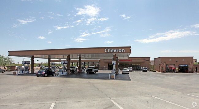
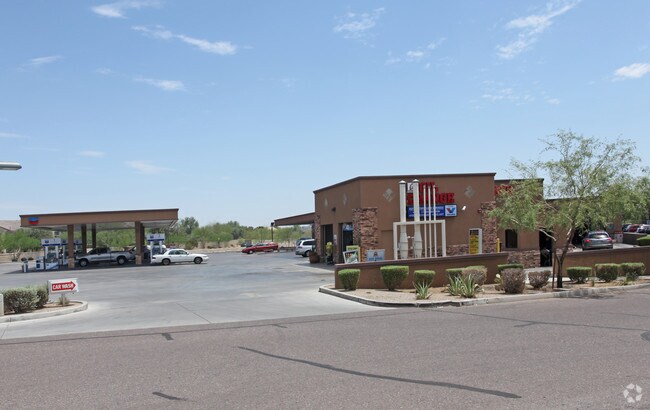
Property Record
29650 N Tatum Blvd, Cave Creek, AZ 85331


NEARBY LISTINGS FOR SALE OR LEASE
-
-
View all Cave Creek listings for sale on LoopNet.com
Property Detail
29650 N Tatum Blvd
211-38-004D
PT NE4 NW4 SEC 30 DAF COM N4 COR SD SEC TH W 660F S 145.25F TH CONT S 66.33F TO PT ON S R/W TATUM BLVD TH N 64D 23M W 48.44F TO TPOB TH S 25D 35M W 25.58F TO BEG CUR TO LEFT TH 51.97F ALG SD CUR TO BEG CUR TO RIGHT TH 142.45F ALG SD CUR TO PT TH S 55
Storebuilding
Maricopa
X
Arizona
04013C0888M
1.84 AC
2025
Carefree
2025
Phoenix
612800
Phoenix-Mesa-Scottsdale, AZ
9,464 SF
DEMOGRAPHICS near 29650 N Tatum Blvd
1 Mile
3 Mile
5 Mile
2024 Total Population
7,230
27,550
64,081
2029 Population
7,803
29,729
69,819
Pop Growth 2024-2029
+ 7.93%
+ 7.91%
+ 8.95%
Average Age
44
44
44
2024 Total Households
2,943
10,512
24,918
HH Growth 2024-2029
+ 7.99%
+ 7.96%
+ 9.15%
Median Household Inc
$115,007
$122,833
$135,140
Avg Household Size
2.40
2.60
2.50
2024 Avg HH Vehicles
2.00
2.00
2.00
Median Home Value
$481,823
$560,857
$659,435
Median Year Built
1995
1996
1998
Nearby Places
Map Layers
Map Styles
 Street
 Aerial
- Restaurants
- Banks
- Shops
- Fitness
- Groceries
PUBLIC TRANSPORTATION
AIRPORT
Phoenix Sky Harbor International
DRIVE
WALK
Distance
Phoenix Sky Harbor International
40 min
27.1 mi
Freight Ports
Port of San Diego
DRIVE
WALK
Distance
Port of San Diego
423 min
376.2 mi
Nearby Properties
Address
Land Use
TOTAL SIZE
Lot Size
Zoning
Address
Land Use
TOTAL SIZE
Lot Size
Zoning
557,887 SF
163.54 AC
R-43
Address
Land Use
TOTAL SIZE
Lot Size
Zoning
328 SF
96.24 AC
R-43AG
Address
Land Use
TOTAL SIZE
Lot Size
Zoning
108,124 SF
26.19 AC
R-35
Address
Land Use
TOTAL SIZE
Lot Size
Zoning
10 SF
13.75 AC
R-35
Address
Land Use
TOTAL SIZE
Lot Size
Zoning
79,429 SF
17.76 AC
R-35
Address
Land Use
TOTAL SIZE
Lot Size
Zoning
30,172 SF
14.13 AC
S1
Address
Land Use
TOTAL SIZE
Lot Size
Zoning
70.35 AC
R-35
Address
Land Use
TOTAL SIZE
Lot Size
Zoning
34,576 SF
23 AC
R-43
Address
Land Use
TOTAL SIZE
Lot Size
Zoning
15.34 AC
PAD
Address
Land Use
TOTAL SIZE
Lot Size
Zoning
13,960 SF
33.20 AC
R-35
Address
Land Use
TOTAL SIZE
Lot Size
Zoning
65,728 SF
12.07 AC
C-C
Address
Land Use
TOTAL SIZE
Lot Size
Zoning
74,132 SF
7.93 AC
PAD
Address
Land Use
TOTAL SIZE
Lot Size
Zoning
43,674 SF
9.26 AC
C-C
Address
Land Use
TOTAL SIZE
Lot Size
Zoning
135,578 SF
2.85 AC
C-C
Address
Land Use
TOTAL SIZE
Lot Size
Zoning
600 SF
38.67 AC
R-43
Address
Land Use
TOTAL SIZE
Lot Size
Zoning
116,269 SF
5.01 AC
C-N
Address
Land Use
TOTAL SIZE
Lot Size
Zoning
68,338 SF
16.15 AC
R-43
Address
Land Use
TOTAL SIZE
Lot Size
Zoning
140,290 SF
5.13 AC
CP/GCP
Address
Land Use
TOTAL SIZE
Lot Size
Zoning
45,425 SF
22.94 AC
R-43AG
Address
Land Use
TOTAL SIZE
Lot Size
Zoning
34,693 SF
5.73 AC
R-35
Address
Land Use
TOTAL SIZE
Lot Size
Zoning
52,022 SF
10.01 AC
R-43
Address
Land Use
TOTAL SIZE
Lot Size
Zoning
55,478 SF
5.24 AC
C-C
Address
Land Use
TOTAL SIZE
Lot Size
Zoning
1,010.34 AC
R-35
Address
Land Use
TOTAL SIZE
Lot Size
Zoning
102,591 SF
3.81 AC
C-C
Address
Land Use
TOTAL SIZE
Lot Size
Zoning
40,743 SF
6.90 AC
C-N
Address
Land Use
TOTAL SIZE
Lot Size
Zoning
12.17 AC
R-6
Address
Land Use
TOTAL SIZE
Lot Size
Zoning
34,888 SF
4.69 AC
S-1
Address
Land Use
TOTAL SIZE
Lot Size
Zoning
27,015 SF
3.14 AC
C-2
Address
Land Use
TOTAL SIZE
Lot Size
Zoning
13,982 SF
5.34 AC
R-43AG
Address
Land Use
TOTAL SIZE
Lot Size
Zoning
25,217 SF
1.43 AC
R-35
The World's #1 Commercial Real Estate Marketplace
Connect with us
© 2025 CoStar Group
The information above has been obtained from sources believed reliable. While we do not doubt its accuracy we have not verified it and make no guarantee, warranty or representation about it. It is your responsibility to independently confirm its accuracy and completeness. Any projections, opinions, assumptions, or estimates used are for example only and do not represent the current or future performance of the property. The value of this transaction to you depends on tax and other factors which should be evaluated by your tax, financial, and legal advisors. You and your advisors should conduct a careful, independent investigation of the property to determine to your satisfaction the suitability of the property for your needs.