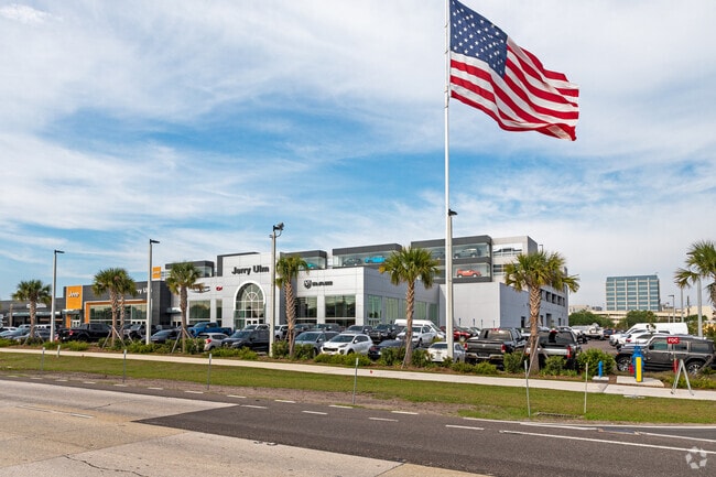
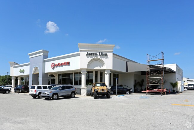
Property Record
2966 N Dale Mabry Hwy, Tampa, FL 33607


NEARBY LISTINGS FOR SALE OR LEASE
Property Detail
2966 N Dale Mabry Hwy
Tampa-St. Petersburg-Clearwater, FL
Unplatted
A-16-29-18-ZZZ-000005-47610.0
TRACT BEG 81.89 FT W AND 50 FT S OF NE COR OF NW 1/4 OF NE 1/4 AND RUN S 400 FT, W 622.8 FT, N 400 FT AND E 622.8 FT TO BEG LESS SR R/W AND LESS ADDL R/W FOR SR 600 ... TOG WITH COM AT NE COR OF NW 1/4 OF NE 1/4 RUN WEST 81.89 FT SOUTH 451.60 FT FOR
Vehiclerentalsvehiclesales
Hillsborough
X
Florida
12057C0334J
47610
2024
7.78 AC
2024
Westshore
004601
Tampa/St Petersburg
289,441 SF
DEMOGRAPHICS near 2966 N Dale Mabry Hwy
1 Mile
3 Mile
5 Mile
2024 Total Population
12,016
103,585
285,233
2029 Population
13,227
113,685
311,940
Pop Growth 2024-2029
+ 10.08%
+ 9.75%
+ 9.36%
Average Age
39
39
39
2024 Total Households
5,725
44,763
122,040
HH Growth 2024-2029
+ 10.46%
+ 10.11%
+ 9.75%
Median Household Inc
$65,878
$64,612
$64,349
Avg Household Size
2.00
2.20
2.20
2024 Avg HH Vehicles
2.00
2.00
2.00
Median Home Value
$321,253
$396,644
$365,205
Median Year Built
1999
1979
1979
Nearby Places
Map Layers
Map Styles
 Street
 Aerial
- Restaurants
- Banks
- Shops
- Fitness
- Groceries
PUBLIC TRANSPORTATION
COMMUTER RAIL
DRIVE
WALK
Distance
10 min
4.8 mi
AIRPORT
Tampa International
DRIVE
WALK
Distance
Tampa International
9 min
3.6 mi
St Pete-Clearwater International
DRIVE
WALK
Distance
St Pete-Clearwater International
29 min
15.2 mi
Nearby Properties
Address
Land Use
TOTAL SIZE
Lot Size
Zoning
Address
Land Use
TOTAL SIZE
Lot Size
Zoning
2,308,592 SF
1,915.65 AC
M-AP-1
Address
Land Use
TOTAL SIZE
Lot Size
Zoning
2,700,512 SF
87.53 AC
PD-A
Address
Land Use
TOTAL SIZE
Lot Size
Zoning
927,709 SF
74.68 AC
PD-A
Address
Land Use
TOTAL SIZE
Lot Size
Zoning
1,278,217 SF
0.02 AC
CI
Address
Land Use
TOTAL SIZE
Lot Size
Zoning
1,083,666 SF
26.73 AC
OP-1
Address
Land Use
TOTAL SIZE
Lot Size
Zoning
142,972 SF
21.79 AC
M-AP-1
Address
Land Use
TOTAL SIZE
Lot Size
Zoning
124,768 SF
13.26 AC
CBD-2
Address
Land Use
TOTAL SIZE
Lot Size
Zoning
449,135 SF
16.72 AC
PD
Address
Land Use
TOTAL SIZE
Lot Size
Zoning
428,819 SF
5.24 AC
CBD-1
Address
Land Use
TOTAL SIZE
Lot Size
Zoning
532,661 SF
76.96 AC
CI
Address
Land Use
TOTAL SIZE
Lot Size
Zoning
476,090 SF
2.02 AC
CBD-1
Address
Land Use
TOTAL SIZE
Lot Size
Zoning
350,039 SF
2.40 AC
PD
Address
Land Use
TOTAL SIZE
Lot Size
Zoning
465,058 SF
0.99 AC
CBD-1
Address
Land Use
TOTAL SIZE
Lot Size
Zoning
399,394 SF
4.14 AC
PD-A
Address
Land Use
TOTAL SIZE
Lot Size
Zoning
429,656 SF
6.97 AC
PD
Address
Land Use
TOTAL SIZE
Lot Size
Zoning
401,486 SF
13.22 AC
PD-A
Address
Land Use
TOTAL SIZE
Lot Size
Zoning
387,234 SF
5.31 AC
OP-1
Address
Land Use
TOTAL SIZE
Lot Size
Zoning
352,071 SF
21.42 AC
M-AP-2
Address
Land Use
TOTAL SIZE
Lot Size
Zoning
598,902 SF
36.33 AC
PD
Address
Land Use
TOTAL SIZE
Lot Size
Zoning
367,609 SF
5.46 AC
PD
Address
Land Use
TOTAL SIZE
Lot Size
Zoning
393,971 SF
6.85 AC
PD
Address
Land Use
TOTAL SIZE
Lot Size
Zoning
309,242 SF
7.44 AC
PD-A
Address
Land Use
TOTAL SIZE
Lot Size
Zoning
349,631 SF
4.39 AC
CBD-1
Address
Land Use
TOTAL SIZE
Lot Size
Zoning
305,936 SF
5.47 AC
PD-A
Address
Land Use
TOTAL SIZE
Lot Size
Zoning
2,226 SF
438.48 AC
SPI-AP-1
Address
Land Use
TOTAL SIZE
Lot Size
Zoning
291,736 SF
2.87 AC
PD
Address
Land Use
TOTAL SIZE
Lot Size
Zoning
485,897 SF
2.90 AC
PD
Address
Land Use
TOTAL SIZE
Lot Size
Zoning
296,342 SF
2.86 AC
PD
Address
Land Use
TOTAL SIZE
Lot Size
Zoning
344,612 SF
6.09 AC
PD
Address
Land Use
TOTAL SIZE
Lot Size
Zoning
382,085 SF
4.09 AC
PD
The World's #1 Commercial Real Estate Marketplace
Connect with us
© 2026 CoStar Group
The information above has been obtained from sources believed reliable. While we do not doubt its accuracy we have not verified it and make no guarantee, warranty or representation about it. It is your responsibility to independently confirm its accuracy and completeness. Any projections, opinions, assumptions, or estimates used are for example only and do not represent the current or future performance of the property. The value of this transaction to you depends on tax and other factors which should be evaluated by your tax, financial, and legal advisors. You and your advisors should conduct a careful, independent investigation of the property to determine to your satisfaction the suitability of the property for your needs.