Property Record
2967 133Rd St W, Shakopee, MN 55379
NEARBY LISTINGS FOR SALE OR LEASE
Property Detail
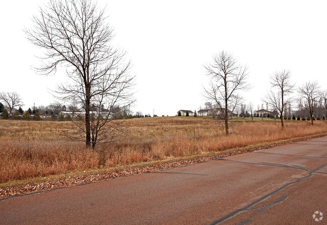
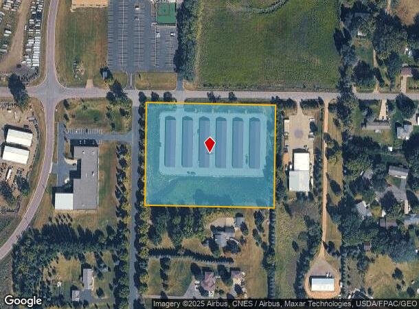
2967 133Rd St W
Minneapolis/St Paul
Harvest Moon
Minneapolis-St. Paul-Bloomington, MN-WI
HARVEST MOON LOT 001 BLOCK 002
7-023-005-0
Scott
Commercialnec
Minnesota
2025
1
2025
5.01 AC
080307
Scott County Outlying
DEMOGRAPHICS near 2967 133Rd St W
1 Mile
3 Mile
5 Mile
2024 Total Population
832
19,304
68,467
2029 Population
929
20,979
73,870
Pop Growth 2024-2029
+ 11.66%
+ 8.68%
+ 7.89%
Average Age
36
37
37
2024 Total Households
279
6,717
24,088
HH Growth 2024-2029
+ 12.19%
+ 8.65%
+ 8.07%
Median Household Inc
$57,856
$87,998
$92,106
Avg Household Size
3.00
2.80
2.70
2024 Avg HH Vehicles
2.00
2.00
2.00
Median Home Value
$275,806
$322,697
$332,767
Median Year Built
1987
1991
1995
Nearby Places
Map Layers
Map Styles
 Street
 Aerial
- Restaurants
- Banks
- Shops
- Fitness
- Groceries
PUBLIC TRANSPORTATION
AIRPORT
Minneapolis-St Paul International/Wold-Chamberlain
DRIVE
WALK
Distance
Minneapolis-St Paul International/Wold-Chamberlain
35 min
24.9 mi
SALE & LEASE HISTORY
LISTING DATE
SALE/LEASE

Dec 26, 2019
For Sale
Nearby Properties
Address
Land Use
TOTAL SIZE
Lot Size
Zoning
Address
Land Use
TOTAL SIZE
Lot Size
Zoning
625,426 SF
40.47 AC
Address
Land Use
TOTAL SIZE
Lot Size
Zoning
20,086 SF
12.99 AC
Address
Land Use
TOTAL SIZE
Lot Size
Zoning
Address
Land Use
TOTAL SIZE
Lot Size
Zoning
164,809 SF
7.28 AC
Address
Land Use
TOTAL SIZE
Lot Size
Zoning
Address
Land Use
TOTAL SIZE
Lot Size
Zoning
26.05 AC
Address
Land Use
TOTAL SIZE
Lot Size
Zoning
191,395 SF
5.16 AC
Address
Land Use
TOTAL SIZE
Lot Size
Zoning
20.79 AC
Address
Land Use
TOTAL SIZE
Lot Size
Zoning
33,982 SF
0.38 AC
Address
Land Use
TOTAL SIZE
Lot Size
Zoning
128,456 SF
15.85 AC
Address
Land Use
TOTAL SIZE
Lot Size
Zoning
3.75 AC
Address
Land Use
TOTAL SIZE
Lot Size
Zoning
110,502 SF
13.27 AC
Address
Land Use
TOTAL SIZE
Lot Size
Zoning
119.59 AC
I-2
Address
Land Use
TOTAL SIZE
Lot Size
Zoning
101,295 SF
11.55 AC
Address
Land Use
TOTAL SIZE
Lot Size
Zoning
44,599 SF
3.25 AC
Address
Land Use
TOTAL SIZE
Lot Size
Zoning
92,380 SF
20.05 AC
I-2
Address
Land Use
TOTAL SIZE
Lot Size
Zoning
100.55 AC
Address
Land Use
TOTAL SIZE
Lot Size
Zoning
157.60 AC
I-1
Address
Land Use
TOTAL SIZE
Lot Size
Zoning
29,674 SF
4.29 AC
Address
Land Use
TOTAL SIZE
Lot Size
Zoning
89,797 SF
13.38 AC
Address
Land Use
TOTAL SIZE
Lot Size
Zoning
17,600 SF
3.46 AC
Address
Land Use
TOTAL SIZE
Lot Size
Zoning
11,816 SF
48.66 AC
Address
Land Use
TOTAL SIZE
Lot Size
Zoning
5,940 SF
1.52 AC
Address
Land Use
TOTAL SIZE
Lot Size
Zoning
40,626 SF
3.41 AC
Address
Land Use
TOTAL SIZE
Lot Size
Zoning
100,524 SF
3.57 AC
Address
Land Use
TOTAL SIZE
Lot Size
Zoning
100,524 SF
2.72 AC
Address
Land Use
TOTAL SIZE
Lot Size
Zoning
13,383 SF
1.05 AC
Address
Land Use
TOTAL SIZE
Lot Size
Zoning
11,616 SF
1.75 AC
Address
Land Use
TOTAL SIZE
Lot Size
Zoning
4.84 AC
The World's #1 Commercial Real Estate Marketplace
Connect with us
© 2025 CoStar Group
The information above has been obtained from sources believed reliable. While we do not doubt its accuracy we have not verified it and make no guarantee, warranty or representation about it. It is your responsibility to independently confirm its accuracy and completeness. Any projections, opinions, assumptions, or estimates used are for example only and do not represent the current or future performance of the property. The value of this transaction to you depends on tax and other factors which should be evaluated by your tax, financial, and legal advisors. You and your advisors should conduct a careful, independent investigation of the property to determine to your satisfaction the suitability of the property for your needs.