Property Record
2967 Harrison St, Paducah, KY 42001
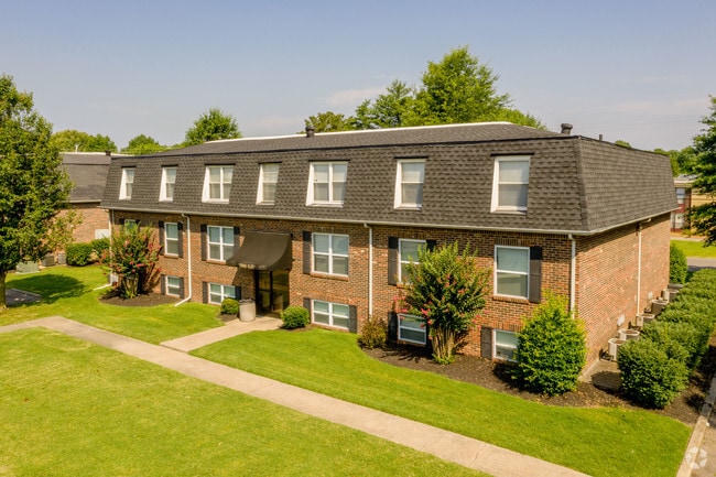

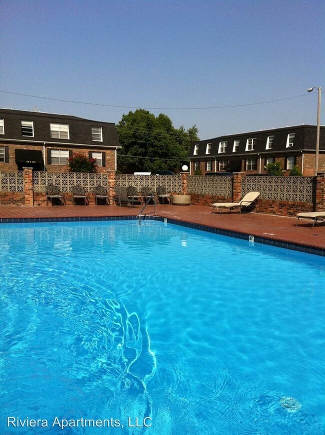
Property Detail
2967 Harrison St
Paducah, KY-IL
15-13-1-6, 15-12-1 RIVIERA APTS 2967 HARRISON ST
095-43-10-001
MCCRACKEN
Commercialnec
Kentucky
B and X Area of moderate flood hazard, usually the area between the limits of the 100-year and 500-year floods.
1.34 AC
2025
Kentucky West Area
2025
Other Market Areas
030700
NEARBY LISTINGS FOR SALE OR LEASE
DEMOGRAPHICS near 2967 Harrison St
1 mile
3 mile
5 mile
2025 Total Population
6,523
29,425
47,194
2030 Population
6,441
29,400
47,157
Pop Growth 2025-2030
(1.26%)
(0.08%)
(0.08%)
Average Age
40
41
41
2025 Total Households
3,035
12,788
20,540
HH Growth 2025-2030
(1.22%)
(0.13%)
(0.08%)
Median Household Inc
$54,500
$49,742
$54,351
Avg Household Size
2.10
2.10
2.20
2025 Avg HH Vehicles
2.00
2.00
2.00
Median Home Value
$150,141
$165,953
$169,177
Median Year Built
1957
1969
1975
Nearby Places
Map Layers
Map Styles
 Street
 Aerial
Layers
 Traffic
 Biking
Places
Listings with unknown addresses are not visible on the map
- Restaurants
- Banks
- Shops
- Fitness
- Groceries
Nearby Properties
Address
Land Use
TOTAL SIZE
Lot Size
Zoning
Address
Land Use
TOTAL SIZE
Lot Size
Zoning
Address
Land Use
TOTAL SIZE
Lot Size
Zoning
35.07 AC
Address
Land Use
TOTAL SIZE
Lot Size
Zoning
33.35 AC
Address
Land Use
TOTAL SIZE
Lot Size
Zoning
65.20 AC
Address
Land Use
TOTAL SIZE
Lot Size
Zoning
Address
Land Use
TOTAL SIZE
Lot Size
Zoning
11.84 AC
Address
Land Use
TOTAL SIZE
Lot Size
Zoning
4.27 AC
Address
Land Use
TOTAL SIZE
Lot Size
Zoning
Address
Land Use
TOTAL SIZE
Lot Size
Zoning
Address
Land Use
TOTAL SIZE
Lot Size
Zoning
10.39 AC
Address
Land Use
TOTAL SIZE
Lot Size
Zoning
Address
Land Use
TOTAL SIZE
Lot Size
Zoning
13.34 AC
Address
Land Use
TOTAL SIZE
Lot Size
Zoning
7.05 AC
Address
Land Use
TOTAL SIZE
Lot Size
Zoning
10.17 AC
Address
Land Use
TOTAL SIZE
Lot Size
Zoning
27.89 AC
Address
Land Use
TOTAL SIZE
Lot Size
Zoning
Address
Land Use
TOTAL SIZE
Lot Size
Zoning
1.37 AC
Address
Land Use
TOTAL SIZE
Lot Size
Zoning
8.54 AC
Address
Land Use
TOTAL SIZE
Lot Size
Zoning
13.03 AC
Address
Land Use
TOTAL SIZE
Lot Size
Zoning
5.17 AC
Address
Land Use
TOTAL SIZE
Lot Size
Zoning
11.81 AC
Address
Land Use
TOTAL SIZE
Lot Size
Zoning
5.08 AC
Address
Land Use
TOTAL SIZE
Lot Size
Zoning
24.38 AC
Address
Land Use
TOTAL SIZE
Lot Size
Zoning
28.04 AC
Address
Land Use
TOTAL SIZE
Lot Size
Zoning
13.90 AC
Address
Land Use
TOTAL SIZE
Lot Size
Zoning
12.32 AC
Address
Land Use
TOTAL SIZE
Lot Size
Zoning
Address
Land Use
TOTAL SIZE
Lot Size
Zoning
13.47 AC
Address
Land Use
TOTAL SIZE
Lot Size
Zoning
Address
Land Use
TOTAL SIZE
Lot Size
Zoning
37.34 AC
The World's #1 Commercial Real Estate Marketplace
Connect with us
© 2026 CoStar Group
The information above has been obtained from sources believed reliable. While we do not doubt its accuracy we have not verified it and make no guarantee, warranty or representation about it. It is your responsibility to independently confirm its accuracy and completeness. Any projections, opinions, assumptions, or estimates used are for example only and do not represent the current or future performance of the property. The value of this transaction to you depends on tax and other factors which should be evaluated by your tax, financial, and legal advisors. You and your advisors should conduct a careful, independent investigation of the property to determine to your satisfaction the suitability of the property for your needs.