Property Record
29675 Bulverde Ln, Bulverde, TX 78163
NEARBY LISTINGS FOR SALE OR LEASE
Property Detail
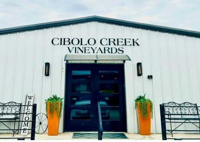
29675 Bulverde Ln
San Antonio-New Braunfels, TX
Bulverde Gardens (A-206 Sur-192 G Herrer
11-0130-0008-00
BULVERDE GARDENS (A-206 SUR-192 G HERRERA), TRACT 8, ACRES .77
Commercialnec
Comal
AE
Texas
48029C0130G
8
2024
0.77 AC
2025
Comal County
310706
San Antonio
4,240 SF
DEMOGRAPHICS near 29675 Bulverde Ln
1 Mile
3 Mile
5 Mile
2024 Total Population
1,703
14,881
58,782
2029 Population
1,927
17,427
66,950
Pop Growth 2024-2029
+ 13.15%
+ 17.11%
+ 13.90%
Average Age
39
39
38
2024 Total Households
557
5,012
19,764
HH Growth 2024-2029
+ 13.82%
+ 17.62%
+ 14.34%
Median Household Inc
$154,570
$132,279
$120,961
Avg Household Size
3.00
3.00
2.90
2024 Avg HH Vehicles
2.00
2.00
2.00
Median Home Value
$421,090
$377,269
$381,665
Median Year Built
2010
2009
2007
Nearby Places
Map Layers
Map Styles
 Street
 Aerial
- Restaurants
- Banks
- Shops
- Fitness
- Groceries
PUBLIC TRANSPORTATION
AIRPORT
San Antonio International
DRIVE
WALK
Distance
San Antonio International
23 min
16.3 mi
Freight Ports
Calhoun Port
DRIVE
WALK
Distance
Calhoun Port
200 min
165.0 mi
SALE & LEASE HISTORY
LISTING DATE
SALE/LEASE

Sep 06, 2024
For Sale
Oct 29, 2024
For Sale
Jun 21, 2024
For Sale
Jul 01, 2024
For Lease
Jan 16, 2024
For Sale
Jan 09, 2025
For Lease
Dec 12, 2024
For Sale
Aug 30, 2024
For Lease
Aug 30, 2024
For Sale
Apr 04, 2025
For Sale
Nearby Properties
Address
Land Use
TOTAL SIZE
Lot Size
Zoning
Address
Land Use
TOTAL SIZE
Lot Size
Zoning
310,384 SF
14.25 AC
Address
Land Use
TOTAL SIZE
Lot Size
Zoning
137,704 SF
26.31 AC
Address
Land Use
TOTAL SIZE
Lot Size
Zoning
66,166 SF
85.74 AC
Address
Land Use
TOTAL SIZE
Lot Size
Zoning
28.60 AC
Address
Land Use
TOTAL SIZE
Lot Size
Zoning
69,435 SF
12.74 AC
Address
Land Use
TOTAL SIZE
Lot Size
Zoning
20.13 AC
Address
Land Use
TOTAL SIZE
Lot Size
Zoning
74,320 SF
4.55 AC
Address
Land Use
TOTAL SIZE
Lot Size
Zoning
63,236 SF
15.29 AC
Address
Land Use
TOTAL SIZE
Lot Size
Zoning
76,120 SF
3.90 AC
Address
Land Use
TOTAL SIZE
Lot Size
Zoning
5,508 SF
3.50 AC
Address
Land Use
TOTAL SIZE
Lot Size
Zoning
183.24 AC
Address
Land Use
TOTAL SIZE
Lot Size
Zoning
19.32 AC
Address
Land Use
TOTAL SIZE
Lot Size
Zoning
5,400 SF
3.24 AC
Address
Land Use
TOTAL SIZE
Lot Size
Zoning
57,226 SF
6.95 AC
Address
Land Use
TOTAL SIZE
Lot Size
Zoning
134.81 AC
Address
Land Use
TOTAL SIZE
Lot Size
Zoning
71,743 SF
6.87 AC
Address
Land Use
TOTAL SIZE
Lot Size
Zoning
13,969 SF
10.03 AC
Address
Land Use
TOTAL SIZE
Lot Size
Zoning
6,590 SF
211.63 AC
Address
Land Use
TOTAL SIZE
Lot Size
Zoning
9,280 SF
3.93 AC
Address
Land Use
TOTAL SIZE
Lot Size
Zoning
1,070 SF
303.68 AC
Address
Land Use
TOTAL SIZE
Lot Size
Zoning
19,554 SF
3.19 AC
Address
Land Use
TOTAL SIZE
Lot Size
Zoning
13,172 SF
1.98 AC
Address
Land Use
TOTAL SIZE
Lot Size
Zoning
13,552 SF
4.48 AC
Address
Land Use
TOTAL SIZE
Lot Size
Zoning
11.30 AC
Address
Land Use
TOTAL SIZE
Lot Size
Zoning
13,557 SF
2.31 AC
Address
Land Use
TOTAL SIZE
Lot Size
Zoning
23,314 SF
3 AC
Address
Land Use
TOTAL SIZE
Lot Size
Zoning
12,248 SF
26.73 AC
Address
Land Use
TOTAL SIZE
Lot Size
Zoning
7,236 SF
0.72 AC
Address
Land Use
TOTAL SIZE
Lot Size
Zoning
3,120 SF
10.02 AC
Address
Land Use
TOTAL SIZE
Lot Size
Zoning
70.39 AC
The World's #1 Commercial Real Estate Marketplace
Connect with us
© 2026 CoStar Group
The information above has been obtained from sources believed reliable. While we do not doubt its accuracy we have not verified it and make no guarantee, warranty or representation about it. It is your responsibility to independently confirm its accuracy and completeness. Any projections, opinions, assumptions, or estimates used are for example only and do not represent the current or future performance of the property. The value of this transaction to you depends on tax and other factors which should be evaluated by your tax, financial, and legal advisors. You and your advisors should conduct a careful, independent investigation of the property to determine to your satisfaction the suitability of the property for your needs.