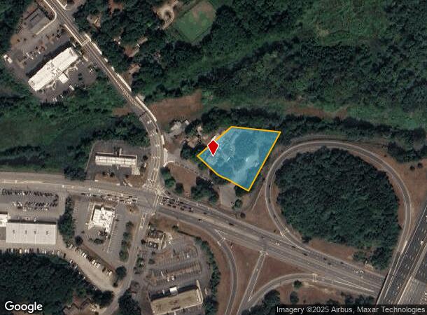
Property Record
297 Elm St, Amesbury, MA 01913

NEARBY LISTINGS FOR SALE OR LEASE
Property Detail
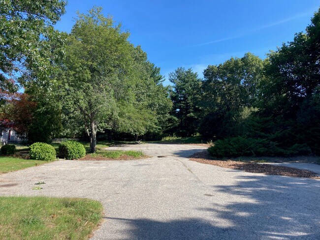
297 Elm St
AMES-000080-000000-000012
Amesbury
Commercialnec
Essex
X
Massachusetts
25009C0107G
1.28 AC
2025
Amesbury/Ipswich
2025
Boston
266300
Boston-Cambridge-Newton, MA-NH
DEMOGRAPHICS near 297 Elm St
1 Mile
3 Mile
5 Mile
2024 Total Population
2,558
34,905
62,323
2029 Population
2,543
34,787
62,946
Pop Growth 2024-2029
(0.59%)
(0.34%)
+ 1.00%
Average Age
44
44
45
2024 Total Households
1,070
14,702
26,770
HH Growth 2024-2029
(0.65%)
(0.50%)
+ 0.87%
Median Household Inc
$103,431
$100,452
$101,053
Avg Household Size
2.30
2.30
2.30
2024 Avg HH Vehicles
2.00
2.00
2.00
Median Home Value
$466,502
$532,009
$540,282
Median Year Built
1955
1970
1973
Nearby Places
Map Layers
Map Styles
 Street
 Aerial
- Restaurants
- Banks
- Shops
- Fitness
- Groceries
PUBLIC TRANSPORTATION
AIRPORT
Portsmouth International at Pease
DRIVE
WALK
Distance
Portsmouth International at Pease
28 min
19.1 mi
General Edward Lawrence Logan International
DRIVE
WALK
Distance
General Edward Lawrence Logan International
52 min
37.3 mi
Manchester Boston Regional
DRIVE
WALK
Distance
Manchester Boston Regional
59 min
41.8 mi
Freight Ports
Port of Boston
DRIVE
WALK
Distance
Port of Boston
55 min
40.3 mi
SALE & LEASE HISTORY
LISTING DATE
SALE/LEASE

Sep 10, 2021
For Lease
Nearby Properties
Address
Land Use
TOTAL SIZE
Lot Size
Zoning
Address
Land Use
TOTAL SIZE
Lot Size
Zoning
207,982 SF
14.58 AC
Address
Land Use
TOTAL SIZE
Lot Size
Zoning
26.44 AC
OP
Address
Land Use
TOTAL SIZE
Lot Size
Zoning
504,280 SF
80.02 AC
I3
Address
Land Use
TOTAL SIZE
Lot Size
Zoning
107,053 SF
17.51 AC
Address
Land Use
TOTAL SIZE
Lot Size
Zoning
170,444 SF
13.30 AC
Address
Land Use
TOTAL SIZE
Lot Size
Zoning
163,948 SF
20.31 AC
Address
Land Use
TOTAL SIZE
Lot Size
Zoning
176,157 SF
25.53 AC
OSC
Address
Land Use
TOTAL SIZE
Lot Size
Zoning
2,362 SF
342.02 AC
Address
Land Use
TOTAL SIZE
Lot Size
Zoning
145,676 SF
17.42 AC
OSC
Address
Land Use
TOTAL SIZE
Lot Size
Zoning
9.31 AC
R8
Address
Land Use
TOTAL SIZE
Lot Size
Zoning
94,943 SF
15.52 AC
RCZD
Address
Land Use
TOTAL SIZE
Lot Size
Zoning
191,775 SF
23.50 AC
C
Address
Land Use
TOTAL SIZE
Lot Size
Zoning
79,991 SF
2.66 AC
IC
Address
Land Use
TOTAL SIZE
Lot Size
Zoning
2.47 AC
R8
Address
Land Use
TOTAL SIZE
Lot Size
Zoning
4.30 AC
R40
Address
Land Use
TOTAL SIZE
Lot Size
Zoning
3.68 AC
R40
Address
Land Use
TOTAL SIZE
Lot Size
Zoning
106,820 SF
9.97 AC
Address
Land Use
TOTAL SIZE
Lot Size
Zoning
274,050 SF
29.02 AC
I
Address
Land Use
TOTAL SIZE
Lot Size
Zoning
44,661 SF
4.47 AC
Address
Land Use
TOTAL SIZE
Lot Size
Zoning
106,787 SF
22.25 AC
C
Address
Land Use
TOTAL SIZE
Lot Size
Zoning
93,090 SF
87 SF
Address
Land Use
TOTAL SIZE
Lot Size
Zoning
147,462 SF
10.60 AC
I
Address
Land Use
TOTAL SIZE
Lot Size
Zoning
112,559 SF
11.27 AC
Address
Land Use
TOTAL SIZE
Lot Size
Zoning
61,320 SF
35.32 AC
OSC
Address
Land Use
TOTAL SIZE
Lot Size
Zoning
57,754 SF
5.27 AC
Address
Land Use
TOTAL SIZE
Lot Size
Zoning
118,008 SF
11.04 AC
Address
Land Use
TOTAL SIZE
Lot Size
Zoning
148,744 SF
4.10 AC
Address
Land Use
TOTAL SIZE
Lot Size
Zoning
Address
Land Use
TOTAL SIZE
Lot Size
Zoning
148,639 SF
24.60 AC
Address
Land Use
TOTAL SIZE
Lot Size
Zoning
31,428 SF
10.61 AC
The World's #1 Commercial Real Estate Marketplace
Connect with us
© 2026 CoStar Group
The information above has been obtained from sources believed reliable. While we do not doubt its accuracy we have not verified it and make no guarantee, warranty or representation about it. It is your responsibility to independently confirm its accuracy and completeness. Any projections, opinions, assumptions, or estimates used are for example only and do not represent the current or future performance of the property. The value of this transaction to you depends on tax and other factors which should be evaluated by your tax, financial, and legal advisors. You and your advisors should conduct a careful, independent investigation of the property to determine to your satisfaction the suitability of the property for your needs.