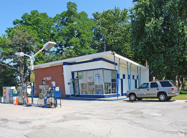
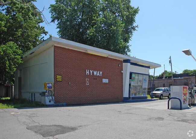
Property Record
2970 Dewey Ave, Rochester, NY 14616

NEARBY LISTINGS FOR SALE OR LEASE
Property Detail
2970 Dewey Ave
262800-060-810-0002-018-220
L57 & L59 T2 D1 SHRT RNGE JOHN REID PROP 221-51 PL-A ACQUIS 1180-87
Servicestation
Monroe
X
New York
36055C0182G
18.220
2025
0.29 AC
2024
Northwest
013800
Rochester
1,116 SF
Rochester, NY
DEMOGRAPHICS near 2970 Dewey Ave
1 Mile
3 Mile
5 Mile
2024 Total Population
14,786
105,110
238,757
2029 Population
14,563
103,734
235,334
Pop Growth 2024-2029
(1.51%)
(1.31%)
(1.43%)
Average Age
40
41
40
2024 Total Households
6,433
46,163
100,562
HH Growth 2024-2029
(1.62%)
(1.37%)
(1.47%)
Median Household Inc
$57,367
$56,487
$51,694
Avg Household Size
2.20
2.20
2.30
2024 Avg HH Vehicles
2.00
2.00
1.00
Median Home Value
$107,659
$139,170
$139,707
Median Year Built
1951
1957
1957
Nearby Places
Map Layers
Map Styles
 Street
 Aerial
- Restaurants
- Banks
- Shops
- Fitness
- Groceries
PUBLIC TRANSPORTATION
COMMUTER RAIL
DRIVE
WALK
Distance
10 min
5.5 mi
AIRPORT
Frederick Douglass/Greater Rochester International
DRIVE
WALK
Distance
Frederick Douglass/Greater Rochester International
17 min
9.3 mi
SALE & LEASE HISTORY
LISTING DATE
SALE/LEASE

Sep 24, 2018
For Sale
Oct 04, 2022
For Sale
May 12, 2020
For Sale
Nearby Properties
Address
Land Use
TOTAL SIZE
Lot Size
Zoning
Address
Land Use
TOTAL SIZE
Lot Size
Zoning
64,041 SF
42.66 AC
Address
Land Use
TOTAL SIZE
Lot Size
Zoning
270,150 SF
34.40 AC
02 - SINGL
Address
Land Use
TOTAL SIZE
Lot Size
Zoning
18,831 SF
70.63 AC
Address
Land Use
TOTAL SIZE
Lot Size
Zoning
Address
Land Use
TOTAL SIZE
Lot Size
Zoning
352,001 SF
76.90 AC
Address
Land Use
TOTAL SIZE
Lot Size
Zoning
330,700 SF
66.90 AC
Address
Land Use
TOTAL SIZE
Lot Size
Zoning
211,954 SF
9.91 AC
15
Address
Land Use
TOTAL SIZE
Lot Size
Zoning
65,000 SF
5.10 AC
Address
Land Use
TOTAL SIZE
Lot Size
Zoning
37,487 SF
47.63 AC
Address
Land Use
TOTAL SIZE
Lot Size
Zoning
491,375 SF
5.90 AC
Address
Land Use
TOTAL SIZE
Lot Size
Zoning
410,400 SF
2.88 AC
Address
Land Use
TOTAL SIZE
Lot Size
Zoning
225,793 SF
32.60 AC
Address
Land Use
TOTAL SIZE
Lot Size
Zoning
227,808 SF
69.10 AC
Address
Land Use
TOTAL SIZE
Lot Size
Zoning
273,663 SF
80.37 AC
Address
Land Use
TOTAL SIZE
Lot Size
Zoning
274,700 SF
24.79 AC
Address
Land Use
TOTAL SIZE
Lot Size
Zoning
6,617 SF
275.73 AC
Address
Land Use
TOTAL SIZE
Lot Size
Zoning
148,440 SF
4.18 AC
Address
Land Use
TOTAL SIZE
Lot Size
Zoning
205,616 SF
3.10 AC
Address
Land Use
TOTAL SIZE
Lot Size
Zoning
Address
Land Use
TOTAL SIZE
Lot Size
Zoning
2,855 SF
243.50 AC
Address
Land Use
TOTAL SIZE
Lot Size
Zoning
179,837 SF
8.01 AC
Address
Land Use
TOTAL SIZE
Lot Size
Zoning
521,507 SF
37.98 AC
Address
Land Use
TOTAL SIZE
Lot Size
Zoning
187.40 AC
Address
Land Use
TOTAL SIZE
Lot Size
Zoning
104,880 SF
9 AC
05 - COMME
Address
Land Use
TOTAL SIZE
Lot Size
Zoning
145,943 SF
16.15 AC
05 - COMME
Address
Land Use
TOTAL SIZE
Lot Size
Zoning
3,348 SF
31.29 AC
07 - MIXED
Address
Land Use
TOTAL SIZE
Lot Size
Zoning
14,800 SF
14.91 AC
05 - COMME
Address
Land Use
TOTAL SIZE
Lot Size
Zoning
54,606 SF
5.53 AC
05 - COMME
Address
Land Use
TOTAL SIZE
Lot Size
Zoning
15,762 SF
17.38 AC
05 - COMME
Address
Land Use
TOTAL SIZE
Lot Size
Zoning
99,308 SF
6.80 AC
05 - COMME
The World's #1 Commercial Real Estate Marketplace
Connect with us
© 2025 CoStar Group
The information above has been obtained from sources believed reliable. While we do not doubt its accuracy we have not verified it and make no guarantee, warranty or representation about it. It is your responsibility to independently confirm its accuracy and completeness. Any projections, opinions, assumptions, or estimates used are for example only and do not represent the current or future performance of the property. The value of this transaction to you depends on tax and other factors which should be evaluated by your tax, financial, and legal advisors. You and your advisors should conduct a careful, independent investigation of the property to determine to your satisfaction the suitability of the property for your needs.