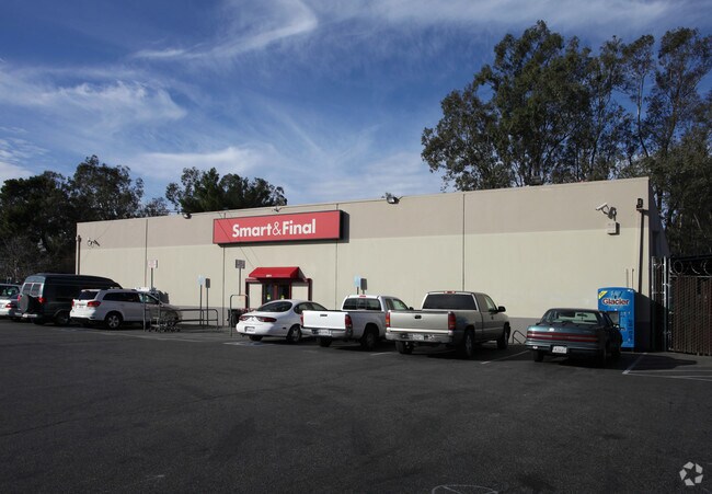
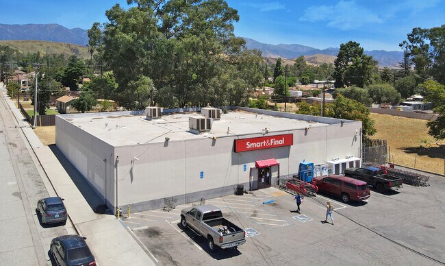
Property Record
2971 W Ramsey St, Banning, CA 92220


NEARBY LISTINGS FOR SALE OR LEASE
Property Detail
2971 W Ramsey St
Riverside-San Bernardino-Ontario, CA
Sylvan Acres
538-182-007
POR LOT 8 BLK G MB 012/092 SYLVAN ACRES
Supermarket
Riverside
X
California
06065C0816G
8
2024
0.50 AC
2025
Beaumont/Hemet
044101
Inland Empire (California)
9,000 SF
DEMOGRAPHICS near 2971 W Ramsey St
1 mile
3 mile
5 mile
2024 Total Population
7,388
43,066
74,676
2029 Population
7,859
45,444
78,983
Pop Growth 2024-2029
+ 6.38%
+ 5.52%
+ 5.77%
Average Age
41
43
40
2024 Total Households
2,619
15,216
25,414
HH Growth 2024-2029
+ 6.11%
+ 5.18%
+ 5.42%
Median Household Inc
$47,910
$59,259
$67,890
Avg Household Size
2.80
2.70
2.80
2024 Avg HH Vehicles
2.00
2.00
2.00
Median Home Value
$190,877
$339,324
$359,998
Median Year Built
1978
1989
1990
Nearby Places
Map Layers
Map Styles
 Street
 Aerial
Transit
 Traffic
 Biking
Places
Listings with unknown addresses are not visible on the map
- Restaurants
- Banks
- Shops
- Fitness
- Groceries
PUBLIC TRANSPORTATION
AIRPORT
Palm Springs International
Drive
Walk
Distance
Palm Springs International
34 min
28.4 mi
Freight Ports
Port of Long Beach
Drive
Walk
Distance
Port of Long Beach
107 min
84.2 mi
SALE & LEASE HISTORY
LISTING DATE
SALE/LEASE

Jul 29, 2020
For Sale
Nearby Properties
Address
Land Use
TOTAL SIZE
Lot Size
Zoning
Address
Land Use
TOTAL SIZE
Lot Size
Zoning
146,056 SF
15.95 AC
Address
Land Use
TOTAL SIZE
Lot Size
Zoning
95,590 SF
7.48 AC
Address
Land Use
TOTAL SIZE
Lot Size
Zoning
216,071 SF
21.90 AC
Address
Land Use
TOTAL SIZE
Lot Size
Zoning
3,820 SF
20.62 AC
RA
Address
Land Use
TOTAL SIZE
Lot Size
Zoning
116,175 SF
4.86 AC
RA
Address
Land Use
TOTAL SIZE
Lot Size
Zoning
44,506 SF
2.35 AC
Address
Land Use
TOTAL SIZE
Lot Size
Zoning
97,103 SF
8 AC
Address
Land Use
TOTAL SIZE
Lot Size
Zoning
39,866 SF
3.55 AC
Address
Land Use
TOTAL SIZE
Lot Size
Zoning
43,105 SF
4.23 AC
Address
Land Use
TOTAL SIZE
Lot Size
Zoning
42,325 SF
2.31 AC
Address
Land Use
TOTAL SIZE
Lot Size
Zoning
44,506 SF
2.84 AC
Address
Land Use
TOTAL SIZE
Lot Size
Zoning
141,286 SF
10.72 AC
Address
Land Use
TOTAL SIZE
Lot Size
Zoning
200 SF
20.76 AC
C2
Address
Land Use
TOTAL SIZE
Lot Size
Zoning
200 SF
20.76 AC
C2
Address
Land Use
TOTAL SIZE
Lot Size
Zoning
54,131 SF
3.23 AC
M1
Address
Land Use
TOTAL SIZE
Lot Size
Zoning
27,359 SF
1.97 AC
C2
Address
Land Use
TOTAL SIZE
Lot Size
Zoning
42,602 SF
3.91 AC
RA
Address
Land Use
TOTAL SIZE
Lot Size
Zoning
59,641 SF
2.02 AC
CPS
Address
Land Use
TOTAL SIZE
Lot Size
Zoning
24,542 SF
3.02 AC
Address
Land Use
TOTAL SIZE
Lot Size
Zoning
82,587 SF
6.78 AC
Address
Land Use
TOTAL SIZE
Lot Size
Zoning
39,250 SF
1.38 AC
C2
Address
Land Use
TOTAL SIZE
Lot Size
Zoning
62,796 SF
1.48 AC
Address
Land Use
TOTAL SIZE
Lot Size
Zoning
909 SF
8.17 AC
RA
Address
Land Use
TOTAL SIZE
Lot Size
Zoning
20,800 SF
1.10 AC
C2
Address
Land Use
TOTAL SIZE
Lot Size
Zoning
54,455 SF
5.53 AC
R3
Address
Land Use
TOTAL SIZE
Lot Size
Zoning
44,335 SF
4 AC
Address
Land Use
TOTAL SIZE
Lot Size
Zoning
17,272 SF
1.99 AC
Address
Land Use
TOTAL SIZE
Lot Size
Zoning
42,500 SF
4.06 AC
Address
Land Use
TOTAL SIZE
Lot Size
Zoning
11,411 SF
2.47 AC
The World's #1 Commercial Real Estate Marketplace
Connect with us
© 2026 CoStar Group
The information above has been obtained from sources believed reliable. While we do not doubt its accuracy we have not verified it and make no guarantee, warranty or representation about it. It is your responsibility to independently confirm its accuracy and completeness. Any projections, opinions, assumptions, or estimates used are for example only and do not represent the current or future performance of the property. The value of this transaction to you depends on tax and other factors which should be evaluated by your tax, financial, and legal advisors. You and your advisors should conduct a careful, independent investigation of the property to determine to your satisfaction the suitability of the property for your needs.