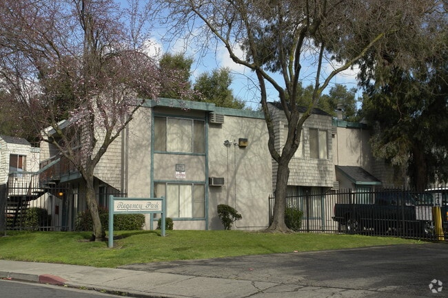
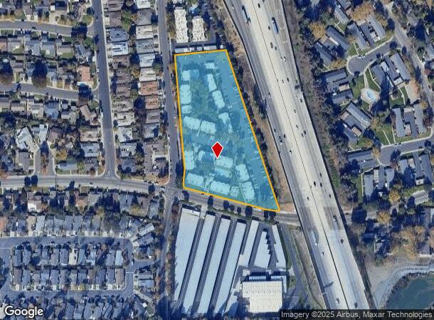
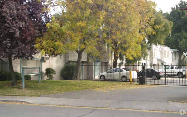
Property Record
2973 W Swain Rd, Stockton, CA 95219

NEARBY LISTINGS FOR SALE OR LEASE
Property Detail
2973 W Swain Rd
Stockton-Lodi, CA
I-5 Condo
100-290-16
REDRAW 830907 FR ORIG APN 095290235
Apartment
San Joaquin
X
California
06077C0315F
1
2025
4.60 AC
2025
Lincoln Village West
003106
Stockton/Modesto
82,960 SF
DEMOGRAPHICS near 2973 W Swain Rd
1 Mile
3 Mile
5 Mile
2024 Total Population
19,389
134,779
257,427
2029 Population
20,397
142,029
271,568
Pop Growth 2024-2029
+ 5.20%
+ 5.38%
+ 5.49%
Average Age
39
38
37
2024 Total Households
7,689
46,884
84,786
HH Growth 2024-2029
+ 5.19%
+ 5.47%
+ 5.59%
Median Household Inc
$79,860
$74,488
$71,026
Avg Household Size
2.50
2.80
2.90
2024 Avg HH Vehicles
2.00
2.00
2.00
Median Home Value
$453,108
$395,486
$386,129
Median Year Built
1978
1974
1976
Nearby Places
Map Layers
Map Styles
 Street
 Aerial
- Restaurants
- Banks
- Shops
- Fitness
- Groceries
PUBLIC TRANSPORTATION
COMMUTER RAIL
Stockton (San Joaquins - Amtrak)
DRIVE
WALK
Distance
Stockton (San Joaquins - Amtrak)
11 min
6.8 mi
Stockton (ACE Train - Altamont Commuter Express (ACE), Altamont Corridor Express - Altamont Commuter Express (ACE))
DRIVE
WALK
Distance
Stockton (ACE Train - Altamont Commuter Express (ACE), Altamont Corridor Express - Altamont Commuter Express (ACE))
12 min
7.4 mi
AIRPORT
Stockton Metro
DRIVE
WALK
Distance
Stockton Metro
18 min
12.2 mi
Freight Ports
Port of Stockton
DRIVE
WALK
Distance
Port of Stockton
8 min
4.7 mi
Nearby Properties
Address
Land Use
TOTAL SIZE
Lot Size
Zoning
Address
Land Use
TOTAL SIZE
Lot Size
Zoning
30,080 SF
82.44 AC
Address
Land Use
TOTAL SIZE
Lot Size
Zoning
10,334 SF
22.41 AC
Address
Land Use
TOTAL SIZE
Lot Size
Zoning
60,137 SF
7.22 AC
Address
Land Use
TOTAL SIZE
Lot Size
Zoning
10,208 SF
47.57 AC
Address
Land Use
TOTAL SIZE
Lot Size
Zoning
22.89 AC
Address
Land Use
TOTAL SIZE
Lot Size
Zoning
254,378 SF
17.07 AC
Address
Land Use
TOTAL SIZE
Lot Size
Zoning
161,229 SF
10.16 AC
Address
Land Use
TOTAL SIZE
Lot Size
Zoning
23,112 SF
9.20 AC
Address
Land Use
TOTAL SIZE
Lot Size
Zoning
151,271 SF
8.97 AC
Address
Land Use
TOTAL SIZE
Lot Size
Zoning
82,512 SF
4.14 AC
Address
Land Use
TOTAL SIZE
Lot Size
Zoning
14,212 SF
26.11 AC
Address
Land Use
TOTAL SIZE
Lot Size
Zoning
18.66 AC
Address
Land Use
TOTAL SIZE
Lot Size
Zoning
97,276 SF
5.46 AC
RHD
Address
Land Use
TOTAL SIZE
Lot Size
Zoning
89,725 SF
4.02 AC
Address
Land Use
TOTAL SIZE
Lot Size
Zoning
190,923 SF
3.96 AC
Address
Land Use
TOTAL SIZE
Lot Size
Zoning
Address
Land Use
TOTAL SIZE
Lot Size
Zoning
14,035 SF
10.02 AC
Address
Land Use
TOTAL SIZE
Lot Size
Zoning
77,568 SF
2.58 AC
Address
Land Use
TOTAL SIZE
Lot Size
Zoning
81,482 SF
5 AC
RM
Address
Land Use
TOTAL SIZE
Lot Size
Zoning
5,888 SF
3.64 AC
Address
Land Use
TOTAL SIZE
Lot Size
Zoning
119,341 SF
7.98 AC
Address
Land Use
TOTAL SIZE
Lot Size
Zoning
176,492 SF
10.55 AC
Address
Land Use
TOTAL SIZE
Lot Size
Zoning
146,660 SF
8.35 AC
Address
Land Use
TOTAL SIZE
Lot Size
Zoning
5.70 AC
RL
Address
Land Use
TOTAL SIZE
Lot Size
Zoning
44,752 SF
2.31 AC
Address
Land Use
TOTAL SIZE
Lot Size
Zoning
11,720 SF
4.28 AC
Address
Land Use
TOTAL SIZE
Lot Size
Zoning
95,592 SF
3.20 AC
O
Address
Land Use
TOTAL SIZE
Lot Size
Zoning
64,656 SF
3.55 AC
Address
Land Use
TOTAL SIZE
Lot Size
Zoning
55,228 SF
4.04 AC
The World's #1 Commercial Real Estate Marketplace
Connect with us
© 2026 CoStar Group
The information above has been obtained from sources believed reliable. While we do not doubt its accuracy we have not verified it and make no guarantee, warranty or representation about it. It is your responsibility to independently confirm its accuracy and completeness. Any projections, opinions, assumptions, or estimates used are for example only and do not represent the current or future performance of the property. The value of this transaction to you depends on tax and other factors which should be evaluated by your tax, financial, and legal advisors. You and your advisors should conduct a careful, independent investigation of the property to determine to your satisfaction the suitability of the property for your needs.