Property Record
2988 1St St, La Verne, CA 91750

NEARBY LISTINGS FOR SALE OR LEASE
Property Detail
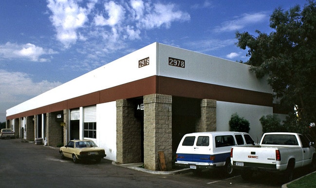
2988 1St St
Los Angeles-Long Beach-Glendale, CA
Parcel Map No 10927
8371-004-015
P M 114-51 POR OF LOT 2
Lightindustrial
Los Angeles
X
California
06071C8600J
2
2024
5.75 AC
2025
East San Gabriel Valley
401500
Los Angeles
82,625 SF
DEMOGRAPHICS near 2988 1St St
1 Mile
3 Mile
5 Mile
2024 Total Population
17,443
149,840
334,498
2029 Population
16,839
145,017
327,147
Pop Growth 2024-2029
(3.46%)
(3.22%)
(2.20%)
Average Age
39
39
39
2024 Total Households
5,854
46,778
101,647
HH Growth 2024-2029
(3.64%)
(3.50%)
(2.40%)
Median Household Inc
$79,536
$81,406
$82,429
Avg Household Size
2.90
3.00
3.10
2024 Avg HH Vehicles
2.00
2.00
2.00
Median Home Value
$658,408
$650,298
$645,755
Median Year Built
1968
1967
1971
Nearby Places
Map Layers
Map Styles
 Street
 Aerial
- Restaurants
- Banks
- Shops
- Fitness
- Groceries
PUBLIC TRANSPORTATION
TRANSIT/SUBWAY
Pomona (North) (San Bernardino Line - Southern California Regional Rail Authority (Metrolink))
DRIVE
WALK
Distance
Pomona (North) (San Bernardino Line - Southern California Regional Rail Authority (Metrolink))
2 min
10 min
0.4 mi
COMMUTER RAIL
Pomona (North) (San Bernardino Line - Southern California Regional Rail Authority (Metrolink))
DRIVE
WALK
Distance
Pomona (North) (San Bernardino Line - Southern California Regional Rail Authority (Metrolink))
3 min
10 min
0.5 mi
Claremont (San Bernardino Line - Southern California Regional Rail Authority (Metrolink))
DRIVE
WALK
Distance
Claremont (San Bernardino Line - Southern California Regional Rail Authority (Metrolink))
7 min
2.8 mi
AIRPORT
Ontario International
DRIVE
WALK
Distance
Ontario International
19 min
11.2 mi
John Wayne/Orange County
DRIVE
WALK
Distance
John Wayne/Orange County
47 min
35.9 mi
Long Beach (Daugherty Field)
DRIVE
WALK
Distance
Long Beach (Daugherty Field)
53 min
39.9 mi
Nearby Properties
Address
Land Use
TOTAL SIZE
Lot Size
Zoning
Address
Land Use
TOTAL SIZE
Lot Size
Zoning
369,745 SF
22.12 AC
LVO
Address
Land Use
TOTAL SIZE
Lot Size
Zoning
491,876 SF
22.46 AC
Address
Land Use
TOTAL SIZE
Lot Size
Zoning
672,929 SF
90.10 AC
CLE*
Address
Land Use
TOTAL SIZE
Lot Size
Zoning
749,184 SF
32.26 AC
POM1
Address
Land Use
TOTAL SIZE
Lot Size
Zoning
126,533 SF
19.51 AC
Address
Land Use
TOTAL SIZE
Lot Size
Zoning
43,129 SF
21.20 AC
CLE*
Address
Land Use
TOTAL SIZE
Lot Size
Zoning
134,182 SF
1.56 AC
CLE*
Address
Land Use
TOTAL SIZE
Lot Size
Zoning
418,820 SF
4.42 AC
Address
Land Use
TOTAL SIZE
Lot Size
Zoning
296,080 SF
14.57 AC
CLRM2000*
Address
Land Use
TOTAL SIZE
Lot Size
Zoning
224,998 SF
2.61 AC
CLI*
Address
Land Use
TOTAL SIZE
Lot Size
Zoning
120,943 SF
CLE*
Address
Land Use
TOTAL SIZE
Lot Size
Zoning
250,772 SF
23.93 AC
CLE*
Address
Land Use
TOTAL SIZE
Lot Size
Zoning
142,438 SF
8.99 AC
CLRM
Address
Land Use
TOTAL SIZE
Lot Size
Zoning
125,388 SF
8.88 AC
LVPR15A*
Address
Land Use
TOTAL SIZE
Lot Size
Zoning
198,575 SF
7.72 AC
LUCPD*
Address
Land Use
TOTAL SIZE
Lot Size
Zoning
176,482 SF
2.31 AC
POMU
Address
Land Use
TOTAL SIZE
Lot Size
Zoning
70,400 SF
11.04 AC
POM1*
Address
Land Use
TOTAL SIZE
Lot Size
Zoning
157,736 SF
8.14 AC
POC1
Address
Land Use
TOTAL SIZE
Lot Size
Zoning
272,258 SF
1.41 AC
POMU
Address
Land Use
TOTAL SIZE
Lot Size
Zoning
151,267 SF
8.26 AC
SDM1*
Address
Land Use
TOTAL SIZE
Lot Size
Zoning
411,984 SF
10.47 AC
LVCPD-PR8A
Address
Land Use
TOTAL SIZE
Lot Size
Zoning
99,508 SF
16.74 AC
CLE*
Address
Land Use
TOTAL SIZE
Lot Size
Zoning
107,525 SF
POR4*
Address
Land Use
TOTAL SIZE
Lot Size
Zoning
119,109 SF
10.39 AC
CLE*
Address
Land Use
TOTAL SIZE
Lot Size
Zoning
355,816 SF
16.59 AC
POC4*
Address
Land Use
TOTAL SIZE
Lot Size
Zoning
108,751 SF
16.41 AC
CLCP*
Address
Land Use
TOTAL SIZE
Lot Size
Zoning
178,472 SF
2.85 AC
CLE*
Address
Land Use
TOTAL SIZE
Lot Size
Zoning
104,676 SF
7.92 AC
LVPR15A*
Address
Land Use
TOTAL SIZE
Lot Size
Zoning
155,697 SF
1.82 AC
POC3*
The World's #1 Commercial Real Estate Marketplace
Connect with us
© 2025 CoStar Group
The information above has been obtained from sources believed reliable. While we do not doubt its accuracy we have not verified it and make no guarantee, warranty or representation about it. It is your responsibility to independently confirm its accuracy and completeness. Any projections, opinions, assumptions, or estimates used are for example only and do not represent the current or future performance of the property. The value of this transaction to you depends on tax and other factors which should be evaluated by your tax, financial, and legal advisors. You and your advisors should conduct a careful, independent investigation of the property to determine to your satisfaction the suitability of the property for your needs.