Property Record
2975 Mitchell Ranch Way, Rural El Pomar Estrella, CA 93446
NEARBY LISTINGS FOR SALE OR LEASE
-
-
View all Rural El Pomar Estrella listings for sale on LoopNet.com
Property Detail
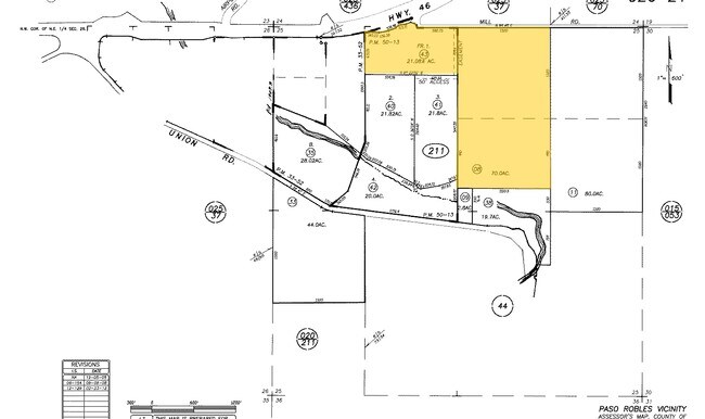
2975 Mitchell Ranch Way
San Luis Obispo-Paso Robles-Arroyo Grande, CA
Parcel Map Co 99-275
026-211-043
PM 55-42 PAR 1
Winery
San Luis Obispo
X
California
06079C0394H
1
2024
21.08 AC
2025
North 101 Corridor
010102
San Luis Obispo/Paso Robles
DEMOGRAPHICS near 2975 Mitchell Ranch Way
1 Mile
3 Mile
5 Mile
2024 Total Population
72
18,404
36,605
2029 Population
71
18,208
36,267
Pop Growth 2024-2029
(1.39%)
(1.06%)
(0.92%)
Average Age
46
42
40
2024 Total Households
29
6,642
13,389
HH Growth 2024-2029
0.00%
(1.26%)
(1.08%)
Median Household Inc
$112,500
$85,578
$82,266
Avg Household Size
2.40
2.70
2.70
2024 Avg HH Vehicles
2.00
2.00
2.00
Median Home Value
$683,333
$582,679
$625,026
Median Year Built
2000
1989
1987
Nearby Places
Map Layers
Map Styles
 Street
 Aerial
- Restaurants
- Banks
- Shops
- Fitness
- Groceries
PUBLIC TRANSPORTATION
COMMUTER RAIL
Paso Robles Amtrak Station (Coast Starlight - Amtrak)
DRIVE
WALK
Distance
Paso Robles Amtrak Station (Coast Starlight - Amtrak)
8 min
4.3 mi
AIRPORT
San Luis County Regional
DRIVE
WALK
Distance
San Luis County Regional
51 min
38.4 mi
Freight Ports
The Port of Hueneme
DRIVE
WALK
Distance
The Port of Hueneme
208 min
165.4 mi
Nearby Properties
Address
Land Use
TOTAL SIZE
Lot Size
Zoning
Address
Land Use
TOTAL SIZE
Lot Size
Zoning
197,140 SF
11.87 AC
R3
Address
Land Use
TOTAL SIZE
Lot Size
Zoning
115,054 SF
18.78 AC
PM
Address
Land Use
TOTAL SIZE
Lot Size
Zoning
282,906 SF
10 AC
R4
Address
Land Use
TOTAL SIZE
Lot Size
Zoning
129,241 SF
18.91 AC
POS
Address
Land Use
TOTAL SIZE
Lot Size
Zoning
77,710 SF
44 AC
AG
Address
Land Use
TOTAL SIZE
Lot Size
Zoning
63.59 AC
POS
Address
Land Use
TOTAL SIZE
Lot Size
Zoning
24.74 AC
AG
Address
Land Use
TOTAL SIZE
Lot Size
Zoning
152,938 SF
13.60 AC
M
Address
Land Use
TOTAL SIZE
Lot Size
Zoning
34.76 AC
Address
Land Use
TOTAL SIZE
Lot Size
Zoning
91,903 SF
5.10 AC
POS
Address
Land Use
TOTAL SIZE
Lot Size
Zoning
2,557 SF
9.70 AC
M
Address
Land Use
TOTAL SIZE
Lot Size
Zoning
11.53 AC
C3
Address
Land Use
TOTAL SIZE
Lot Size
Zoning
3.01 AC
Address
Land Use
TOTAL SIZE
Lot Size
Zoning
65,931 SF
3.16 AC
PM
Address
Land Use
TOTAL SIZE
Lot Size
Zoning
14,995 SF
10.74 AC
Address
Land Use
TOTAL SIZE
Lot Size
Zoning
74,710 SF
7.79 AC
R3
Address
Land Use
TOTAL SIZE
Lot Size
Zoning
14.75 AC
Address
Land Use
TOTAL SIZE
Lot Size
Zoning
Address
Land Use
TOTAL SIZE
Lot Size
Zoning
28,050 SF
2.01 AC
PM
Address
Land Use
TOTAL SIZE
Lot Size
Zoning
32,698 SF
3.45 AC
R1
Address
Land Use
TOTAL SIZE
Lot Size
Zoning
11.27 AC
PM
Address
Land Use
TOTAL SIZE
Lot Size
Zoning
4.20 AC
AP
Address
Land Use
TOTAL SIZE
Lot Size
Zoning
1,584 SF
255.80 AC
AG
Address
Land Use
TOTAL SIZE
Lot Size
Zoning
3,650 SF
17.40 AC
R1
Address
Land Use
TOTAL SIZE
Lot Size
Zoning
31,458 SF
3.99 AC
PM
Address
Land Use
TOTAL SIZE
Lot Size
Zoning
6,025 SF
224.27 AC
POS
Address
Land Use
TOTAL SIZE
Lot Size
Zoning
201.46 AC
Address
Land Use
TOTAL SIZE
Lot Size
Zoning
72,118 SF
4.30 AC
AP
Address
Land Use
TOTAL SIZE
Lot Size
Zoning
1.10 AC
The World's #1 Commercial Real Estate Marketplace
Connect with us
© 2026 CoStar Group
The information above has been obtained from sources believed reliable. While we do not doubt its accuracy we have not verified it and make no guarantee, warranty or representation about it. It is your responsibility to independently confirm its accuracy and completeness. Any projections, opinions, assumptions, or estimates used are for example only and do not represent the current or future performance of the property. The value of this transaction to you depends on tax and other factors which should be evaluated by your tax, financial, and legal advisors. You and your advisors should conduct a careful, independent investigation of the property to determine to your satisfaction the suitability of the property for your needs.