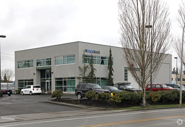
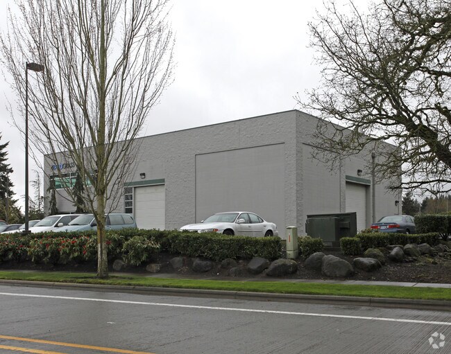
Property Record
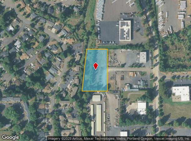
29757 Sw Kinsman Rd, Wilsonville, OR 97070
NEARBY LISTINGS FOR SALE OR LEASE
Property Detail
29757 Sw Kinsman Rd
Portland-Vancouver-Hillsboro, OR-WA
Partition Plat
00810545
1990-59 PARTITION PLAT PARCEL 3
Industrialacreage
Clackamas
AE
Oregon
41067C0625E
3
2025
1.73 AC
2025
Wilsonville
022707
Portland
DEMOGRAPHICS near 29757 Sw Kinsman Rd
1 Mile
3 Mile
5 Mile
2024 Total Population
12,778
29,275
63,664
2029 Population
13,099
29,932
64,416
Pop Growth 2024-2029
+ 2.51%
+ 2.24%
+ 1.18%
Average Age
38
41
41
2024 Total Households
5,085
11,616
23,818
HH Growth 2024-2029
+ 2.52%
+ 2.30%
+ 1.28%
Median Household Inc
$100,520
$95,126
$103,510
Avg Household Size
2.50
2.40
2.60
2024 Avg HH Vehicles
2.00
2.00
2.00
Median Home Value
$530,250
$622,613
$586,374
Median Year Built
2004
1996
1993
Nearby Places
Map Layers
Map Styles
 Street
 Aerial
- Restaurants
- Banks
- Shops
- Fitness
- Groceries
PUBLIC TRANSPORTATION
COMMUTER RAIL
Wilsonville (Westside Express Service - Tri-County Metropolitan Transportation District of Oregon Rail (TriMet Rail))
DRIVE
WALK
Distance
Wilsonville (Westside Express Service - Tri-County Metropolitan Transportation District of Oregon Rail (TriMet Rail))
2 min
13 min
0.7 mi
Tualatin (Westside Express Service - Tri-County Metropolitan Transportation District of Oregon Rail (TriMet Rail))
DRIVE
WALK
Distance
Tualatin (Westside Express Service - Tri-County Metropolitan Transportation District of Oregon Rail (TriMet Rail))
11 min
7.2 mi
AIRPORT
Portland International
DRIVE
WALK
Distance
Portland International
44 min
29.6 mi
Freight Ports
Port of Portland
DRIVE
WALK
Distance
Port of Portland
30 min
20.8 mi
Nearby Properties
Address
Land Use
TOTAL SIZE
Lot Size
Zoning
Address
Land Use
TOTAL SIZE
Lot Size
Zoning
508,000 SF
69.72 AC
PFC
Address
Land Use
TOTAL SIZE
Lot Size
Zoning
20.21 AC
FDAHI
Address
Land Use
TOTAL SIZE
Lot Size
Zoning
9.76 AC
PDI
Address
Land Use
TOTAL SIZE
Lot Size
Zoning
54.36 AC
PDI
Address
Land Use
TOTAL SIZE
Lot Size
Zoning
16.18 AC
PDR4
Address
Land Use
TOTAL SIZE
Lot Size
Zoning
21.25 AC
PDR5
Address
Land Use
TOTAL SIZE
Lot Size
Zoning
Address
Land Use
TOTAL SIZE
Lot Size
Zoning
26.06 AC
PDI
Address
Land Use
TOTAL SIZE
Lot Size
Zoning
24.75 AC
PDI
Address
Land Use
TOTAL SIZE
Lot Size
Zoning
Address
Land Use
TOTAL SIZE
Lot Size
Zoning
18.49 AC
TC
Address
Land Use
TOTAL SIZE
Lot Size
Zoning
24.67 AC
PDR6
Address
Land Use
TOTAL SIZE
Lot Size
Zoning
20.20 AC
PDR6
Address
Land Use
TOTAL SIZE
Lot Size
Zoning
14.44 AC
PDI
Address
Land Use
TOTAL SIZE
Lot Size
Zoning
26.18 AC
PDI
Address
Land Use
TOTAL SIZE
Lot Size
Zoning
87.02 AC
PDI
Address
Land Use
TOTAL SIZE
Lot Size
Zoning
Address
Land Use
TOTAL SIZE
Lot Size
Zoning
14.05 AC
PDR5
Address
Land Use
TOTAL SIZE
Lot Size
Zoning
3,474 SF
23.31 AC
PDI
Address
Land Use
TOTAL SIZE
Lot Size
Zoning
Address
Land Use
TOTAL SIZE
Lot Size
Zoning
9,918 SF
25.16 AC
PDR5
Address
Land Use
TOTAL SIZE
Lot Size
Zoning
20.89 AC
PDR5
Address
Land Use
TOTAL SIZE
Lot Size
Zoning
12.32 AC
PDR5
Address
Land Use
TOTAL SIZE
Lot Size
Zoning
3.41 AC
PDR4
Address
Land Use
TOTAL SIZE
Lot Size
Zoning
20.84 AC
PDI
Address
Land Use
TOTAL SIZE
Lot Size
Zoning
Address
Land Use
TOTAL SIZE
Lot Size
Zoning
14 AC
PDR6
Address
Land Use
TOTAL SIZE
Lot Size
Zoning
Address
Land Use
TOTAL SIZE
Lot Size
Zoning
Address
Land Use
TOTAL SIZE
Lot Size
Zoning
The World's #1 Commercial Real Estate Marketplace
Connect with us
© 2025 CoStar Group
The information above has been obtained from sources believed reliable. While we do not doubt its accuracy we have not verified it and make no guarantee, warranty or representation about it. It is your responsibility to independently confirm its accuracy and completeness. Any projections, opinions, assumptions, or estimates used are for example only and do not represent the current or future performance of the property. The value of this transaction to you depends on tax and other factors which should be evaluated by your tax, financial, and legal advisors. You and your advisors should conduct a careful, independent investigation of the property to determine to your satisfaction the suitability of the property for your needs.