Property Record
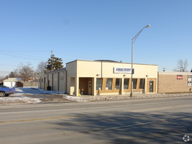
2976 W Broad St, Columbus, OH 43204


NEARBY LISTINGS FOR SALE OR LEASE
Property Detail
2976 W Broad St
Columbus, OH
Columbia Park Annex
010-065560
2976 W BROAD ST COLUMBIA PARK ANNEX LOTS 2-3 (96 X 150)
Storebuilding
Franklin
X
Ohio
39049C0304K
2-3 9
2024
0.33 AC
2025
Downtown West
004500
Columbus
5,695 SF
DEMOGRAPHICS near 2976 W Broad St
1 mile
3 mile
5 mile
2024 Total Population
21,760
117,357
300,099
2029 Population
22,225
118,600
301,598
Pop Growth 2024-2029
+ 2.14%
+ 1.06%
+ 0.50%
Average Age
36
37
36
2024 Total Households
7,993
45,792
127,288
HH Growth 2024-2029
+ 1.91%
+ 0.94%
+ 0.47%
Median Household Inc
$52,078
$55,990
$65,381
Avg Household Size
2.60
2.50
2.20
2024 Avg HH Vehicles
2.00
2.00
2.00
Median Home Value
$152,131
$174,526
$236,048
Median Year Built
1949
1964
1976
Nearby Places
Map Layers
Map Styles
 Street
 Aerial
Transit
 Traffic
 Biking
Places
Listings with unknown addresses are not visible on the map
- Restaurants
- Banks
- Shops
- Fitness
- Groceries
PUBLIC TRANSPORTATION
AIRPORT
John Glenn Columbus International
Drive
Walk
Distance
John Glenn Columbus International
20 min
12.1 mi
Rickenbacker International
Drive
Walk
Distance
Rickenbacker International
27 min
19.2 mi
Freight Ports
Port of Toledo
Drive
Walk
Distance
Port of Toledo
186 min
137.5 mi
SALE & LEASE HISTORY
LISTING DATE
SALE/LEASE

Mar 28, 2022
For Sale
Nearby Properties
Address
Land Use
TOTAL SIZE
Lot Size
Zoning
Address
Land Use
TOTAL SIZE
Lot Size
Zoning
764,116 SF
256.31 AC
Address
Land Use
TOTAL SIZE
Lot Size
Zoning
1,215,421 SF
108.07 AC
Address
Land Use
TOTAL SIZE
Lot Size
Zoning
302,079 SF
77.95 AC
Address
Land Use
TOTAL SIZE
Lot Size
Zoning
385,225 SF
5.89 AC
Address
Land Use
TOTAL SIZE
Lot Size
Zoning
479,979 SF
5.43 AC
Address
Land Use
TOTAL SIZE
Lot Size
Zoning
642,900 SF
21.84 AC
Address
Land Use
TOTAL SIZE
Lot Size
Zoning
555,347 SF
24.77 AC
Address
Land Use
TOTAL SIZE
Lot Size
Zoning
299,580 SF
3.94 AC
Address
Land Use
TOTAL SIZE
Lot Size
Zoning
417,131 SF
27.85 AC
Address
Land Use
TOTAL SIZE
Lot Size
Zoning
257,723 SF
38.06 AC
Address
Land Use
TOTAL SIZE
Lot Size
Zoning
87,654 SF
45.30 AC
Address
Land Use
TOTAL SIZE
Lot Size
Zoning
329,215 SF
8.33 AC
Address
Land Use
TOTAL SIZE
Lot Size
Zoning
344,697 SF
8.29 AC
Address
Land Use
TOTAL SIZE
Lot Size
Zoning
34,521 SF
29.23 AC
Address
Land Use
TOTAL SIZE
Lot Size
Zoning
50,837 SF
10.12 AC
Address
Land Use
TOTAL SIZE
Lot Size
Zoning
70,995 SF
38.78 AC
Address
Land Use
TOTAL SIZE
Lot Size
Zoning
156,839 SF
48.45 AC
Address
Land Use
TOTAL SIZE
Lot Size
Zoning
108,828 SF
23.51 AC
Address
Land Use
TOTAL SIZE
Lot Size
Zoning
143.78 AC
Address
Land Use
TOTAL SIZE
Lot Size
Zoning
112,287 SF
2.72 AC
Address
Land Use
TOTAL SIZE
Lot Size
Zoning
759,600 SF
23.75 AC
Address
Land Use
TOTAL SIZE
Lot Size
Zoning
138,003 SF
2.94 AC
Address
Land Use
TOTAL SIZE
Lot Size
Zoning
202,330 SF
18.89 AC
Address
Land Use
TOTAL SIZE
Lot Size
Zoning
24,592 SF
76.12 AC
Address
Land Use
TOTAL SIZE
Lot Size
Zoning
178,452 SF
34.84 AC
Address
Land Use
TOTAL SIZE
Lot Size
Zoning
69,650 SF
15.15 AC
Address
Land Use
TOTAL SIZE
Lot Size
Zoning
122,290 SF
1.44 AC
Address
Land Use
TOTAL SIZE
Lot Size
Zoning
84,002 SF
4.08 AC
Address
Land Use
TOTAL SIZE
Lot Size
Zoning
94,593 SF
7.97 AC
Address
Land Use
TOTAL SIZE
Lot Size
Zoning
64,133 SF
21.83 AC
The World's #1 Commercial Real Estate Marketplace
Connect with us
© 2026 CoStar Group
The information above has been obtained from sources believed reliable. While we do not doubt its accuracy we have not verified it and make no guarantee, warranty or representation about it. It is your responsibility to independently confirm its accuracy and completeness. Any projections, opinions, assumptions, or estimates used are for example only and do not represent the current or future performance of the property. The value of this transaction to you depends on tax and other factors which should be evaluated by your tax, financial, and legal advisors. You and your advisors should conduct a careful, independent investigation of the property to determine to your satisfaction the suitability of the property for your needs.