Property Record
2977 N Interstate 35, San Marcos, TX 78666


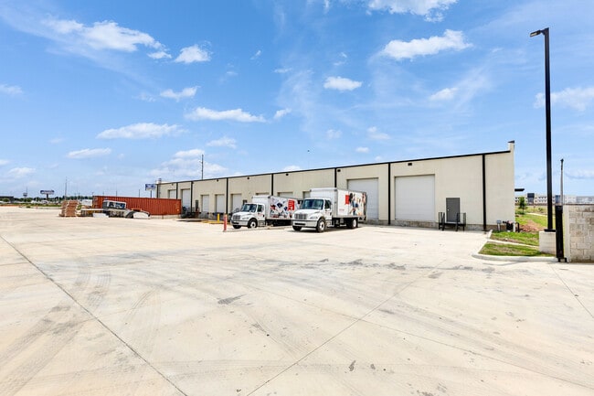
Property Detail
2977 N Interstate 35
Austin-Round Rock-San Marcos, TX
BLANCO RIVERWALK SUB IIA, BLOCK A, LOT 1E1, ACRES 2.154
R171261
HAYS
Commercialnec
Texas
C and X Area of minimal flood hazard, usually depicted on FIRMs as above the 500-year flood level.
1e1
2024
2.15 AC
2025
Hays County
010309
Austin
20,000 SF
NEARBY LISTINGS FOR SALE OR LEASE
-
-
View all San Marcos listings for lease on LoopNet.com
DEMOGRAPHICS near 2977 N Interstate 35
1 mile
3 mile
5 mile
2025 Total Population
2,679
29,650
90,855
2030 Population
3,160
34,560
105,081
Pop Growth 2025-2030
+ 17.95%
+ 16.56%
+ 15.66%
Average Age
32
33
33
2025 Total Households
935
11,703
33,081
HH Growth 2025-2030
+ 19.14%
+ 16.75%
+ 16.69%
Median Household Inc
$67,045
$61,859
$67,649
Avg Household Size
2.80
2.50
2.50
2025 Avg HH Vehicles
2.00
2.00
2.00
Median Home Value
$215,000
$350,000
$340,940
Median Year Built
2010
2010
2006
Nearby Places
Map Layers
Map Styles
 Street
 Aerial
Layers
 Traffic
 Biking
Places
Listings with unknown addresses are not visible on the map
- Restaurants
- Banks
- Shops
- Fitness
- Groceries
PUBLIC TRANSPORTATION
COMMUTER RAIL
Drive
Walk
Distance
9 min
5.6 mi
AIRPORT
Austin-Bergstrom International
Drive
Walk
Distance
Austin-Bergstrom International
46 min
34.7 mi
SALE & LEASE HISTORY
LISTING DATE
SALE/LEASE

Oct 03, 2019
For Lease
Dec 09, 2020
For Lease
Nearby Properties
Address
Land Use
TOTAL SIZE
Lot Size
Zoning
Address
Land Use
TOTAL SIZE
Lot Size
Zoning
1,647,300 SF
96.81 AC
Address
Land Use
TOTAL SIZE
Lot Size
Zoning
40.48 AC
Address
Land Use
TOTAL SIZE
Lot Size
Zoning
324,430 SF
23.60 AC
Address
Land Use
TOTAL SIZE
Lot Size
Zoning
479,270 SF
24.78 AC
Address
Land Use
TOTAL SIZE
Lot Size
Zoning
301,745 SF
16.14 AC
Address
Land Use
TOTAL SIZE
Lot Size
Zoning
264,570 SF
14.23 AC
Address
Land Use
TOTAL SIZE
Lot Size
Zoning
354,670 SF
13 AC
Address
Land Use
TOTAL SIZE
Lot Size
Zoning
278,193 SF
17.44 AC
Address
Land Use
TOTAL SIZE
Lot Size
Zoning
365,750 SF
19.65 AC
Address
Land Use
TOTAL SIZE
Lot Size
Zoning
306,818 SF
18.33 AC
Address
Land Use
TOTAL SIZE
Lot Size
Zoning
215,696 SF
28.15 AC
Address
Land Use
TOTAL SIZE
Lot Size
Zoning
215,688 SF
10.36 AC
Address
Land Use
TOTAL SIZE
Lot Size
Zoning
300,779 SF
10.84 AC
Address
Land Use
TOTAL SIZE
Lot Size
Zoning
193,192 SF
18.45 AC
Address
Land Use
TOTAL SIZE
Lot Size
Zoning
248,868 SF
17.77 AC
Address
Land Use
TOTAL SIZE
Lot Size
Zoning
4,173 SF
128.50 AC
Address
Land Use
TOTAL SIZE
Lot Size
Zoning
185,184 SF
11.22 AC
Address
Land Use
TOTAL SIZE
Lot Size
Zoning
233,640 SF
12.99 AC
Address
Land Use
TOTAL SIZE
Lot Size
Zoning
248,850 SF
19.33 AC
Address
Land Use
TOTAL SIZE
Lot Size
Zoning
247,836 SF
19.42 AC
Address
Land Use
TOTAL SIZE
Lot Size
Zoning
175,131 SF
12.24 AC
Address
Land Use
TOTAL SIZE
Lot Size
Zoning
138,522 SF
7.95 AC
Address
Land Use
TOTAL SIZE
Lot Size
Zoning
132,825 SF
52.74 AC
Address
Land Use
TOTAL SIZE
Lot Size
Zoning
203,840 SF
16.70 AC
Address
Land Use
TOTAL SIZE
Lot Size
Zoning
6.61 AC
Address
Land Use
TOTAL SIZE
Lot Size
Zoning
229,600 SF
16.50 AC
Address
Land Use
TOTAL SIZE
Lot Size
Zoning
36,219 SF
18.14 AC
Address
Land Use
TOTAL SIZE
Lot Size
Zoning
89,700 SF
3.31 AC
Address
Land Use
TOTAL SIZE
Lot Size
Zoning
83,453 SF
22.24 AC
Address
Land Use
TOTAL SIZE
Lot Size
Zoning
133,480 SF
7.45 AC
The World's #1 Commercial Real Estate Marketplace
Connect with us
© 2026 CoStar Group
The information above has been obtained from sources believed reliable. While we do not doubt its accuracy we have not verified it and make no guarantee, warranty or representation about it. It is your responsibility to independently confirm its accuracy and completeness. Any projections, opinions, assumptions, or estimates used are for example only and do not represent the current or future performance of the property. The value of this transaction to you depends on tax and other factors which should be evaluated by your tax, financial, and legal advisors. You and your advisors should conduct a careful, independent investigation of the property to determine to your satisfaction the suitability of the property for your needs.