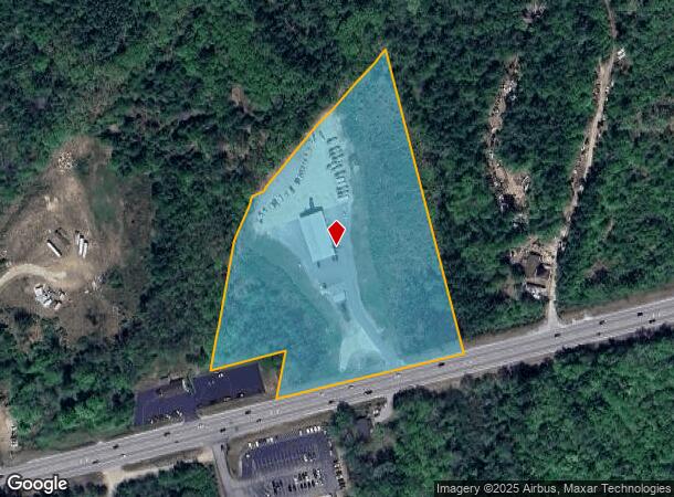
Property Record
298 Dover Rd, Chichester, NH 03258

NEARBY LISTINGS FOR SALE OR LEASE
Property Detail
298 Dover Rd
Commercialbuilding
Merrimack
X
New Hampshire
33013C0556E
8.04 AC
2024
Concord/New Hampshire North Area
2024
Other Market Areas
033000
Concord, NH
11,160 SF
CHCH-000003-000040
DEMOGRAPHICS near 298 Dover Rd
1 mile
3 mile
5 mile
2024 Total Population
721
4,259
19,027
2029 Population
760
4,506
19,998
Pop Growth 2024-2029
+ 5.41%
+ 5.80%
+ 5.10%
Average Age
44
44
44
2024 Total Households
268
1,627
7,872
HH Growth 2024-2029
+ 5.60%
+ 5.72%
+ 4.93%
Median Household Inc
$115,853
$100,387
$78,371
Avg Household Size
2.70
2.60
2.40
2024 Avg HH Vehicles
3.00
2.00
2.00
Median Home Value
$364,942
$341,423
$305,860
Median Year Built
1988
1988
1983
Nearby Places
Map Layers
Map Styles
 Street
 Aerial
Transit
 Traffic
 Biking
Places
Listings with unknown addresses are not visible on the map
- Restaurants
- Banks
- Shops
- Fitness
- Groceries
PUBLIC TRANSPORTATION
AIRPORT
Manchester Boston Regional
Drive
Walk
Distance
Manchester Boston Regional
46 min
30.5 mi
Freight Ports
Portland, ME
Drive
Walk
Distance
Portland, ME
119 min
79.3 mi
SALE & LEASE HISTORY
LISTING DATE
SALE/LEASE

Feb 13, 2018
For Sale
Nearby Properties
Address
Land Use
TOTAL SIZE
Lot Size
Zoning
Address
Land Use
TOTAL SIZE
Lot Size
Zoning
194,386 SF
33.30 AC
GWP
Address
Land Use
TOTAL SIZE
Lot Size
Zoning
135,161 SF
36.20 AC
GWP
Address
Land Use
TOTAL SIZE
Lot Size
Zoning
44,963 SF
16.29 AC
COMM V
Address
Land Use
TOTAL SIZE
Lot Size
Zoning
34,478 SF
55.60 AC
RA
Address
Land Use
TOTAL SIZE
Lot Size
Zoning
49,099 SF
6.31 AC
GWP
Address
Land Use
TOTAL SIZE
Lot Size
Zoning
30,580 SF
5.39 AC
GWP
Address
Land Use
TOTAL SIZE
Lot Size
Zoning
1,520 SF
143.90 AC
C/ICOM
Address
Land Use
TOTAL SIZE
Lot Size
Zoning
35,230 SF
18.40 AC
C/ICOM
Address
Land Use
TOTAL SIZE
Lot Size
Zoning
11.07 AC
RM
Address
Land Use
TOTAL SIZE
Lot Size
Zoning
2,556 SF
167.37 AC
C-1D
Address
Land Use
TOTAL SIZE
Lot Size
Zoning
19,098 SF
5.06 AC
COMM/I
Address
Land Use
TOTAL SIZE
Lot Size
Zoning
384 SF
41.74 AC
C-1D
Address
Land Use
TOTAL SIZE
Lot Size
Zoning
16,246 SF
3.35 AC
COMM/I
Address
Land Use
TOTAL SIZE
Lot Size
Zoning
31,554 SF
8.11 AC
VILLLA
Address
Land Use
TOTAL SIZE
Lot Size
Zoning
11,985 SF
11.40 AC
RM
Address
Land Use
TOTAL SIZE
Lot Size
Zoning
8,309 SF
1.35 AC
GWP
Address
Land Use
TOTAL SIZE
Lot Size
Zoning
17,783 SF
11.10 AC
COMM/I
Address
Land Use
TOTAL SIZE
Lot Size
Zoning
5,116 SF
2.64 AC
GWP
Address
Land Use
TOTAL SIZE
Lot Size
Zoning
7,638 SF
12.80 AC
RA
Address
Land Use
TOTAL SIZE
Lot Size
Zoning
8,337 SF
4.16 AC
C/ICOM
Address
Land Use
TOTAL SIZE
Lot Size
Zoning
3,596 SF
2.04 AC
COMM V
Address
Land Use
TOTAL SIZE
Lot Size
Zoning
43.30 AC
RA
Address
Land Use
TOTAL SIZE
Lot Size
Zoning
10,036 SF
3.97 AC
GWP
Address
Land Use
TOTAL SIZE
Lot Size
Zoning
5,679 SF
2.18 AC
GWP
Address
Land Use
TOTAL SIZE
Lot Size
Zoning
16,306 SF
28.99 AC
COMM/I
Address
Land Use
TOTAL SIZE
Lot Size
Zoning
4,212 SF
1.54 AC
COMM V
Address
Land Use
TOTAL SIZE
Lot Size
Zoning
5,399 SF
122.06 AC
RA
Address
Land Use
TOTAL SIZE
Lot Size
Zoning
3,774 SF
2.37 AC
GWP
Address
Land Use
TOTAL SIZE
Lot Size
Zoning
4,203 SF
30.51 AC
RA
Address
Land Use
TOTAL SIZE
Lot Size
Zoning
5,158 SF
2.18 AC
COMM V
The World's #1 Commercial Real Estate Marketplace
Connect with us
© 2026 CoStar Group
The information above has been obtained from sources believed reliable. While we do not doubt its accuracy we have not verified it and make no guarantee, warranty or representation about it. It is your responsibility to independently confirm its accuracy and completeness. Any projections, opinions, assumptions, or estimates used are for example only and do not represent the current or future performance of the property. The value of this transaction to you depends on tax and other factors which should be evaluated by your tax, financial, and legal advisors. You and your advisors should conduct a careful, independent investigation of the property to determine to your satisfaction the suitability of the property for your needs.