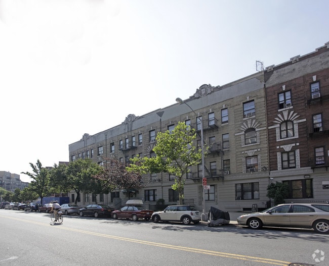
Property Record
298 Saint Johns Pl, Brooklyn, NY 11238
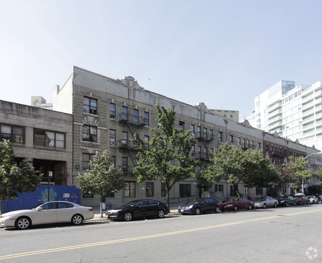

NEARBY LISTINGS FOR SALE OR LEASE
Property Detail
298 Saint Johns Pl
01172-0027
DOCID-2013040401529001
Multifamilydwelling
Kings
X
New York
3604970212F
60
2024
0.12 AC
2025
Prospect Heights
020100
Long Island (New York)
13,923 SF
New York-Jersey City-White Plains, NY-NJ
DEMOGRAPHICS near 298 Saint Johns Pl
1 mile
3 mile
5 mile
2024 Total Population
162,093
1,285,876
2,739,631
2029 Population
154,903
1,216,741
2,562,874
Pop Growth 2024-2029
(4.44%)
(5.38%)
(6.45%)
Average Age
38
38
38
2024 Total Households
71,264
493,655
1,068,499
HH Growth 2024-2029
(4.92%)
(5.76%)
(6.71%)
Median Household Inc
$113,896
$75,086
$78,584
Avg Household Size
2.20
2.50
2.40
2024 Avg HH Vehicles
.00
.00
.00
Median Home Value
$1,065,960
$955,035
$884,387
Median Year Built
1947
1948
1948
Nearby Places
Map Layers
Map Styles
 Street
 Aerial
Transit
 Traffic
 Biking
Places
Listings with unknown addresses are not visible on the map
- Restaurants
- Banks
- Shops
- Fitness
- Groceries
PUBLIC TRANSPORTATION
TRANSIT/SUBWAY
Eastern Parkway-Brooklyn Museum (2 - New York MTA Subway (The Subway), 3 - New York MTA Subway (The Subway), 4 - New York MTA Subway (The Subway))
Drive
Walk
Distance
Eastern Parkway-Brooklyn Museum (2 - New York MTA Subway (The Subway), 3 - New York MTA Subway (The Subway), 4 - New York MTA Subway (The Subway))
2 min
5 min
0.3 mi
Grand Army Plaza (2 - New York MTA Subway (The Subway), 3 - New York MTA Subway (The Subway), 4 - New York MTA Subway (The Subway))
Drive
Walk
Distance
Grand Army Plaza (2 - New York MTA Subway (The Subway), 3 - New York MTA Subway (The Subway), 4 - New York MTA Subway (The Subway))
1 min
6 min
0.3 mi
7 Avenue (B,Q Line) (B - New York MTA Subway (The Subway), Q - New York MTA Subway (The Subway))
Drive
Walk
Distance
7 Avenue (B,Q Line) (B - New York MTA Subway (The Subway), Q - New York MTA Subway (The Subway))
2 min
9 min
0.5 mi
Botanic Garden (Franklin Avenue Shuttle - New York MTA Subway (The Subway))
Drive
Walk
Distance
Botanic Garden (Franklin Avenue Shuttle - New York MTA Subway (The Subway))
2 min
11 min
0.5 mi
Franklin Avenue (2,3,4,5 Line) (2 - New York MTA Subway (The Subway), 3 - New York MTA Subway (The Subway), 4 - New York MTA Subway (The Subway), 5 - New York MTA Subway (The Subway))
Drive
Walk
Distance
Franklin Avenue (2,3,4,5 Line) (2 - New York MTA Subway (The Subway), 3 - New York MTA Subway (The Subway), 4 - New York MTA Subway (The Subway), 5 - New York MTA Subway (The Subway))
2 min
12 min
0.6 mi
COMMUTER RAIL
Drive
Walk
Distance
4 min
19 min
1.0 mi
Nostrand Avenue Station (Far Rockaway Branch - Long Island Rail Road, Hempstead Branch - Long Island Rail Road, Long Beach Branch - Long Island Rail Road, West Hempstead Branch - Long Island Rail Road)
Drive
Walk
Distance
Nostrand Avenue Station (Far Rockaway Branch - Long Island Rail Road, Hempstead Branch - Long Island Rail Road, Long Beach Branch - Long Island Rail Road, West Hempstead Branch - Long Island Rail Road)
5 min
1.4 mi
AIRPORT
LaGuardia
Drive
Walk
Distance
LaGuardia
21 min
10.3 mi
John F Kennedy International
Drive
Walk
Distance
John F Kennedy International
25 min
12.5 mi
Newark Liberty International
Drive
Walk
Distance
Newark Liberty International
30 min
16.0 mi
Freight Ports
NY - Red Hook Container Terminal
Drive
Walk
Distance
NY - Red Hook Container Terminal
9 min
3.3 mi
Nearby Properties
Address
Land Use
TOTAL SIZE
Lot Size
Zoning
Address
Land Use
TOTAL SIZE
Lot Size
Zoning
2,812,739 SF
2.10 AC
C5-3
Address
Land Use
TOTAL SIZE
Lot Size
Zoning
7,058,736 SF
147.61 AC
M3-1
Address
Land Use
TOTAL SIZE
Lot Size
Zoning
869,038 SF
1.53 AC
M1-1
Address
Land Use
TOTAL SIZE
Lot Size
Zoning
92,440 SF
466.23 AC
R5
Address
Land Use
TOTAL SIZE
Lot Size
Zoning
2,542,066 SF
174.49 AC
R3-2
Address
Land Use
TOTAL SIZE
Lot Size
Zoning
923,000 SF
4.87 AC
R7-2
Address
Land Use
TOTAL SIZE
Lot Size
Zoning
923,000 SF
4.87 AC
R7-2
Address
Land Use
TOTAL SIZE
Lot Size
Zoning
923,000 SF
4.87 AC
R7-2
Address
Land Use
TOTAL SIZE
Lot Size
Zoning
923,000 SF
4.87 AC
R7-2
Address
Land Use
TOTAL SIZE
Lot Size
Zoning
923,000 SF
4.87 AC
R7-2
Address
Land Use
TOTAL SIZE
Lot Size
Zoning
923,000 SF
4.87 AC
R7-2
Address
Land Use
TOTAL SIZE
Lot Size
Zoning
923,000 SF
4.87 AC
R7-2
Address
Land Use
TOTAL SIZE
Lot Size
Zoning
923,000 SF
4.87 AC
R7-2
Address
Land Use
TOTAL SIZE
Lot Size
Zoning
923,000 SF
4.87 AC
R7-2
Address
Land Use
TOTAL SIZE
Lot Size
Zoning
923,000 SF
4.87 AC
R7-2
Address
Land Use
TOTAL SIZE
Lot Size
Zoning
923,000 SF
4.87 AC
R7-2
Address
Land Use
TOTAL SIZE
Lot Size
Zoning
923,000 SF
4.87 AC
R7-2
Address
Land Use
TOTAL SIZE
Lot Size
Zoning
923,000 SF
4.87 AC
R7-2
Address
Land Use
TOTAL SIZE
Lot Size
Zoning
923,000 SF
4.87 AC
R7-2
Address
Land Use
TOTAL SIZE
Lot Size
Zoning
923,000 SF
4.87 AC
R7-2
Address
Land Use
TOTAL SIZE
Lot Size
Zoning
923,000 SF
4.87 AC
R7-2
Address
Land Use
TOTAL SIZE
Lot Size
Zoning
923,000 SF
4.87 AC
R7-2
Address
Land Use
TOTAL SIZE
Lot Size
Zoning
923,000 SF
4.87 AC
R7-2
Address
Land Use
TOTAL SIZE
Lot Size
Zoning
923,000 SF
4.87 AC
R7-2
Address
Land Use
TOTAL SIZE
Lot Size
Zoning
923,000 SF
4.87 AC
R7-2
Address
Land Use
TOTAL SIZE
Lot Size
Zoning
923,000 SF
4.87 AC
R7-2
Address
Land Use
TOTAL SIZE
Lot Size
Zoning
923,000 SF
4.87 AC
R7-2
Address
Land Use
TOTAL SIZE
Lot Size
Zoning
923,000 SF
4.87 AC
R7-2
Address
Land Use
TOTAL SIZE
Lot Size
Zoning
923,000 SF
4.87 AC
R7-2
Address
Land Use
TOTAL SIZE
Lot Size
Zoning
923,000 SF
4.87 AC
R7-2
The World's #1 Commercial Real Estate Marketplace
Connect with us
© 2026 CoStar Group
The information above has been obtained from sources believed reliable. While we do not doubt its accuracy we have not verified it and make no guarantee, warranty or representation about it. It is your responsibility to independently confirm its accuracy and completeness. Any projections, opinions, assumptions, or estimates used are for example only and do not represent the current or future performance of the property. The value of this transaction to you depends on tax and other factors which should be evaluated by your tax, financial, and legal advisors. You and your advisors should conduct a careful, independent investigation of the property to determine to your satisfaction the suitability of the property for your needs.