Property Record
2980 Oates St, West Sacramento, CA 95691


NEARBY LISTINGS FOR SALE OR LEASE
Property Detail
2980 Oates St
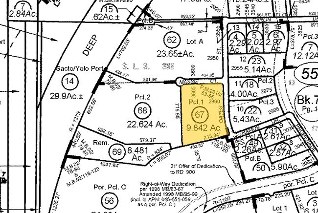
045-551-067-000
Southport Business Park
Warehouse
PM 5210 PCL A 2022 M 84-85
ARE
Yolo
06113C0640G
California
2024
3.69 AC
2025
West Sacramento
010310
Sacramento
50,192 SF
Sacramento--Roseville--Arden-Arcade, CA
DEMOGRAPHICS near 2980 Oates St
1 Mile
3 Mile
5 Mile
2024 Total Population
6,866
33,438
138,255
2029 Population
6,989
33,899
139,905
Pop Growth 2024-2029
+ 1.79%
+ 1.38%
+ 1.19%
Average Age
35
38
41
2024 Total Households
2,224
11,788
56,745
HH Growth 2024-2029
+ 2.11%
+ 1.47%
+ 1.30%
Median Household Inc
$117,551
$100,794
$85,006
Avg Household Size
3.00
2.80
2.30
2024 Avg HH Vehicles
2.00
2.00
2.00
Median Home Value
$463,054
$481,257
$566,877
Median Year Built
2004
1999
1973
Nearby Places
Map Layers
Map Styles
 Street
 Aerial
- Restaurants
- Banks
- Shops
- Fitness
- Groceries
PUBLIC TRANSPORTATION
COMMUTER RAIL
Sacramento (Capitol Corridor - Capitol Corridor Joint Powers Authority)
DRIVE
WALK
Distance
Sacramento (Capitol Corridor - Capitol Corridor Joint Powers Authority)
13 min
6.4 mi
AIRPORT
Sacramento International
DRIVE
WALK
Distance
Sacramento International
28 min
17.3 mi
Freight Ports
Port of Stockton
DRIVE
WALK
Distance
Port of Stockton
62 min
50.5 mi
SALE & LEASE HISTORY
LISTING DATE
SALE/LEASE

Aug 20, 2019
For Sale
Nearby Properties
Address
Land Use
TOTAL SIZE
Lot Size
Zoning
Address
Land Use
TOTAL SIZE
Lot Size
Zoning
110,584 SF
9.76 AC
B-P
Address
Land Use
TOTAL SIZE
Lot Size
Zoning
267,053 SF
22.19 AC
M2
Address
Land Use
TOTAL SIZE
Lot Size
Zoning
379,161 SF
22.70 AC
MU
Address
Land Use
TOTAL SIZE
Lot Size
Zoning
181,432 SF
35.96 AC
MU
Address
Land Use
TOTAL SIZE
Lot Size
Zoning
218,656 SF
0.08 AC
MU
Address
Land Use
TOTAL SIZE
Lot Size
Zoning
260,285 SF
20.22 AC
C2
Address
Land Use
TOTAL SIZE
Lot Size
Zoning
27.65 AC
M-3
Address
Land Use
TOTAL SIZE
Lot Size
Zoning
229,130 SF
10.64 AC
BP
Address
Land Use
TOTAL SIZE
Lot Size
Zoning
222,937 SF
10.18 AC
HDR
Address
Land Use
TOTAL SIZE
Lot Size
Zoning
422,059 SF
22.62 AC
MU
Address
Land Use
TOTAL SIZE
Lot Size
Zoning
31.93 AC
M-3
Address
Land Use
TOTAL SIZE
Lot Size
Zoning
22.62 AC
BP
Address
Land Use
TOTAL SIZE
Lot Size
Zoning
387,420 SF
20.75 AC
MU
Address
Land Use
TOTAL SIZE
Lot Size
Zoning
236,812 SF
12.12 AC
MU
Address
Land Use
TOTAL SIZE
Lot Size
Zoning
444,600 SF
24.81 AC
MU
Address
Land Use
TOTAL SIZE
Lot Size
Zoning
474,792 SF
23.65 AC
MU
Address
Land Use
TOTAL SIZE
Lot Size
Zoning
1,849 SF
1.80 AC
M2
Address
Land Use
TOTAL SIZE
Lot Size
Zoning
5.65 AC
M-2
Address
Land Use
TOTAL SIZE
Lot Size
Zoning
302,598 SF
12.30 AC
M2
Address
Land Use
TOTAL SIZE
Lot Size
Zoning
115,234 SF
36.70 AC
M-3
Address
Land Use
TOTAL SIZE
Lot Size
Zoning
300,098 SF
15.79 AC
MU
Address
Land Use
TOTAL SIZE
Lot Size
Zoning
73,349 SF
1.82 AC
C2
Address
Land Use
TOTAL SIZE
Lot Size
Zoning
249,048 SF
12.48 AC
MU
Address
Land Use
TOTAL SIZE
Lot Size
Zoning
17.50 AC
MU
Address
Land Use
TOTAL SIZE
Lot Size
Zoning
138,684 SF
11.53 AC
BP
Address
Land Use
TOTAL SIZE
Lot Size
Zoning
6,600 SF
12.65 AC
M2
Address
Land Use
TOTAL SIZE
Lot Size
Zoning
363,888 SF
20.36 AC
M1
Address
Land Use
TOTAL SIZE
Lot Size
Zoning
148,021 SF
8.42 AC
BP
Address
Land Use
TOTAL SIZE
Lot Size
Zoning
127,062 SF
8.50 AC
C2
Address
Land Use
TOTAL SIZE
Lot Size
Zoning
6.63 AC
M2
The World's #1 Commercial Real Estate Marketplace
Connect with us
© 2025 CoStar Group
The information above has been obtained from sources believed reliable. While we do not doubt its accuracy we have not verified it and make no guarantee, warranty or representation about it. It is your responsibility to independently confirm its accuracy and completeness. Any projections, opinions, assumptions, or estimates used are for example only and do not represent the current or future performance of the property. The value of this transaction to you depends on tax and other factors which should be evaluated by your tax, financial, and legal advisors. You and your advisors should conduct a careful, independent investigation of the property to determine to your satisfaction the suitability of the property for your needs.