Property Record
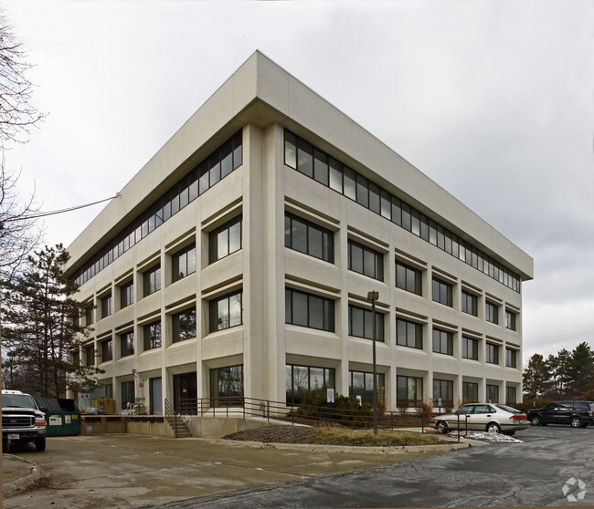
29800 Bainbridge Rd, Solon, OH 44139


NEARBY LISTINGS FOR SALE OR LEASE
Property Detail
29800 Bainbridge Rd
Cleveland-Elyria, OH
Pt
951-30-002
TR 1 18 19 30 31 PT VAC ST LOT1 95133001
Charitableorganization
Cuyahoga
AE
Ohio
39035C0239E
1
0
8.20 AC
2024
Southeast
184104
Cleveland
55,696 SF
DEMOGRAPHICS near 29800 Bainbridge Rd
1 mile
3 mile
5 mile
2024 Total Population
1,982
35,998
108,282
2029 Population
1,943
35,202
106,153
Pop Growth 2024-2029
(1.97%)
(2.21%)
(1.97%)
Average Age
44
42
42
2024 Total Households
715
14,932
45,299
HH Growth 2024-2029
(1.82%)
(2.33%)
(2.10%)
Median Household Inc
$131,250
$71,109
$69,274
Avg Household Size
2.70
2.30
2.30
2024 Avg HH Vehicles
2.00
2.00
2.00
Median Home Value
$342,437
$255,810
$243,215
Median Year Built
1977
1970
1966
Nearby Places
Map Layers
Map Styles
 Street
 Aerial
Transit
 Traffic
 Biking
Places
Listings with unknown addresses are not visible on the map
- Restaurants
- Banks
- Shops
- Fitness
- Groceries
PUBLIC TRANSPORTATION
AIRPORT
Cleveland-Hopkins International
Drive
Walk
Distance
Cleveland-Hopkins International
34 min
22.9 mi
Freight Ports
Port of Toledo
Drive
Walk
Distance
Port of Toledo
148 min
123.8 mi
Nearby Properties
Address
Land Use
TOTAL SIZE
Lot Size
Zoning
Address
Land Use
TOTAL SIZE
Lot Size
Zoning
130,621 SF
67.21 AC
I-2
Address
Land Use
TOTAL SIZE
Lot Size
Zoning
90.68 AC
I-2
Address
Land Use
TOTAL SIZE
Lot Size
Zoning
144,978 SF
31.14 AC
R-3
Address
Land Use
TOTAL SIZE
Lot Size
Zoning
197,000 SF
42.41 AC
I-2
Address
Land Use
TOTAL SIZE
Lot Size
Zoning
246,138 SF
67.82 AC
R-1-C
Address
Land Use
TOTAL SIZE
Lot Size
Zoning
344,806 SF
35.19 AC
R-1-A
Address
Land Use
TOTAL SIZE
Lot Size
Zoning
396,420 SF
26.02 AC
IG
Address
Land Use
TOTAL SIZE
Lot Size
Zoning
184,512 SF
5.22 AC
C-1
Address
Land Use
TOTAL SIZE
Lot Size
Zoning
351,000 SF
25.48 AC
IG
Address
Land Use
TOTAL SIZE
Lot Size
Zoning
458,000 SF
35.06 AC
IG
Address
Land Use
TOTAL SIZE
Lot Size
Zoning
243,040 SF
9.36 AC
R-3-B
Address
Land Use
TOTAL SIZE
Lot Size
Zoning
838,521 SF
5.70 AC
I
Address
Land Use
TOTAL SIZE
Lot Size
Zoning
49,264 SF
13.36 AC
C-3
Address
Land Use
TOTAL SIZE
Lot Size
Zoning
302,022 SF
19.04 AC
I-2
Address
Land Use
TOTAL SIZE
Lot Size
Zoning
147,635 SF
15.14 AC
I-2
Address
Land Use
TOTAL SIZE
Lot Size
Zoning
324,644 SF
15.13 AC
I
Address
Land Use
TOTAL SIZE
Lot Size
Zoning
262,950 SF
26.24 AC
IG
Address
Land Use
TOTAL SIZE
Lot Size
Zoning
594,909 SF
39.82 AC
I-2
Address
Land Use
TOTAL SIZE
Lot Size
Zoning
20.49 AC
R-1-C
Address
Land Use
TOTAL SIZE
Lot Size
Zoning
37.51 AC
I-2
Address
Land Use
TOTAL SIZE
Lot Size
Zoning
351,911 SF
39.85 AC
I-2
Address
Land Use
TOTAL SIZE
Lot Size
Zoning
146,006 SF
8.38 AC
R-1
Address
Land Use
TOTAL SIZE
Lot Size
Zoning
90,287 SF
66.28 AC
G-2
Address
Land Use
TOTAL SIZE
Lot Size
Zoning
14.67 AC
I-2
Address
Land Use
TOTAL SIZE
Lot Size
Zoning
441.72 AC
1F-2
Address
Land Use
TOTAL SIZE
Lot Size
Zoning
268,672 SF
25.07 AC
R-3
Address
Land Use
TOTAL SIZE
Lot Size
Zoning
66,157 SF
13.08 AC
Address
Land Use
TOTAL SIZE
Lot Size
Zoning
155,974 SF
5.33 AC
R-3
Address
Land Use
TOTAL SIZE
Lot Size
Zoning
197,930 SF
14.80 AC
I-2
Address
Land Use
TOTAL SIZE
Lot Size
Zoning
210,600 SF
12.69 AC
I-2
The World's #1 Commercial Real Estate Marketplace
Connect with us
© 2026 CoStar Group
The information above has been obtained from sources believed reliable. While we do not doubt its accuracy we have not verified it and make no guarantee, warranty or representation about it. It is your responsibility to independently confirm its accuracy and completeness. Any projections, opinions, assumptions, or estimates used are for example only and do not represent the current or future performance of the property. The value of this transaction to you depends on tax and other factors which should be evaluated by your tax, financial, and legal advisors. You and your advisors should conduct a careful, independent investigation of the property to determine to your satisfaction the suitability of the property for your needs.