Property Record
2981 N Main St, Decatur, IL 62526

Current Lease Availabilities
NEARBY LISTINGS FOR SALE OR LEASE
Property Detail
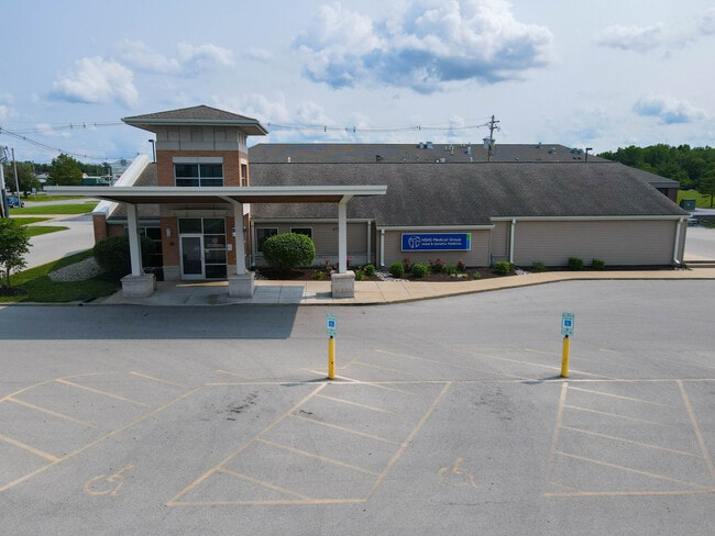
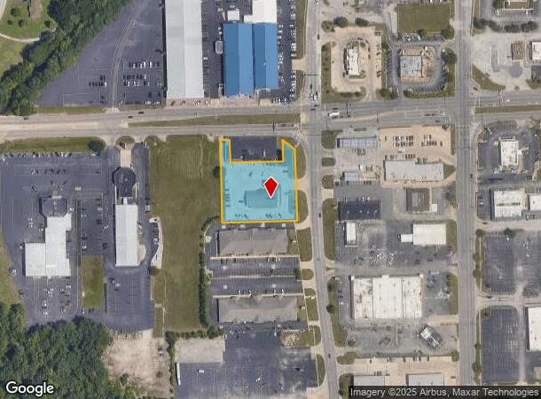
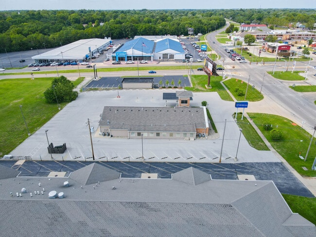
2981 N Main St
Decatur, IL
Nord Subdivision
04-12-03-226-005
S180 TR A & ALL TR B NE NE ~SRVY BK1630/654 ~
Medicalbuilding
Macon
X
Illinois
17115C0189E
1.27 AC
2024
Springfield/Decatur
2024
Other Market Areas
002001
DEMOGRAPHICS near 2981 N Main St
1 Mile
3 Mile
5 Mile
2024 Total Population
6,816
49,000
72,864
2029 Population
6,618
48,134
71,156
Pop Growth 2024-2029
(2.90%)
(1.77%)
(2.34%)
Average Age
45
39
41
2024 Total Households
3,328
21,038
31,700
HH Growth 2024-2029
(3.03%)
(1.85%)
(2.44%)
Median Household Inc
$34,963
$38,135
$42,741
Avg Household Size
1.90
2.10
2.10
2024 Avg HH Vehicles
1.00
1.00
2.00
Median Home Value
$74,160
$78,906
$91,753
Median Year Built
1963
1960
1961
Nearby Places
- Restaurants
- Banks
- Shops
- Fitness
- Groceries
Nearby Properties
Address
Land Use
TOTAL SIZE
Lot Size
Zoning
Address
Land Use
TOTAL SIZE
Lot Size
Zoning
107.54 AC
MUNICIPAL
Address
Land Use
TOTAL SIZE
Lot Size
Zoning
12.21 AC
MUNICIPAL
Address
Land Use
TOTAL SIZE
Lot Size
Zoning
1.03 AC
MUNICIPAL
Address
Land Use
TOTAL SIZE
Lot Size
Zoning
207,420 SF
12.41 AC
MUNICIPAL
Address
Land Use
TOTAL SIZE
Lot Size
Zoning
1.40 AC
MUNICIPAL
Address
Land Use
TOTAL SIZE
Lot Size
Zoning
6.60 AC
MUNICIPAL
Address
Land Use
TOTAL SIZE
Lot Size
Zoning
1,604 SF
12.80 AC
MUNICIPAL
Address
Land Use
TOTAL SIZE
Lot Size
Zoning
3.88 AC
MUNICIPAL
Address
Land Use
TOTAL SIZE
Lot Size
Zoning
17.82 AC
MUNICIPAL
Address
Land Use
TOTAL SIZE
Lot Size
Zoning
13.92 AC
MUNICIPAL
Address
Land Use
TOTAL SIZE
Lot Size
Zoning
12.24 AC
MUNICIPAL
Address
Land Use
TOTAL SIZE
Lot Size
Zoning
6.68 AC
MUNICIPAL
Address
Land Use
TOTAL SIZE
Lot Size
Zoning
23.56 AC
MUNICIPAL
Address
Land Use
TOTAL SIZE
Lot Size
Zoning
18.50 AC
MUNICIPAL
Address
Land Use
TOTAL SIZE
Lot Size
Zoning
6.89 AC
MUNICIPAL
Address
Land Use
TOTAL SIZE
Lot Size
Zoning
19.95 AC
MUNICIPAL
Address
Land Use
TOTAL SIZE
Lot Size
Zoning
7.82 AC
MUNICIPAL
Address
Land Use
TOTAL SIZE
Lot Size
Zoning
3.35 AC
MUNICIPAL
Address
Land Use
TOTAL SIZE
Lot Size
Zoning
3.55 AC
MUNICIPAL
Address
Land Use
TOTAL SIZE
Lot Size
Zoning
14.66 AC
MUNICIPAL
Address
Land Use
TOTAL SIZE
Lot Size
Zoning
13.04 AC
MUNICIPAL
Address
Land Use
TOTAL SIZE
Lot Size
Zoning
7.03 AC
MUNICIPAL
Address
Land Use
TOTAL SIZE
Lot Size
Zoning
1.10 AC
MUNICIPAL
Address
Land Use
TOTAL SIZE
Lot Size
Zoning
78.13 AC
MUNICIPAL
Address
Land Use
TOTAL SIZE
Lot Size
Zoning
4.82 AC
MUNICIPAL
Address
Land Use
TOTAL SIZE
Lot Size
Zoning
6.35 AC
MUNICIPAL
Address
Land Use
TOTAL SIZE
Lot Size
Zoning
3.93 AC
MUNICIPAL
Address
Land Use
TOTAL SIZE
Lot Size
Zoning
61.42 AC
MUNICIPAL
The World's #1 Commercial Real Estate Marketplace
Connect with us
© 2025 CoStar Group
The information above has been obtained from sources believed reliable. While we do not doubt its accuracy we have not verified it and make no guarantee, warranty or representation about it. It is your responsibility to independently confirm its accuracy and completeness. Any projections, opinions, assumptions, or estimates used are for example only and do not represent the current or future performance of the property. The value of this transaction to you depends on tax and other factors which should be evaluated by your tax, financial, and legal advisors. You and your advisors should conduct a careful, independent investigation of the property to determine to your satisfaction the suitability of the property for your needs.