Property Record
2985 Bethel Ln, Sarasota, FL 34240

Current Lease Availabilities
NEARBY LISTINGS FOR SALE OR LEASE
Property Detail
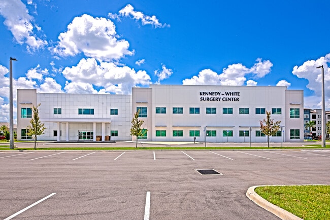
2985 Bethel Ln
North Port-Sarasota-Bradenton, FL
Not Part Of A Subdivision
0208-04-0001
PARCEL B, APEX BP LAND CONDOMINIUM, CB 48 PG 36-38, SUBJ TO 53747 C-SF ACCESS, PED & PARKING ESMT TO SARASOTA COUNTY DESC IN ORI 2023174244 ALSO SUBJ TO 378 SF UTILITY ESMT TO SARASOTA
Religious
Sarasota
AE
Florida
12115C0159G
2
2024
31.73 AC
2025
Sarasota
001404
Tampa/St Petersburg
27,877 SF
DEMOGRAPHICS near 2985 Bethel Ln
1 Mile
3 Mile
5 Mile
2024 Total Population
4,469
44,027
139,586
2029 Population
5,138
49,687
157,337
Pop Growth 2024-2029
+ 14.97%
+ 12.86%
+ 12.72%
Average Age
43
45
47
2024 Total Households
1,876
18,650
61,083
HH Growth 2024-2029
+ 14.55%
+ 12.82%
+ 12.56%
Median Household Inc
$79,435
$78,646
$73,374
Avg Household Size
2.30
2.20
2.20
2024 Avg HH Vehicles
2.00
2.00
2.00
Median Home Value
$299,672
$327,206
$330,761
Median Year Built
1991
1986
1986
Nearby Places
Map Layers
Map Styles
 Street
 Aerial
- Restaurants
- Banks
- Shops
- Fitness
- Groceries
PUBLIC TRANSPORTATION
AIRPORT
Sarasota/Bradenton International
DRIVE
WALK
Distance
Sarasota/Bradenton International
28 min
14.8 mi
Freight Ports
Port Manatee
DRIVE
WALK
Distance
Port Manatee
39 min
27.3 mi
Nearby Properties
Address
Land Use
TOTAL SIZE
Lot Size
Zoning
Address
Land Use
TOTAL SIZE
Lot Size
Zoning
92,398 SF
178.58 AC
OUE1
Address
Land Use
TOTAL SIZE
Lot Size
Zoning
343,370 SF
10.77 AC
VPD
Address
Land Use
TOTAL SIZE
Lot Size
Zoning
343,100 SF
13.67 AC
VPD
Address
Land Use
TOTAL SIZE
Lot Size
Zoning
332,686 SF
37.78 AC
VPD
Address
Land Use
TOTAL SIZE
Lot Size
Zoning
350,210 SF
13.36 AC
PED
Address
Land Use
TOTAL SIZE
Lot Size
Zoning
268,645 SF
9.38 AC
VPD
Address
Land Use
TOTAL SIZE
Lot Size
Zoning
122,380 SF
26.49 AC
VPD
Address
Land Use
TOTAL SIZE
Lot Size
Zoning
374,477 SF
15.55 AC
PED
Address
Land Use
TOTAL SIZE
Lot Size
Zoning
206,326 SF
5.01 AC
VPD
Address
Land Use
TOTAL SIZE
Lot Size
Zoning
120,140 SF
5.09 AC
VPD
Address
Land Use
TOTAL SIZE
Lot Size
Zoning
128,638 SF
59.55 AC
PCD
Address
Land Use
TOTAL SIZE
Lot Size
Zoning
86,651 SF
22.68 AC
PED
Address
Land Use
TOTAL SIZE
Lot Size
Zoning
143,277 SF
21.39 AC
PCD
Address
Land Use
TOTAL SIZE
Lot Size
Zoning
64,454 SF
2.56 AC
PED
Address
Land Use
TOTAL SIZE
Lot Size
Zoning
119,960 SF
27.91 AC
PID
Address
Land Use
TOTAL SIZE
Lot Size
Zoning
49,034 SF
396.35 AC
RE2
Address
Land Use
TOTAL SIZE
Lot Size
Zoning
77,072 SF
10.17 AC
PCD
Address
Land Use
TOTAL SIZE
Lot Size
Zoning
107,734 SF
32.85 AC
GU
Address
Land Use
TOTAL SIZE
Lot Size
Zoning
146,176 SF
33.37 AC
PID
Address
Land Use
TOTAL SIZE
Lot Size
Zoning
88,921 SF
8.14 AC
RE1
Address
Land Use
TOTAL SIZE
Lot Size
Zoning
101.28 AC
VPD
Address
Land Use
TOTAL SIZE
Lot Size
Zoning
1,491 SF
28.15 AC
PED
Address
Land Use
TOTAL SIZE
Lot Size
Zoning
60,949 SF
5.69 AC
PCD
Address
Land Use
TOTAL SIZE
Lot Size
Zoning
63,371 SF
10.52 AC
PCD
Address
Land Use
TOTAL SIZE
Lot Size
Zoning
17,875 SF
13.40 AC
OUE
Address
Land Use
TOTAL SIZE
Lot Size
Zoning
50,158 SF
33.13 AC
RE1
Address
Land Use
TOTAL SIZE
Lot Size
Zoning
103,320 SF
1.32 AC
PED
Address
Land Use
TOTAL SIZE
Lot Size
Zoning
14,689 SF
1.67 AC
VPD
Address
Land Use
TOTAL SIZE
Lot Size
Zoning
23,409 SF
1.06 AC
VPD
Address
Land Use
TOTAL SIZE
Lot Size
Zoning
988 SF
15.96 AC
PED
The World's #1 Commercial Real Estate Marketplace
Connect with us
© 2026 CoStar Group
The information above has been obtained from sources believed reliable. While we do not doubt its accuracy we have not verified it and make no guarantee, warranty or representation about it. It is your responsibility to independently confirm its accuracy and completeness. Any projections, opinions, assumptions, or estimates used are for example only and do not represent the current or future performance of the property. The value of this transaction to you depends on tax and other factors which should be evaluated by your tax, financial, and legal advisors. You and your advisors should conduct a careful, independent investigation of the property to determine to your satisfaction the suitability of the property for your needs.