Property Record
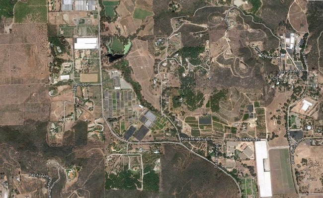
2985 N Twin Oaks Valley Rd, San Marcos, CA 92069

NEARBY LISTINGS FOR SALE OR LEASE
Property Detail
2985 N Twin Oaks Valley Rd
182-180-23
SEC 26-11-3W NEQ 19.40 AC M/L IN
Horticulturegrowinghousesagricultural
San Diego
AE
California
06073C0783G
17.58 AC
2024
Outlying SD County N
2025
San Diego
019208
San Diego-Chula Vista-Carlsbad, CA
DEMOGRAPHICS near 2985 N Twin Oaks Valley Rd
1 Mile
3 Mile
5 Mile
2024 Total Population
838
24,155
167,878
2029 Population
840
23,852
166,594
Pop Growth 2024-2029
+ 0.24%
(1.25%)
(0.76%)
Average Age
42
41
39
2024 Total Households
263
7,893
54,406
HH Growth 2024-2029
0.00%
(1.53%)
(0.93%)
Median Household Inc
$85,185
$123,023
$88,806
Avg Household Size
3.10
3.00
3.00
2024 Avg HH Vehicles
3.00
2.00
2.00
Median Home Value
$834,710
$777,268
$695,385
Median Year Built
1977
1987
1982
Nearby Places
Map Layers
Map Styles
 Street
 Aerial
- Restaurants
- Banks
- Shops
- Fitness
- Groceries
Nearby Properties
Address
Land Use
TOTAL SIZE
Lot Size
Zoning
Address
Land Use
TOTAL SIZE
Lot Size
Zoning
59,858 SF
12.12 AC
A70
Address
Land Use
TOTAL SIZE
Lot Size
Zoning
78,352 SF
4.83 AC
RU
Address
Land Use
TOTAL SIZE
Lot Size
Zoning
77,128 SF
4.44 AC
RU
Address
Land Use
TOTAL SIZE
Lot Size
Zoning
48,342 SF
4.07 AC
L-I
Address
Land Use
TOTAL SIZE
Lot Size
Zoning
52,551 SF
20.80 AC
C42
Address
Land Use
TOTAL SIZE
Lot Size
Zoning
18.24 AC
R-2
Address
Land Use
TOTAL SIZE
Lot Size
Zoning
33,035 SF
11.23 AC
A70
Address
Land Use
TOTAL SIZE
Lot Size
Zoning
49,607 SF
3.38 AC
SPA
Address
Land Use
TOTAL SIZE
Lot Size
Zoning
94,980 SF
8.18 AC
R-2
Address
Land Use
TOTAL SIZE
Lot Size
Zoning
13.96 AC
A70
Address
Land Use
TOTAL SIZE
Lot Size
Zoning
62,304 SF
4.42 AC
SPA
Address
Land Use
TOTAL SIZE
Lot Size
Zoning
68.66 AC
S82
Address
Land Use
TOTAL SIZE
Lot Size
Zoning
3,433 SF
1.58 AC
C36
Address
Land Use
TOTAL SIZE
Lot Size
Zoning
42,911 SF
7.04 AC
C36
Address
Land Use
TOTAL SIZE
Lot Size
Zoning
6.50 AC
A70
Address
Land Use
TOTAL SIZE
Lot Size
Zoning
7,179 SF
19.73 AC
A70
Address
Land Use
TOTAL SIZE
Lot Size
Zoning
223.56 AC
S92
Address
Land Use
TOTAL SIZE
Lot Size
Zoning
47.71 AC
S82
Address
Land Use
TOTAL SIZE
Lot Size
Zoning
13.29 AC
A-2
Address
Land Use
TOTAL SIZE
Lot Size
Zoning
4,147 SF
6.84 AC
A70
Address
Land Use
TOTAL SIZE
Lot Size
Zoning
3.60 AC
A70
Address
Land Use
TOTAL SIZE
Lot Size
Zoning
175.81 AC
S82
Address
Land Use
TOTAL SIZE
Lot Size
Zoning
166.50 AC
S92
Address
Land Use
TOTAL SIZE
Lot Size
Zoning
17.28 AC
A70
Address
Land Use
TOTAL SIZE
Lot Size
Zoning
2,790 SF
1.70 AC
C36
Address
Land Use
TOTAL SIZE
Lot Size
Zoning
7,789 SF
11.57 AC
A70
Address
Land Use
TOTAL SIZE
Lot Size
Zoning
1,700 SF
19.40 AC
A70
Address
Land Use
TOTAL SIZE
Lot Size
Zoning
30,000 SF
4.42 AC
I / I (SP)
Address
Land Use
TOTAL SIZE
Lot Size
Zoning
23,815 SF
1.10 AC
S88
Address
Land Use
TOTAL SIZE
Lot Size
Zoning
1,440 SF
9.34 AC
A70
The World's #1 Commercial Real Estate Marketplace
Connect with us
© 2026 CoStar Group
The information above has been obtained from sources believed reliable. While we do not doubt its accuracy we have not verified it and make no guarantee, warranty or representation about it. It is your responsibility to independently confirm its accuracy and completeness. Any projections, opinions, assumptions, or estimates used are for example only and do not represent the current or future performance of the property. The value of this transaction to you depends on tax and other factors which should be evaluated by your tax, financial, and legal advisors. You and your advisors should conduct a careful, independent investigation of the property to determine to your satisfaction the suitability of the property for your needs.