Property Record
299 Adams St, Bedford Hills, NY 10507
NEARBY LISTINGS FOR SALE OR LEASE
Property Detail
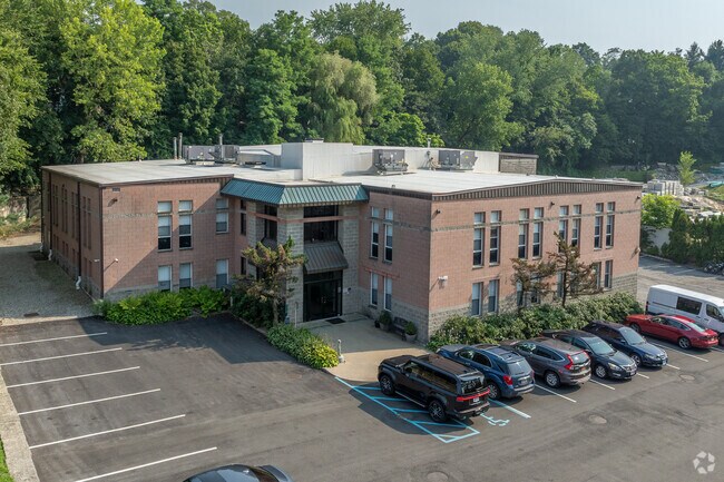
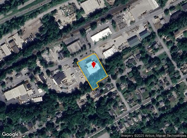
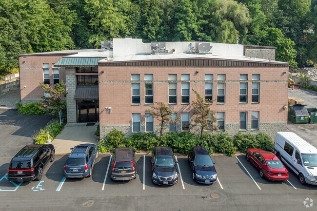
299 Adams St
2000-060-014-00003-000-0038
Westchester
Distributionwarehouseregional
New York
X
38.000
36119C0152F
1.20 AC
2025
North
2024
Westchester/So Connecticut
012804
New York-Jersey City-White Plains, NY-NJ
DEMOGRAPHICS near 299 Adams St
1 Mile
3 Mile
5 Mile
2024 Total Population
6,780
19,472
43,879
2029 Population
6,697
19,212
43,022
Pop Growth 2024-2029
(1.22%)
(1.34%)
(1.95%)
Average Age
40
42
42
2024 Total Households
2,059
6,815
14,931
HH Growth 2024-2029
(1.46%)
(1.50%)
(2.16%)
Median Household Inc
$96,825
$116,976
$146,336
Avg Household Size
2.70
2.60
2.80
2024 Avg HH Vehicles
2.00
2.00
2.00
Median Home Value
$686,015
$711,434
$744,709
Median Year Built
1965
1966
1966
Nearby Places
- Restaurants
- Banks
- Shops
- Fitness
- Groceries
PUBLIC TRANSPORTATION
TRANSIT/SUBWAY
Bedford Hills Station (Harlem Line - Metro-North Commuter Railroad Company (Metro-North))
DRIVE
WALK
Distance
Bedford Hills Station (Harlem Line - Metro-North Commuter Railroad Company (Metro-North))
2 min
15 min
0.8 mi
COMMUTER RAIL
Bedford Hills Station (Harlem Line - Metro-North Commuter Railroad Company (Metro-North))
DRIVE
WALK
Distance
Bedford Hills Station (Harlem Line - Metro-North Commuter Railroad Company (Metro-North))
2 min
15 min
0.8 mi
Katonah Station (Harlem Line - Metro-North Commuter Railroad Company (Metro-North))
DRIVE
WALK
Distance
Katonah Station (Harlem Line - Metro-North Commuter Railroad Company (Metro-North))
4 min
1.9 mi
AIRPORT
Westchester County
DRIVE
WALK
Distance
Westchester County
25 min
17.0 mi
New York Stewart International
DRIVE
WALK
Distance
New York Stewart International
66 min
40.9 mi
LaGuardia
DRIVE
WALK
Distance
LaGuardia
58 min
42.3 mi
Freight Ports
NY - Red Hook Container Terminal
DRIVE
WALK
Distance
NY - Red Hook Container Terminal
71 min
50.4 mi
Nearby Properties
Address
Land Use
TOTAL SIZE
Lot Size
Zoning
Address
Land Use
TOTAL SIZE
Lot Size
Zoning
31 AC
ML
Address
Land Use
TOTAL SIZE
Lot Size
Zoning
80.80 AC
Address
Land Use
TOTAL SIZE
Lot Size
Zoning
540,000 SF
206.12 AC
Address
Land Use
TOTAL SIZE
Lot Size
Zoning
Address
Land Use
TOTAL SIZE
Lot Size
Zoning
92.34 AC
Address
Land Use
TOTAL SIZE
Lot Size
Zoning
18.08 AC
Address
Land Use
TOTAL SIZE
Lot Size
Zoning
54.14 AC
Address
Land Use
TOTAL SIZE
Lot Size
Zoning
11.71 AC
Address
Land Use
TOTAL SIZE
Lot Size
Zoning
143.80 AC
Address
Land Use
TOTAL SIZE
Lot Size
Zoning
7.62 AC
RM-29
Address
Land Use
TOTAL SIZE
Lot Size
Zoning
14.14 AC
Address
Land Use
TOTAL SIZE
Lot Size
Zoning
3.67 AC
CL
Address
Land Use
TOTAL SIZE
Lot Size
Zoning
3.13 AC
MG
Address
Land Use
TOTAL SIZE
Lot Size
Zoning
Address
Land Use
TOTAL SIZE
Lot Size
Zoning
6.26 AC
GC
Address
Land Use
TOTAL SIZE
Lot Size
Zoning
Address
Land Use
TOTAL SIZE
Lot Size
Zoning
80.94 AC
Address
Land Use
TOTAL SIZE
Lot Size
Zoning
4.20 AC
MG
Address
Land Use
TOTAL SIZE
Lot Size
Zoning
142.69 AC
Address
Land Use
TOTAL SIZE
Lot Size
Zoning
3.21 AC
CL
Address
Land Use
TOTAL SIZE
Lot Size
Zoning
9.80 AC
Address
Land Use
TOTAL SIZE
Lot Size
Zoning
Address
Land Use
TOTAL SIZE
Lot Size
Zoning
130.31 AC
Address
Land Use
TOTAL SIZE
Lot Size
Zoning
Address
Land Use
TOTAL SIZE
Lot Size
Zoning
Address
Land Use
TOTAL SIZE
Lot Size
Zoning
0.74 AC
CB-1
Address
Land Use
TOTAL SIZE
Lot Size
Zoning
2.59 AC
RM-29
Address
Land Use
TOTAL SIZE
Lot Size
Zoning
1.21 AC
MG
Address
Land Use
TOTAL SIZE
Lot Size
Zoning
Address
Land Use
TOTAL SIZE
Lot Size
Zoning
The World's #1 Commercial Real Estate Marketplace
Connect with us
© 2025 CoStar Group
The information above has been obtained from sources believed reliable. While we do not doubt its accuracy we have not verified it and make no guarantee, warranty or representation about it. It is your responsibility to independently confirm its accuracy and completeness. Any projections, opinions, assumptions, or estimates used are for example only and do not represent the current or future performance of the property. The value of this transaction to you depends on tax and other factors which should be evaluated by your tax, financial, and legal advisors. You and your advisors should conduct a careful, independent investigation of the property to determine to your satisfaction the suitability of the property for your needs.