Property Record
263 Wells Mills Rd, Waretown, NJ 08758


NEARBY LISTINGS FOR SALE OR LEASE
Property Detail
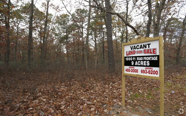
263 Wells Mills Rd
Lakewood-New Brunswick, NJ
1.66 AC
21-00056-0000-00013-03
Ocean
Vacantlandnec
New Jersey
A
13.3
34029C0411F
1.66 AC
2024
Ocean County
2025
Northern New Jersey
733002
DEMOGRAPHICS near 263 Wells Mills Rd
1 Mile
3 Mile
5 Mile
2024 Total Population
1,958
23,968
60,945
2029 Population
2,081
25,748
65,267
Pop Growth 2024-2029
+ 6.28%
+ 7.43%
+ 7.09%
Average Age
62
45
43
2024 Total Households
992
9,858
23,611
HH Growth 2024-2029
+ 6.25%
+ 6.99%
+ 6.70%
Median Household Inc
$91,443
$88,812
$86,822
Avg Household Size
2.00
2.40
2.50
2024 Avg HH Vehicles
2.00
2.00
2.00
Median Home Value
$425,188
$336,378
$321,780
Median Year Built
2005
1989
1987
Nearby Places
Map Layers
Map Styles
 Street
 Aerial
- Restaurants
- Banks
- Shops
- Fitness
- Groceries
PUBLIC TRANSPORTATION
AIRPORT
Atlantic City International
DRIVE
WALK
Distance
Atlantic City International
65 min
36.5 mi
Freight Ports
Port of Philadelphia
DRIVE
WALK
Distance
Port of Philadelphia
70 min
53.8 mi
SALE & LEASE HISTORY
LISTING DATE
SALE/LEASE

Sep 18, 2019
For Sale
Dec 27, 2017
For Sale
Nearby Properties
Address
Land Use
TOTAL SIZE
Lot Size
Zoning
Address
Land Use
TOTAL SIZE
Lot Size
Zoning
139.60 AC
M6
Address
Land Use
TOTAL SIZE
Lot Size
Zoning
85.65 AC
R40
Address
Land Use
TOTAL SIZE
Lot Size
Zoning
528.70 AC
M6
Address
Land Use
TOTAL SIZE
Lot Size
Zoning
15.27 AC
C-2
Address
Land Use
TOTAL SIZE
Lot Size
Zoning
46.40 AC
ML-4
Address
Land Use
TOTAL SIZE
Lot Size
Zoning
85.65 AC
R40
Address
Land Use
TOTAL SIZE
Lot Size
Zoning
7.49 AC
R20
Address
Land Use
TOTAL SIZE
Lot Size
Zoning
2.76 AC
TC
Address
Land Use
TOTAL SIZE
Lot Size
Zoning
15.12 AC
R-2
Address
Land Use
TOTAL SIZE
Lot Size
Zoning
9.32 AC
TCO+
Address
Land Use
TOTAL SIZE
Lot Size
Zoning
6,600 SF
10.67 AC
PRD
Address
Land Use
TOTAL SIZE
Lot Size
Zoning
67,548 SF
10.98 AC
CN
Address
Land Use
TOTAL SIZE
Lot Size
Zoning
86,000 SF
2.87 AC
R20
Address
Land Use
TOTAL SIZE
Lot Size
Zoning
11.24 AC
R-2
Address
Land Use
TOTAL SIZE
Lot Size
Zoning
37.70 AC
TCMX
Address
Land Use
TOTAL SIZE
Lot Size
Zoning
23.70 AC
BCWD
Address
Land Use
TOTAL SIZE
Lot Size
Zoning
89.90 AC
R-2
Address
Land Use
TOTAL SIZE
Lot Size
Zoning
56.23 AC
BC
Address
Land Use
TOTAL SIZE
Lot Size
Zoning
2,557 SF
633.96 AC
Address
Land Use
TOTAL SIZE
Lot Size
Zoning
18.15 AC
TCMX
Address
Land Use
TOTAL SIZE
Lot Size
Zoning
11,695 SF
9.31 AC
R20
Address
Land Use
TOTAL SIZE
Lot Size
Zoning
4,230 SF
10.65 AC
CPHD
Address
Land Use
TOTAL SIZE
Lot Size
Zoning
40 AC
TCEC
Address
Land Use
TOTAL SIZE
Lot Size
Zoning
4.85 AC
CPHD
Address
Land Use
TOTAL SIZE
Lot Size
Zoning
18,980 SF
4.19 AC
TCEC
Address
Land Use
TOTAL SIZE
Lot Size
Zoning
3.34 AC
C-1
Address
Land Use
TOTAL SIZE
Lot Size
Zoning
16,992 SF
31.88 AC
FO
Address
Land Use
TOTAL SIZE
Lot Size
Zoning
52,212 SF
4.41 AC
TCCN
Address
Land Use
TOTAL SIZE
Lot Size
Zoning
13,092 SF
1.79 AC
C-2
Address
Land Use
TOTAL SIZE
Lot Size
Zoning
31,658 SF
5.88 AC
TCCN
The World's #1 Commercial Real Estate Marketplace
Connect with us
© 2026 CoStar Group
The information above has been obtained from sources believed reliable. While we do not doubt its accuracy we have not verified it and make no guarantee, warranty or representation about it. It is your responsibility to independently confirm its accuracy and completeness. Any projections, opinions, assumptions, or estimates used are for example only and do not represent the current or future performance of the property. The value of this transaction to you depends on tax and other factors which should be evaluated by your tax, financial, and legal advisors. You and your advisors should conduct a careful, independent investigation of the property to determine to your satisfaction the suitability of the property for your needs.