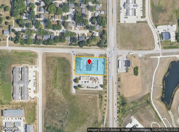
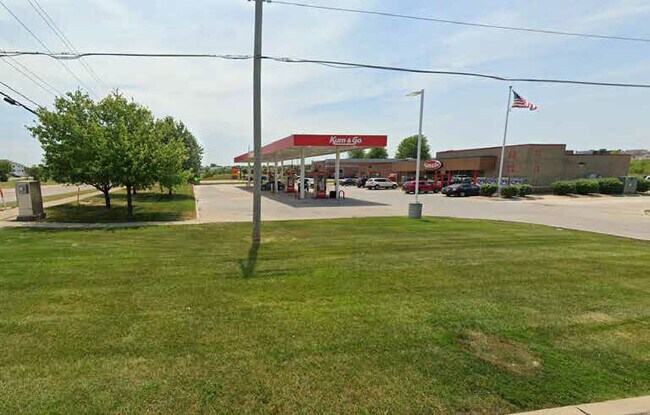
Property Record
2991 Sunset Dr, Norwalk, IA 50211


NEARBY LISTINGS FOR SALE OR LEASE
Property Detail
2991 Sunset Dr
Des Moines-West Des Moines, IA
The Legacy Plat
63170060010
12-77-25 NORWALK THE LEGACY PLAT 6 LOT 1
Storebuilding
Warren
X
Iowa
19181C0131F
1
2024
1.29 AC
2025
South
020202
Des Moines
4,700 SF
DEMOGRAPHICS near 2991 Sunset Dr
1 Mile
3 Mile
5 Mile
2024 Total Population
6,313
19,989
58,614
2029 Population
7,001
21,911
62,416
Pop Growth 2024-2029
+ 10.90%
+ 9.62%
+ 6.49%
Average Age
37
37
38
2024 Total Households
2,343
7,515
23,065
HH Growth 2024-2029
+ 11.35%
+ 9.85%
+ 6.56%
Median Household Inc
$94,745
$81,630
$69,320
Avg Household Size
2.60
2.60
2.50
2024 Avg HH Vehicles
2.00
2.00
2.00
Median Home Value
$244,431
$215,761
$187,528
Median Year Built
2004
1995
1977
Nearby Places
Map Layers
Map Styles
 Street
 Aerial
- Restaurants
- Banks
- Shops
- Fitness
- Groceries
PUBLIC TRANSPORTATION
AIRPORT
Des Moines International
DRIVE
WALK
Distance
Des Moines International
13 min
6.2 mi
Freight Ports
Port Milwaukee
DRIVE
WALK
Distance
Port Milwaukee
428 min
385.5 mi
SALE & LEASE HISTORY
LISTING DATE
SALE/LEASE

Jun 15, 2022
For Sale
Nearby Properties
Address
Land Use
TOTAL SIZE
Lot Size
Zoning
Address
Land Use
TOTAL SIZE
Lot Size
Zoning
351,427 SF
57.41 AC
Address
Land Use
TOTAL SIZE
Lot Size
Zoning
496,782 SF
59.32 AC
Address
Land Use
TOTAL SIZE
Lot Size
Zoning
283,760 SF
27.19 AC
Address
Land Use
TOTAL SIZE
Lot Size
Zoning
283,760 SF
14.96 AC
Address
Land Use
TOTAL SIZE
Lot Size
Zoning
227,640 SF
19.48 AC
Address
Land Use
TOTAL SIZE
Lot Size
Zoning
Address
Land Use
TOTAL SIZE
Lot Size
Zoning
290,292 SF
19.50 AC
Address
Land Use
TOTAL SIZE
Lot Size
Zoning
286,504 SF
23.31 AC
Address
Land Use
TOTAL SIZE
Lot Size
Zoning
397,938 SF
27.97 AC
PUD
Address
Land Use
TOTAL SIZE
Lot Size
Zoning
302,800 SF
20.85 AC
Address
Land Use
TOTAL SIZE
Lot Size
Zoning
298,716 SF
18.90 AC
PUD
Address
Land Use
TOTAL SIZE
Lot Size
Zoning
85,894 SF
38.49 AC
Address
Land Use
TOTAL SIZE
Lot Size
Zoning
93,889 SF
17.07 AC
Address
Land Use
TOTAL SIZE
Lot Size
Zoning
165,040 SF
23.54 AC
Address
Land Use
TOTAL SIZE
Lot Size
Zoning
161,788 SF
9.41 AC
PBP
Address
Land Use
TOTAL SIZE
Lot Size
Zoning
107,550 SF
7.30 AC
Address
Land Use
TOTAL SIZE
Lot Size
Zoning
131,361 SF
7.50 AC
Address
Land Use
TOTAL SIZE
Lot Size
Zoning
106,470 SF
0.56 AC
Address
Land Use
TOTAL SIZE
Lot Size
Zoning
86,789 SF
15.23 AC
Address
Land Use
TOTAL SIZE
Lot Size
Zoning
1,760 SF
15.58 AC
Address
Land Use
TOTAL SIZE
Lot Size
Zoning
74,210 SF
39.21 AC
Address
Land Use
TOTAL SIZE
Lot Size
Zoning
123,398 SF
8.62 AC
Address
Land Use
TOTAL SIZE
Lot Size
Zoning
82,044 SF
2.91 AC
Address
Land Use
TOTAL SIZE
Lot Size
Zoning
38,950 SF
9.99 AC
RM
Address
Land Use
TOTAL SIZE
Lot Size
Zoning
109,422 SF
16.09 AC
PBP
Address
Land Use
TOTAL SIZE
Lot Size
Zoning
178,721 SF
8.19 AC
C-2
Address
Land Use
TOTAL SIZE
Lot Size
Zoning
73,000 SF
4.07 AC
PUD
Address
Land Use
TOTAL SIZE
Lot Size
Zoning
44,047 SF
1.79 AC
Address
Land Use
TOTAL SIZE
Lot Size
Zoning
70,920 SF
3.75 AC
Address
Land Use
TOTAL SIZE
Lot Size
Zoning
73,860 SF
2.52 AC
The World's #1 Commercial Real Estate Marketplace
Connect with us
© 2025 CoStar Group
The information above has been obtained from sources believed reliable. While we do not doubt its accuracy we have not verified it and make no guarantee, warranty or representation about it. It is your responsibility to independently confirm its accuracy and completeness. Any projections, opinions, assumptions, or estimates used are for example only and do not represent the current or future performance of the property. The value of this transaction to you depends on tax and other factors which should be evaluated by your tax, financial, and legal advisors. You and your advisors should conduct a careful, independent investigation of the property to determine to your satisfaction the suitability of the property for your needs.