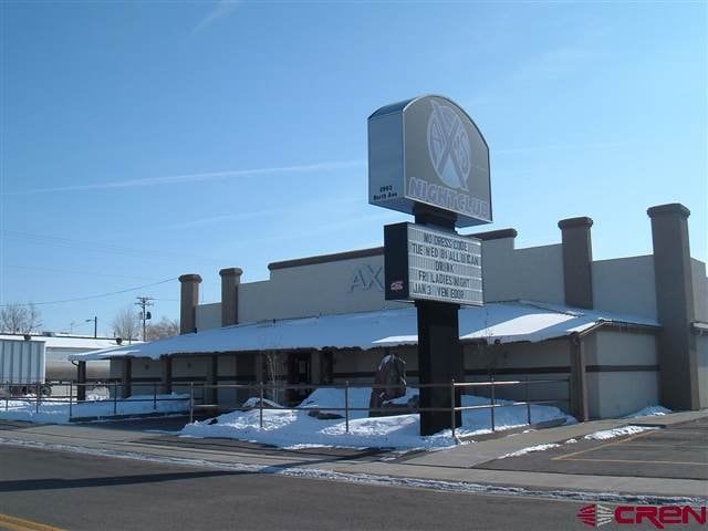
Property Record
2993 North Ave, Grand Junction, CO 81504


NEARBY LISTINGS FOR SALE OR LEASE
Property Detail
2993 North Ave
2943-171-00-242
BEG E 122.40FT & S 30FT FR NW COR NE4NE4NE4 SEC 17 1S 1E E 215FT S 155.50FT S 73DEG03 W 68.40FT S 60FT S 73DEG03 W 156.36FT N 284.03FT TO BEG
Commercialnec
Mesa
X
Colorado
08077C0828F
242
2023
1.15 AC
2024
Colorado Northwest Area
000801
Other Market Areas
8,763 SF
Grand Junction, CO
DEMOGRAPHICS near 2993 North Ave
1 mile
3 mile
5 mile
2024 Total Population
12,200
68,832
105,384
2029 Population
12,797
72,128
110,466
Pop Growth 2024-2029
+ 4.89%
+ 4.79%
+ 4.82%
Average Age
39
40
41
2024 Total Households
4,868
27,577
42,831
HH Growth 2024-2029
+ 5.01%
+ 4.83%
+ 4.93%
Median Household Inc
$49,739
$55,207
$57,262
Avg Household Size
2.40
2.40
2.30
2024 Avg HH Vehicles
2.00
2.00
2.00
Median Home Value
$231,841
$257,425
$279,979
Median Year Built
1986
1986
1983
Nearby Places
Map Layers
Map Styles
 Street
 Aerial
Transit
 Traffic
 Biking
Places
Listings with unknown addresses are not visible on the map
- Restaurants
- Banks
- Shops
- Fitness
- Groceries
PUBLIC TRANSPORTATION
COMMUTER RAIL
Drive
Walk
Distance
8 min
4.1 mi
AIRPORT
Grand Junction Regional
Drive
Walk
Distance
Grand Junction Regional
13 min
6.0 mi
SALE & LEASE HISTORY
LISTING DATE
SALE/LEASE

Sep 25, 2016
For Lease
Sep 24, 2016
For Sale
Oct 26, 2022
For Sale
Aug 14, 2017
For Sale
Nearby Properties
Address
Land Use
TOTAL SIZE
Lot Size
Zoning
Address
Land Use
TOTAL SIZE
Lot Size
Zoning
365,495 SF
20.90 AC
CSR
Address
Land Use
TOTAL SIZE
Lot Size
Zoning
429,786 SF
16.99 AC
CSR
Address
Land Use
TOTAL SIZE
Lot Size
Zoning
127,583 SF
12.35 AC
C-1
Address
Land Use
TOTAL SIZE
Lot Size
Zoning
227,855 SF
37.91 AC
Address
Land Use
TOTAL SIZE
Lot Size
Zoning
75,770 SF
82.62 AC
CSR
Address
Land Use
TOTAL SIZE
Lot Size
Zoning
105,693 SF
18.23 AC
CSR
Address
Land Use
TOTAL SIZE
Lot Size
Zoning
110,905 SF
29.81 AC
RSF-4
Address
Land Use
TOTAL SIZE
Lot Size
Zoning
112,810 SF
6.33 AC
MU
Address
Land Use
TOTAL SIZE
Lot Size
Zoning
95,382 SF
16.48 AC
RSF-4
Address
Land Use
TOTAL SIZE
Lot Size
Zoning
63,015 SF
26.01 AC
Address
Land Use
TOTAL SIZE
Lot Size
Zoning
222,950 SF
17.36 AC
C-1
Address
Land Use
TOTAL SIZE
Lot Size
Zoning
60,530 SF
8.42 AC
Address
Land Use
TOTAL SIZE
Lot Size
Zoning
53,104 SF
22.43 AC
AFT
Address
Land Use
TOTAL SIZE
Lot Size
Zoning
52,342 SF
19.28 AC
Address
Land Use
TOTAL SIZE
Lot Size
Zoning
57,297 SF
9.39 AC
RSF-4
Address
Land Use
TOTAL SIZE
Lot Size
Zoning
133,087 SF
11.76 AC
C-2
Address
Land Use
TOTAL SIZE
Lot Size
Zoning
68,700 SF
0.16 AC
Address
Land Use
TOTAL SIZE
Lot Size
Zoning
66,566 SF
5.40 AC
Address
Land Use
TOTAL SIZE
Lot Size
Zoning
59,174 SF
9.70 AC
RSF-R
Address
Land Use
TOTAL SIZE
Lot Size
Zoning
51,675 SF
8.37 AC
CSR
Address
Land Use
TOTAL SIZE
Lot Size
Zoning
50,754 SF
6.97 AC
RMF-24
Address
Land Use
TOTAL SIZE
Lot Size
Zoning
17,764 SF
6.81 AC
C-2
Address
Land Use
TOTAL SIZE
Lot Size
Zoning
36,425 SF
10 AC
Address
Land Use
TOTAL SIZE
Lot Size
Zoning
81,321 SF
8.68 AC
PD
Address
Land Use
TOTAL SIZE
Lot Size
Zoning
49,324 SF
6.94 AC
Address
Land Use
TOTAL SIZE
Lot Size
Zoning
47,178 SF
22.27 AC
RMF-8
Address
Land Use
TOTAL SIZE
Lot Size
Zoning
29,973 SF
12.20 AC
Address
Land Use
TOTAL SIZE
Lot Size
Zoning
169,134 SF
6.40 AC
C-2
Address
Land Use
TOTAL SIZE
Lot Size
Zoning
9,280 SF
1.30 AC
C-1 & O
The World's #1 Commercial Real Estate Marketplace
Connect with us
© 2026 CoStar Group
The information above has been obtained from sources believed reliable. While we do not doubt its accuracy we have not verified it and make no guarantee, warranty or representation about it. It is your responsibility to independently confirm its accuracy and completeness. Any projections, opinions, assumptions, or estimates used are for example only and do not represent the current or future performance of the property. The value of this transaction to you depends on tax and other factors which should be evaluated by your tax, financial, and legal advisors. You and your advisors should conduct a careful, independent investigation of the property to determine to your satisfaction the suitability of the property for your needs.