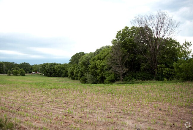
Property Record
67 Address Unassigned, Hanover, MN 55341

NEARBY LISTINGS FOR SALE OR LEASE
Property Detail
67 Address Unassigned
Minneapolis-St. Paul-Bloomington, MN-WI
Unplatted 36 120 24
36-120-24-33-0002
UNPLATTED 36 120 24 THAT PART OF SW 1/4 OF SW 1/4 COM AT A PT 66 FT S FROM CTR PT OF S END OF DAM TH E 150 FT TH N TO CROW RIVER TH WLY ALONG RIVER TO A PT 50 T IRREGULAR
Residentialacreage
Hennepin
AE
Minnesota
27053C0018F
0.18 AC
2024
Northwest
2024
Minneapolis/St Paul
026912
DEMOGRAPHICS near 67 Address Unassigned
1 Mile
3 Mile
5 Mile
2024 Total Population
1,886
8,890
27,921
2029 Population
2,054
9,731
30,454
Pop Growth 2024-2029
+ 8.91%
+ 9.46%
+ 9.07%
Average Age
37
38
37
2024 Total Households
619
2,943
9,220
HH Growth 2024-2029
+ 8.56%
+ 9.28%
+ 8.99%
Median Household Inc
$130,000
$129,427
$125,452
Avg Household Size
3.00
3.00
3.00
2024 Avg HH Vehicles
2.00
2.00
2.00
Median Home Value
$373,243
$374,919
$358,269
Median Year Built
2001
2001
1998
Nearby Places
Map Layers
Map Styles
 Street
 Aerial
- Restaurants
- Banks
- Shops
- Fitness
- Groceries
PUBLIC TRANSPORTATION
AIRPORT
Minneapolis-St Paul International/Wold-Chamberlain
DRIVE
WALK
Distance
Minneapolis-St Paul International/Wold-Chamberlain
58 min
40.6 mi
Freight Ports
Port Milwaukee
DRIVE
WALK
Distance
Port Milwaukee
410 min
365.7 mi
SALE & LEASE HISTORY
LISTING DATE
SALE/LEASE

Sep 24, 2016
For Sale
Feb 24, 2020
For Sale
Apr 04, 2017
For Sale
Nearby Properties
Address
Land Use
TOTAL SIZE
Lot Size
Zoning
Address
Land Use
TOTAL SIZE
Lot Size
Zoning
Address
Land Use
TOTAL SIZE
Lot Size
Zoning
6.44 AC
Address
Land Use
TOTAL SIZE
Lot Size
Zoning
71,030 SF
27.94 AC
Address
Land Use
TOTAL SIZE
Lot Size
Zoning
Address
Land Use
TOTAL SIZE
Lot Size
Zoning
28.73 AC
Address
Land Use
TOTAL SIZE
Lot Size
Zoning
Address
Land Use
TOTAL SIZE
Lot Size
Zoning
9,872 SF
20.08 AC
Address
Land Use
TOTAL SIZE
Lot Size
Zoning
31,632 SF
37.97 AC
Address
Land Use
TOTAL SIZE
Lot Size
Zoning
61.51 AC
Address
Land Use
TOTAL SIZE
Lot Size
Zoning
2,316 SF
4.70 AC
Address
Land Use
TOTAL SIZE
Lot Size
Zoning
14,000 SF
3.97 AC
Address
Land Use
TOTAL SIZE
Lot Size
Zoning
2,890 SF
16.54 AC
Address
Land Use
TOTAL SIZE
Lot Size
Zoning
Address
Land Use
TOTAL SIZE
Lot Size
Zoning
161.02 AC
Address
Land Use
TOTAL SIZE
Lot Size
Zoning
13,162 SF
12 AC
Address
Land Use
TOTAL SIZE
Lot Size
Zoning
Address
Land Use
TOTAL SIZE
Lot Size
Zoning
16,593 SF
4.45 AC
Address
Land Use
TOTAL SIZE
Lot Size
Zoning
62.40 AC
Address
Land Use
TOTAL SIZE
Lot Size
Zoning
6,589 SF
4.78 AC
Address
Land Use
TOTAL SIZE
Lot Size
Zoning
2,640 SF
1.62 AC
Address
Land Use
TOTAL SIZE
Lot Size
Zoning
99.05 AC
Address
Land Use
TOTAL SIZE
Lot Size
Zoning
2,250 SF
1.79 AC
Address
Land Use
TOTAL SIZE
Lot Size
Zoning
2,968 SF
113.46 AC
Address
Land Use
TOTAL SIZE
Lot Size
Zoning
9,000 SF
1.55 AC
Address
Land Use
TOTAL SIZE
Lot Size
Zoning
7,068 SF
3.98 AC
Address
Land Use
TOTAL SIZE
Lot Size
Zoning
33.51 AC
Address
Land Use
TOTAL SIZE
Lot Size
Zoning
9,582 SF
5 AC
Address
Land Use
TOTAL SIZE
Lot Size
Zoning
3,481 SF
1.63 AC
Address
Land Use
TOTAL SIZE
Lot Size
Zoning
76.88 AC
The World's #1 Commercial Real Estate Marketplace
Connect with us
© 2025 CoStar Group
The information above has been obtained from sources believed reliable. While we do not doubt its accuracy we have not verified it and make no guarantee, warranty or representation about it. It is your responsibility to independently confirm its accuracy and completeness. Any projections, opinions, assumptions, or estimates used are for example only and do not represent the current or future performance of the property. The value of this transaction to you depends on tax and other factors which should be evaluated by your tax, financial, and legal advisors. You and your advisors should conduct a careful, independent investigation of the property to determine to your satisfaction the suitability of the property for your needs.