Property Record
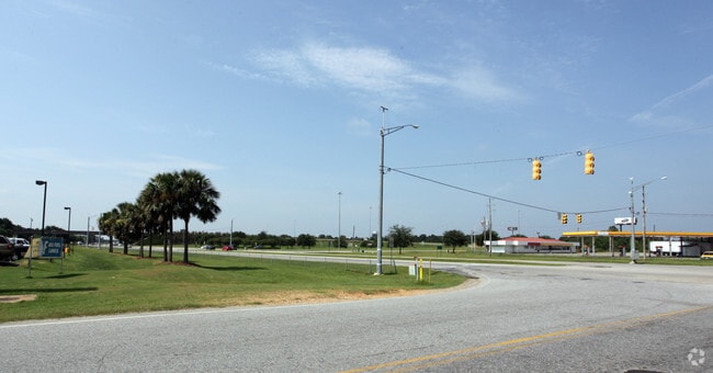
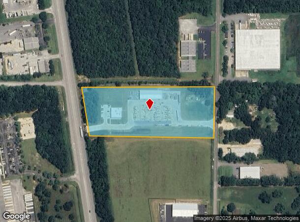
29946 State Highway 59, Loxley, AL 36551

NEARBY LISTINGS FOR SALE OR LEASE
-
-
View all Loxley listings for sale on LoopNet.com
Property Detail
29946 State Highway 59
Daphne-Fairhope-Foley, AL
Carlita Subdivision
33-08-34-0-000-008.001
LOT 1 CARLITA REPLAT 2 SUBDIVISION, SLIDE 2870-C&D,SLIDE-2876-E&F
Commercialacreage
Baldwin
X
Alabama
01003C0542M
1
2024
6.90 AC
2024
Baldwin County
010903
Mobile
DEMOGRAPHICS near 29946 State Highway 59
1 Mile
3 Mile
5 Mile
2024 Total Population
37
3,179
13,959
2029 Population
43
3,612
15,859
Pop Growth 2024-2029
+ 16.22%
+ 13.62%
+ 13.61%
Average Age
42
38
37
2024 Total Households
14
1,094
4,888
HH Growth 2024-2029
+ 14.29%
+ 12.98%
+ 13.05%
Median Household Inc
$51,667
$55,872
$62,023
Avg Household Size
2.50
2.60
2.70
2024 Avg HH Vehicles
3.00
2.00
2.00
Median Home Value
$174,999
$198,664
$202,692
Median Year Built
1993
1988
2000
Nearby Places
- Restaurants
- Banks
- Shops
- Fitness
- Groceries
PUBLIC TRANSPORTATION
AIRPORT
Mobile International
DRIVE
WALK
Distance
Mobile International
30 min
22.7 mi
Mobile Regional
DRIVE
WALK
Distance
Mobile Regional
53 min
36.3 mi
Freight Ports
Port of Mobile
DRIVE
WALK
Distance
Port of Mobile
25 min
19.3 mi
SALE & LEASE HISTORY
LISTING DATE
SALE/LEASE

Sep 24, 2016
For Sale
Sep 15, 2021
For Sale
Nearby Properties
Address
Land Use
TOTAL SIZE
Lot Size
Zoning
Address
Land Use
TOTAL SIZE
Lot Size
Zoning
583,381 SF
147 AC
Address
Land Use
TOTAL SIZE
Lot Size
Zoning
178,238 SF
15 AC
Address
Land Use
TOTAL SIZE
Lot Size
Zoning
827,037 SF
106 AC
Address
Land Use
TOTAL SIZE
Lot Size
Zoning
234,545 SF
12.20 AC
Address
Land Use
TOTAL SIZE
Lot Size
Zoning
125,294 SF
7 AC
Address
Land Use
TOTAL SIZE
Lot Size
Zoning
66,448 SF
8 AC
Address
Land Use
TOTAL SIZE
Lot Size
Zoning
81,447 SF
6.30 AC
Address
Land Use
TOTAL SIZE
Lot Size
Zoning
144,122 SF
7.60 AC
Address
Land Use
TOTAL SIZE
Lot Size
Zoning
144,111 SF
6.90 AC
Address
Land Use
TOTAL SIZE
Lot Size
Zoning
48,343 SF
3 AC
Address
Land Use
TOTAL SIZE
Lot Size
Zoning
4,613 SF
6.40 AC
Address
Land Use
TOTAL SIZE
Lot Size
Zoning
39,082 SF
1.67 AC
Address
Land Use
TOTAL SIZE
Lot Size
Zoning
42,423 SF
2.95 AC
Address
Land Use
TOTAL SIZE
Lot Size
Zoning
8,830 SF
4.40 AC
Address
Land Use
TOTAL SIZE
Lot Size
Zoning
24,920 SF
5.10 AC
Address
Land Use
TOTAL SIZE
Lot Size
Zoning
6,148 SF
1.12 AC
Address
Land Use
TOTAL SIZE
Lot Size
Zoning
20,000 SF
4.60 AC
Address
Land Use
TOTAL SIZE
Lot Size
Zoning
17,000 SF
6.90 AC
Address
Land Use
TOTAL SIZE
Lot Size
Zoning
6.60 AC
Address
Land Use
TOTAL SIZE
Lot Size
Zoning
73,949 SF
3 AC
Address
Land Use
TOTAL SIZE
Lot Size
Zoning
17,021 SF
0.81 AC
Address
Land Use
TOTAL SIZE
Lot Size
Zoning
18,053 SF
4 AC
Address
Land Use
TOTAL SIZE
Lot Size
Zoning
5,334 SF
2.51 AC
Address
Land Use
TOTAL SIZE
Lot Size
Zoning
24,640 SF
2.20 AC
Address
Land Use
TOTAL SIZE
Lot Size
Zoning
10,007 SF
1.14 AC
Address
Land Use
TOTAL SIZE
Lot Size
Zoning
14,656 SF
17 AC
Address
Land Use
TOTAL SIZE
Lot Size
Zoning
Address
Land Use
TOTAL SIZE
Lot Size
Zoning
19,436 SF
3 AC
Address
Land Use
TOTAL SIZE
Lot Size
Zoning
3,340 SF
7 AC
Address
Land Use
TOTAL SIZE
Lot Size
Zoning
28,713 SF
2.50 AC
The World's #1 Commercial Real Estate Marketplace
Connect with us
© 2025 CoStar Group
The information above has been obtained from sources believed reliable. While we do not doubt its accuracy we have not verified it and make no guarantee, warranty or representation about it. It is your responsibility to independently confirm its accuracy and completeness. Any projections, opinions, assumptions, or estimates used are for example only and do not represent the current or future performance of the property. The value of this transaction to you depends on tax and other factors which should be evaluated by your tax, financial, and legal advisors. You and your advisors should conduct a careful, independent investigation of the property to determine to your satisfaction the suitability of the property for your needs.