Property Record
2995 E Flamingo Rd, Las Vegas, NV 89121
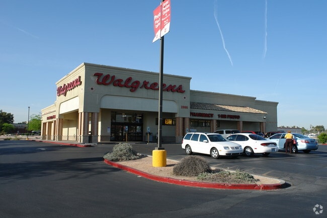


Property Detail
2995 E Flamingo Rd
162-24-112-010
FLAMINGO MCLEOD MEDICAL COMPLEX PLAT BOOK 53 PAGE 7 PT LOT 1
Storebuilding
Clark
C1
Nevada
B and X Area of moderate flood hazard, usually the area between the limits of the 100-year and 500-year floods.
1
2026
1.52 AC
2026
Central East Las Vegas
001711
Las Vegas
13,841 SF
Las Vegas-Henderson-North Las Vegas, NV
NEARBY LISTINGS FOR SALE OR LEASE
DEMOGRAPHICS near 2995 E Flamingo Rd
1 mile
3 mile
5 mile
2025 Total Population
18,168
194,041
476,497
2030 Population
19,035
202,840
499,245
Pop Growth 2025-2030
+ 4.77%
+ 4.53%
+ 4.77%
Average Age
44
40
40
2025 Total Households
7,964
80,210
188,699
HH Growth 2025-2030
+ 4.78%
+ 4.46%
+ 4.98%
Median Household Inc
$64,029
$51,707
$56,278
Avg Household Size
2.20
2.30
2.40
2025 Avg HH Vehicles
2.00
1.00
1.00
Median Home Value
$375,909
$337,774
$357,003
Median Year Built
1980
1978
1985
Nearby Places
Map Layers
Map Styles
 Street
 Aerial
Layers
 Traffic
 Biking
Places
Listings with unknown addresses are not visible on the map
- Restaurants
- Banks
- Shops
- Fitness
- Groceries
PUBLIC TRANSPORTATION
AIRPORT
Harry Reid International
Drive
Walk
Distance
Harry Reid International
10 min
4.8 mi
Boulder City Municipal
Drive
Walk
Distance
Boulder City Municipal
30 min
21.2 mi
Nearby Properties
Address
Land Use
TOTAL SIZE
Lot Size
Zoning
Address
Land Use
TOTAL SIZE
Lot Size
Zoning
74,148 SF
18.51 AC
Address
Land Use
TOTAL SIZE
Lot Size
Zoning
79.03 AC
PF
Address
Land Use
TOTAL SIZE
Lot Size
Zoning
524,471 SF
59.01 AC
Address
Land Use
TOTAL SIZE
Lot Size
Zoning
323,696 SF
24.62 AC
H1
Address
Land Use
TOTAL SIZE
Lot Size
Zoning
76.93 AC
PF
Address
Land Use
TOTAL SIZE
Lot Size
Zoning
48.58 AC
PF
Address
Land Use
TOTAL SIZE
Lot Size
Zoning
265,609 SF
47.36 AC
H1
Address
Land Use
TOTAL SIZE
Lot Size
Zoning
138.07 AC
PF
Address
Land Use
TOTAL SIZE
Lot Size
Zoning
94,198 SF
34.53 AC
H1
Address
Land Use
TOTAL SIZE
Lot Size
Zoning
281,120 SF
21.38 AC
Address
Land Use
TOTAL SIZE
Lot Size
Zoning
56.95 AC
PF
Address
Land Use
TOTAL SIZE
Lot Size
Zoning
345,133 SF
27.01 AC
H1
Address
Land Use
TOTAL SIZE
Lot Size
Zoning
157,191 SF
5.97 AC
Address
Land Use
TOTAL SIZE
Lot Size
Zoning
5,120 SF
14.60 AC
H1
Address
Land Use
TOTAL SIZE
Lot Size
Zoning
5.39 AC
Address
Land Use
TOTAL SIZE
Lot Size
Zoning
44.69 AC
PF
Address
Land Use
TOTAL SIZE
Lot Size
Zoning
549,077 SF
2.90 AC
H1
Address
Land Use
TOTAL SIZE
Lot Size
Zoning
50,000 SF
72.01 AC
PF
Address
Land Use
TOTAL SIZE
Lot Size
Zoning
34,020 SF
7.37 AC
H1
Address
Land Use
TOTAL SIZE
Lot Size
Zoning
25,128 SF
3.48 AC
C:H-1
Address
Land Use
TOTAL SIZE
Lot Size
Zoning
72.03 AC
PF
Address
Land Use
TOTAL SIZE
Lot Size
Zoning
709,943 SF
43.10 AC
C2
Address
Land Use
TOTAL SIZE
Lot Size
Zoning
6,396 SF
15.06 AC
Address
Land Use
TOTAL SIZE
Lot Size
Zoning
95,928 SF
3.71 AC
C:U-V
Address
Land Use
TOTAL SIZE
Lot Size
Zoning
8,611 SF
10 AC
H1
Address
Land Use
TOTAL SIZE
Lot Size
Zoning
239,785 SF
2.20 AC
C:R-5
Address
Land Use
TOTAL SIZE
Lot Size
Zoning
340,439 SF
3.50 AC
C:H-1
Address
Land Use
TOTAL SIZE
Lot Size
Zoning
513,085 SF
53.27 AC
C2
Address
Land Use
TOTAL SIZE
Lot Size
Zoning
88,061 SF
16.87 AC
H1
Address
Land Use
TOTAL SIZE
Lot Size
Zoning
336,359 SF
1.69 AC
H1
The World's #1 Commercial Real Estate Marketplace
Connect with us
© 2026 CoStar Group
The information above has been obtained from sources believed reliable. While we do not doubt its accuracy we have not verified it and make no guarantee, warranty or representation about it. It is your responsibility to independently confirm its accuracy and completeness. Any projections, opinions, assumptions, or estimates used are for example only and do not represent the current or future performance of the property. The value of this transaction to you depends on tax and other factors which should be evaluated by your tax, financial, and legal advisors. You and your advisors should conduct a careful, independent investigation of the property to determine to your satisfaction the suitability of the property for your needs.