Property Record
2997 Shelburne Rd, Shelburne, VT 05482

NEARBY LISTINGS FOR SALE OR LEASE
Property Detail
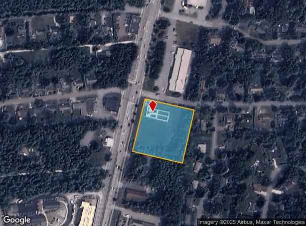
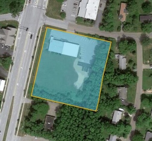
2997 Shelburne Rd
(183) 700-2997
1.73A; COMM BLDG
Commercialnec
Chittenden
X
Vermont
50007C0262D
1.73 AC
0
Other Market Areas
2024
Burlington-South Burlington, VT
003401
DEMOGRAPHICS near 2997 Shelburne Rd
1 Mile
3 Mile
5 Mile
2024 Total Population
3,401
18,986
54,799
2029 Population
3,540
19,445
55,678
Pop Growth 2024-2029
+ 4.09%
+ 2.42%
+ 1.60%
Average Age
45
43
38
2024 Total Households
1,427
8,082
22,136
HH Growth 2024-2029
+ 4.48%
+ 2.60%
+ 1.75%
Median Household Inc
$117,123
$112,987
$85,552
Avg Household Size
2.30
2.30
2.10
2024 Avg HH Vehicles
2.00
2.00
2.00
Median Home Value
$482,469
$470,094
$434,292
Median Year Built
1985
1986
1978
Nearby Places
Map Layers
Map Styles
 Street
 Aerial
- Restaurants
- Banks
- Shops
- Fitness
- Groceries
PUBLIC TRANSPORTATION
COMMUTER RAIL
Btn (Ethan Allen Express - Amtrak)
DRIVE
WALK
Distance
Btn (Ethan Allen Express - Amtrak)
12 min
5.3 mi
AIRPORT
Patrick Leahy Burlington International
DRIVE
WALK
Distance
Patrick Leahy Burlington International
22 min
9.4 mi
Plattsburgh International
DRIVE
WALK
Distance
Plattsburgh International
74 min
38.8 mi
Freight Ports
Montreal
DRIVE
WALK
Distance
Montreal
133 min
102.1 mi
SALE & LEASE HISTORY
LISTING DATE
SALE/LEASE

Feb 09, 2021
For Sale
Nearby Properties
Address
Land Use
TOTAL SIZE
Lot Size
Zoning
Address
Land Use
TOTAL SIZE
Lot Size
Zoning
Address
Land Use
TOTAL SIZE
Lot Size
Zoning
1,339.01 AC
Address
Land Use
TOTAL SIZE
Lot Size
Zoning
216,574 SF
15.36 AC
Address
Land Use
TOTAL SIZE
Lot Size
Zoning
14.89 AC
ELM
Address
Land Use
TOTAL SIZE
Lot Size
Zoning
13.71 AC
NAC
Address
Land Use
TOTAL SIZE
Lot Size
Zoning
6.44 AC
RL
Address
Land Use
TOTAL SIZE
Lot Size
Zoning
54,831 SF
6 AC
Address
Land Use
TOTAL SIZE
Lot Size
Zoning
10.29 AC
Address
Land Use
TOTAL SIZE
Lot Size
Zoning
Address
Land Use
TOTAL SIZE
Lot Size
Zoning
Address
Land Use
TOTAL SIZE
Lot Size
Zoning
137.42 AC
Address
Land Use
TOTAL SIZE
Lot Size
Zoning
Address
Land Use
TOTAL SIZE
Lot Size
Zoning
Address
Land Use
TOTAL SIZE
Lot Size
Zoning
Address
Land Use
TOTAL SIZE
Lot Size
Zoning
126,230 SF
Address
Land Use
TOTAL SIZE
Lot Size
Zoning
13.41 AC
Address
Land Use
TOTAL SIZE
Lot Size
Zoning
Address
Land Use
TOTAL SIZE
Lot Size
Zoning
78,540 SF
3.13 AC
Address
Land Use
TOTAL SIZE
Lot Size
Zoning
65,280 SF
2.43 AC
Address
Land Use
TOTAL SIZE
Lot Size
Zoning
Address
Land Use
TOTAL SIZE
Lot Size
Zoning
62,422 SF
8.14 AC
Address
Land Use
TOTAL SIZE
Lot Size
Zoning
54,946 SF
1.42 AC
Address
Land Use
TOTAL SIZE
Lot Size
Zoning
2.68 AC
Address
Land Use
TOTAL SIZE
Lot Size
Zoning
38.22 AC
Address
Land Use
TOTAL SIZE
Lot Size
Zoning
27.37 AC
Address
Land Use
TOTAL SIZE
Lot Size
Zoning
25,068 SF
1.40 AC
Address
Land Use
TOTAL SIZE
Lot Size
Zoning
Address
Land Use
TOTAL SIZE
Lot Size
Zoning
33,564 SF
2.81 AC
ELM
Address
Land Use
TOTAL SIZE
Lot Size
Zoning
Address
Land Use
TOTAL SIZE
Lot Size
Zoning
41.34 AC
The World's #1 Commercial Real Estate Marketplace
Connect with us
© 2025 CoStar Group
The information above has been obtained from sources believed reliable. While we do not doubt its accuracy we have not verified it and make no guarantee, warranty or representation about it. It is your responsibility to independently confirm its accuracy and completeness. Any projections, opinions, assumptions, or estimates used are for example only and do not represent the current or future performance of the property. The value of this transaction to you depends on tax and other factors which should be evaluated by your tax, financial, and legal advisors. You and your advisors should conduct a careful, independent investigation of the property to determine to your satisfaction the suitability of the property for your needs.