Property Record
2999 Schurz Ave, Bronx, NY 10465
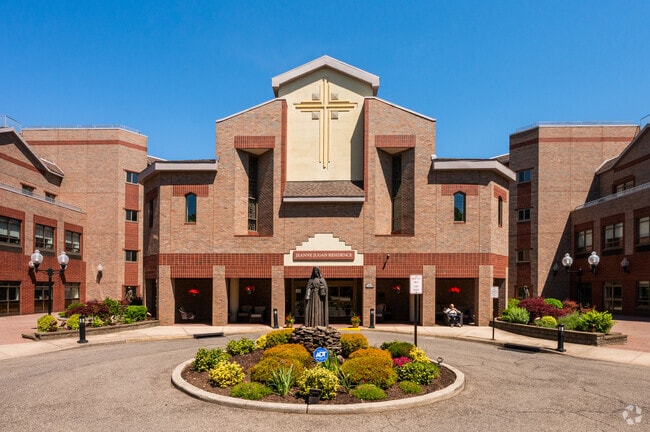


Property Detail
2999 Schurz Ave
05452-0090
Bronx
Governmentalpublicusegeneral
New York
R4A
90
B and X Area of moderate flood hazard, usually the area between the limits of the 100-year and 500-year floods.
2.38 AC
0
Throgs Neck-Edgewater Park
2026
Westchester/So Connecticut
011800
New York-Jersey City-White Plains, NY-NJ
158,282 SF
NEARBY LISTINGS FOR SALE OR LEASE
DEMOGRAPHICS near 2999 Schurz Ave
1 mile
3 mile
5 mile
2025 Total Population
22,243
252,150
1,019,224
2030 Population
20,863
239,521
991,186
Pop Growth 2025-2030
(6.20%)
(5.01%)
(2.75%)
Average Age
41
42
41
2025 Total Households
7,852
90,130
355,954
HH Growth 2025-2030
(7.22%)
(5.48%)
(3.19%)
Median Household Inc
$71,972
$68,107
$57,901
Avg Household Size
2.60
2.70
2.70
2025 Avg HH Vehicles
1.00
1.00
1.00
Median Home Value
$618,075
$690,612
$682,710
Median Year Built
1958
1956
1957
Nearby Places
Map Layers
Map Styles
 Street
 Aerial
Layers
 Traffic
 Biking
Places
Listings with unknown addresses are not visible on the map
- Restaurants
- Banks
- Shops
- Fitness
- Groceries
PUBLIC TRANSPORTATION
COMMUTER RAIL
Murray Hill Station (Port Washington Branch - Long Island Rail Road)
Drive
Walk
Distance
Murray Hill Station (Port Washington Branch - Long Island Rail Road)
13 min
6.6 mi
Broadway Station (Port Washington Branch - Long Island Rail Road)
Drive
Walk
Distance
Broadway Station (Port Washington Branch - Long Island Rail Road)
11 min
6.8 mi
AIRPORT
LaGuardia
Drive
Walk
Distance
LaGuardia
20 min
9.0 mi
John F Kennedy International
Drive
Walk
Distance
John F Kennedy International
25 min
16.8 mi
Westchester County
Drive
Walk
Distance
Westchester County
37 min
23.7 mi
Freight Ports
NY - Red Hook Container Terminal
Drive
Walk
Distance
NY - Red Hook Container Terminal
33 min
21.5 mi
Nearby Properties
Address
Land Use
TOTAL SIZE
Lot Size
Zoning
Address
Land Use
TOTAL SIZE
Lot Size
Zoning
5,000 SF
363.58 AC
PARK
Address
Land Use
TOTAL SIZE
Lot Size
Zoning
1,012,000 SF
7.79 AC
R6
Address
Land Use
TOTAL SIZE
Lot Size
Zoning
485,484 SF
39.63 AC
R5
Address
Land Use
TOTAL SIZE
Lot Size
Zoning
703,265 SF
83.45 AC
R4
Address
Land Use
TOTAL SIZE
Lot Size
Zoning
421,996 SF
136.05 AC
R3-1
Address
Land Use
TOTAL SIZE
Lot Size
Zoning
4,050 SF
113.40 AC
PARK
Address
Land Use
TOTAL SIZE
Lot Size
Zoning
851,821 SF
7.95 AC
R4
Address
Land Use
TOTAL SIZE
Lot Size
Zoning
489,326 SF
19.18 AC
C8-1
Address
Land Use
TOTAL SIZE
Lot Size
Zoning
14,681 SF
97 AC
PARK
Address
Land Use
TOTAL SIZE
Lot Size
Zoning
361,354 SF
C4-2
Address
Land Use
TOTAL SIZE
Lot Size
Zoning
510 SF
68.73 AC
PARK
Address
Land Use
TOTAL SIZE
Lot Size
Zoning
601,260 SF
3.27 AC
R4
Address
Land Use
TOTAL SIZE
Lot Size
Zoning
450,879 SF
9.10 AC
M1-1
Address
Land Use
TOTAL SIZE
Lot Size
Zoning
450,000 SF
5.59 AC
R6
Address
Land Use
TOTAL SIZE
Lot Size
Zoning
726,051 SF
33.66 AC
R5
Address
Land Use
TOTAL SIZE
Lot Size
Zoning
274,840 SF
2.80 AC
M1-1
Address
Land Use
TOTAL SIZE
Lot Size
Zoning
533,460 SF
27.75 AC
M1-1
Address
Land Use
TOTAL SIZE
Lot Size
Zoning
454,631 SF
24.61 AC
M1-1
Address
Land Use
TOTAL SIZE
Lot Size
Zoning
1,172,800 SF
19.66 AC
R4
Address
Land Use
TOTAL SIZE
Lot Size
Zoning
262,716 SF
2.80 AC
M1-1
Address
Land Use
TOTAL SIZE
Lot Size
Zoning
15.83 AC
M2-1
Address
Land Use
TOTAL SIZE
Lot Size
Zoning
164,110 SF
8.07 AC
M1-2
Address
Land Use
TOTAL SIZE
Lot Size
Zoning
239,223 SF
2.66 AC
R4
Address
Land Use
TOTAL SIZE
Lot Size
Zoning
330,240 SF
13.62 AC
C4-1
Address
Land Use
TOTAL SIZE
Lot Size
Zoning
172,268 SF
2.03 AC
C4-4
Address
Land Use
TOTAL SIZE
Lot Size
Zoning
105,000 SF
0.85 AC
R5
Address
Land Use
TOTAL SIZE
Lot Size
Zoning
1,021,752 SF
6.93 AC
R6
Address
Land Use
TOTAL SIZE
Lot Size
Zoning
163,200 SF
3.33 AC
R5
Address
Land Use
TOTAL SIZE
Lot Size
Zoning
127,291 SF
8.07 AC
M1-2
Address
Land Use
TOTAL SIZE
Lot Size
Zoning
366,375 SF
12.03 AC
M1-1
The World's #1 Commercial Real Estate Marketplace
Connect with us
© 2026 CoStar Group
The information above has been obtained from sources believed reliable. While we do not doubt its accuracy we have not verified it and make no guarantee, warranty or representation about it. It is your responsibility to independently confirm its accuracy and completeness. Any projections, opinions, assumptions, or estimates used are for example only and do not represent the current or future performance of the property. The value of this transaction to you depends on tax and other factors which should be evaluated by your tax, financial, and legal advisors. You and your advisors should conduct a careful, independent investigation of the property to determine to your satisfaction the suitability of the property for your needs.