Property Record
2Nd St, Quintana, TX 77541


Save to a Folder
{{folder.Name}}
{{folder.ListingIds.length}} Properties
{{folder.ListingIds.length}} Property
Create a New Folder
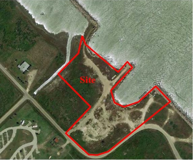
Property Detail
2Nd St
7163-0570-000
QUINTANA BLK 27 (ALL) ACRES 20.8102
Agriculturalland
BRAZORIA
0169
Texas
VE and V1-30 Coastal areas with a 1% or greater chance of flooding and an additional hazard associated with storm waves. These areas have a 26% chance of flooding over the life of a 30-year mortgage.
20.81 AC
2024
South Hwy 35
2025
Houston
664200
Houston-Pasadena-The Woodlands, TX
NEARBY LISTINGS FOR SALE OR LEASE
-
-
View all Quintana listings for sale on LoopNet.com
DEMOGRAPHICS near 2Nd St
1 mile
3 mile
5 mile
2025 Total Population
754
2,526
15,590
2030 Population
917
3,024
17,785
Pop Growth 2025-2030
+ 21.62%
+ 19.71%
+ 14.08%
Average Age
50
47
39
2025 Total Households
375
1,172
5,824
HH Growth 2025-2030
+ 21.87%
+ 20.48%
+ 14.89%
Median Household Inc
$79,167
$71,491
$53,108
Avg Household Size
2.00
2.20
2.70
2025 Avg HH Vehicles
2.00
2.00
2.00
Median Home Value
$354,629
$329,151
$212,178
Median Year Built
1985
1983
1979
Nearby Places
Map Layers
Map Styles
 Street
 Aerial
Layers
 Traffic
 Biking
Places
Listings with unknown addresses are not visible on the map
- Restaurants
- Banks
- Shops
- Fitness
- Groceries
SALE & LEASE HISTORY
LISTING DATE
SALE/LEASE

Sep 24, 2016
For Sale
Nov 11, 2019
For Sale
Mar 31, 2017
For Sale
Nearby Properties
Address
Land Use
TOTAL SIZE
Lot Size
Zoning
Address
Land Use
TOTAL SIZE
Lot Size
Zoning
Address
Land Use
TOTAL SIZE
Lot Size
Zoning
Address
Land Use
TOTAL SIZE
Lot Size
Zoning
Address
Land Use
TOTAL SIZE
Lot Size
Zoning
15.78 AC
0130
Address
Land Use
TOTAL SIZE
Lot Size
Zoning
10,390 SF
4.84 AC
Address
Land Use
TOTAL SIZE
Lot Size
Zoning
65.10 AC
0014
Address
Land Use
TOTAL SIZE
Lot Size
Zoning
64,756 SF
26.71 AC
0200
Address
Land Use
TOTAL SIZE
Lot Size
Zoning
833.28 AC
0230
Address
Land Use
TOTAL SIZE
Lot Size
Zoning
4.65 AC
0110
Address
Land Use
TOTAL SIZE
Lot Size
Zoning
13.80 AC
0850
Address
Land Use
TOTAL SIZE
Lot Size
Zoning
29,466 SF
11.19 AC
0261
Address
Land Use
TOTAL SIZE
Lot Size
Zoning
23,900 SF
14.18 AC
Address
Land Use
TOTAL SIZE
Lot Size
Zoning
9,640 SF
3.41 AC
Address
Land Use
TOTAL SIZE
Lot Size
Zoning
46,955 SF
2.60 AC
Address
Land Use
TOTAL SIZE
Lot Size
Zoning
14,720 SF
4.74 AC
0080
Address
Land Use
TOTAL SIZE
Lot Size
Zoning
5,996 SF
0.27 AC
0014
Address
Land Use
TOTAL SIZE
Lot Size
Zoning
30,000 SF
3.88 AC
Address
Land Use
TOTAL SIZE
Lot Size
Zoning
6,000 SF
10.77 AC
0200
Address
Land Use
TOTAL SIZE
Lot Size
Zoning
18,950 SF
17.77 AC
0165
Address
Land Use
TOTAL SIZE
Lot Size
Zoning
6,242 SF
0.19 AC
Address
Land Use
TOTAL SIZE
Lot Size
Zoning
6.97 AC
0150
Address
Land Use
TOTAL SIZE
Lot Size
Zoning
11,712 SF
34.39 AC
Address
Land Use
TOTAL SIZE
Lot Size
Zoning
24.76 AC
0150
Address
Land Use
TOTAL SIZE
Lot Size
Zoning
5.84 AC
Address
Land Use
TOTAL SIZE
Lot Size
Zoning
45,150 SF
1.03 AC
Address
Land Use
TOTAL SIZE
Lot Size
Zoning
192.19 AC
0030
Address
Land Use
TOTAL SIZE
Lot Size
Zoning
9,202 SF
0.45 AC
Address
Land Use
TOTAL SIZE
Lot Size
Zoning
3,145 SF
2.25 AC
Address
Land Use
TOTAL SIZE
Lot Size
Zoning
3,350 SF
1.15 AC
0001
Address
Land Use
TOTAL SIZE
Lot Size
Zoning
15 AC
0630
The World's #1 Commercial Real Estate Marketplace
Connect with us
© 2026 CoStar Group
The information above has been obtained from sources believed reliable. While we do not doubt its accuracy we have not verified it and make no guarantee, warranty or representation about it. It is your responsibility to independently confirm its accuracy and completeness. Any projections, opinions, assumptions, or estimates used are for example only and do not represent the current or future performance of the property. The value of this transaction to you depends on tax and other factors which should be evaluated by your tax, financial, and legal advisors. You and your advisors should conduct a careful, independent investigation of the property to determine to your satisfaction the suitability of the property for your needs.