Property Record
2S425 S Lorang Rd, Elburn, IL 60119
NEARBY LISTINGS FOR SALE OR LEASE
Property Detail
2S425 S Lorang Rd
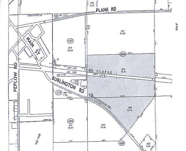
11-30-100-003
THAT PT OF THE NE 1/4 OF SEC 10-41-6 LYING S OF THE SLY LINE OF RAILROAD ROW
Commercialnec
Kane
X
Illinois
17089C0305J
2.27 AC
2024
Western East/West Corr
2024
Chicago
8507032013
Chicago-Naperville-Elgin, IL-IN-WI
DEMOGRAPHICS near 2S425 S Lorang Rd
1 Mile
3 Mile
5 Mile
2024 Total Population
333
2,173
10,363
2029 Population
313
2,118
10,251
Pop Growth 2024-2029
(6.01%)
(2.53%)
(1.08%)
Average Age
44
42
39
2024 Total Households
135
808
3,724
HH Growth 2024-2029
(5.93%)
(2.72%)
(1.24%)
Median Household Inc
$80,833
$111,714
$105,456
Avg Household Size
2.50
2.70
2.80
2024 Avg HH Vehicles
2.00
3.00
2.00
Median Home Value
$322,115
$389,790
$328,129
Median Year Built
1970
1989
1994
Nearby Places
Map Layers
Map Styles
 Street
 Aerial
- Restaurants
- Banks
- Shops
- Fitness
- Groceries
PUBLIC TRANSPORTATION
COMMUTER RAIL
Elburn Station (Union Pacific West Line - Northeast Illinois Regional Commuter Railroad (Metra))
DRIVE
WALK
Distance
Elburn Station (Union Pacific West Line - Northeast Illinois Regional Commuter Railroad (Metra))
13 min
6.2 mi
La Fox Station (Union Pacific West Line - Northeast Illinois Regional Commuter Railroad (Metra))
DRIVE
WALK
Distance
La Fox Station (Union Pacific West Line - Northeast Illinois Regional Commuter Railroad (Metra))
16 min
7.8 mi
Freight Ports
Port Milwaukee
DRIVE
WALK
Distance
Port Milwaukee
147 min
117.0 mi
Nearby Properties
Address
Land Use
TOTAL SIZE
Lot Size
Zoning
Address
Land Use
TOTAL SIZE
Lot Size
Zoning
Address
Land Use
TOTAL SIZE
Lot Size
Zoning
20.34 AC
Address
Land Use
TOTAL SIZE
Lot Size
Zoning
Address
Land Use
TOTAL SIZE
Lot Size
Zoning
64.07 AC
Address
Land Use
TOTAL SIZE
Lot Size
Zoning
4.57 AC
Address
Land Use
TOTAL SIZE
Lot Size
Zoning
Address
Land Use
TOTAL SIZE
Lot Size
Zoning
24.48 AC
Address
Land Use
TOTAL SIZE
Lot Size
Zoning
Address
Land Use
TOTAL SIZE
Lot Size
Zoning
10.68 AC
Address
Land Use
TOTAL SIZE
Lot Size
Zoning
133.36 AC
Address
Land Use
TOTAL SIZE
Lot Size
Zoning
3,749 SF
0.48 AC
Address
Land Use
TOTAL SIZE
Lot Size
Zoning
1.90 AC
Address
Land Use
TOTAL SIZE
Lot Size
Zoning
Address
Land Use
TOTAL SIZE
Lot Size
Zoning
0.27 AC
Address
Land Use
TOTAL SIZE
Lot Size
Zoning
0.91 AC
Address
Land Use
TOTAL SIZE
Lot Size
Zoning
25.67 AC
Address
Land Use
TOTAL SIZE
Lot Size
Zoning
40.91 AC
Address
Land Use
TOTAL SIZE
Lot Size
Zoning
Address
Land Use
TOTAL SIZE
Lot Size
Zoning
Address
Land Use
TOTAL SIZE
Lot Size
Zoning
0.54 AC
Address
Land Use
TOTAL SIZE
Lot Size
Zoning
0.90 AC
Address
Land Use
TOTAL SIZE
Lot Size
Zoning
0.31 AC
The World's #1 Commercial Real Estate Marketplace
Connect with us
© 2025 CoStar Group
The information above has been obtained from sources believed reliable. While we do not doubt its accuracy we have not verified it and make no guarantee, warranty or representation about it. It is your responsibility to independently confirm its accuracy and completeness. Any projections, opinions, assumptions, or estimates used are for example only and do not represent the current or future performance of the property. The value of this transaction to you depends on tax and other factors which should be evaluated by your tax, financial, and legal advisors. You and your advisors should conduct a careful, independent investigation of the property to determine to your satisfaction the suitability of the property for your needs.