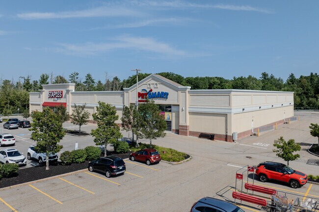
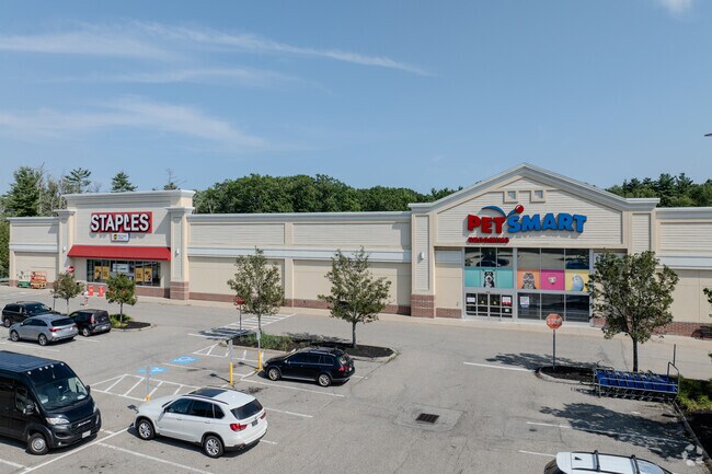
Property Record
3 Alfred St, Biddeford, ME 04005

Property Detail
3 Alfred St
BIDD-000002-000000-000027
YORK
Departmentstore
Maine
B2
27
B and X Area of moderate flood hazard, usually the area between the limits of the 100-year and 500-year floods.
5.18 AC
2025
York County
2025
Portland/South Portland
025203
Portland-South Portland, ME
40,129 SF
NEARBY LISTINGS FOR SALE OR LEASE
-
-
View all Biddeford listings for sale on LoopNet.com
DEMOGRAPHICS near 3 Alfred St
1 mile
3 mile
5 mile
2025 Total Population
602
14,252
39,020
2030 Population
629
14,394
39,630
Pop Growth 2025-2030
+ 4.49%
+ 1.00%
+ 1.56%
Average Age
43
43
42
2025 Total Households
230
6,114
16,681
HH Growth 2025-2030
+ 4.35%
+ 0.80%
+ 1.48%
Median Household Inc
$104,167
$74,607
$76,622
Avg Household Size
2.60
2.20
2.30
2025 Avg HH Vehicles
3.00
2.00
2.00
Median Home Value
$463,333
$395,022
$404,541
Median Year Built
1991
1964
1973
Nearby Places
Map Layers
Map Styles
 Street
 Aerial
Layers
 Traffic
 Biking
Places
Listings with unknown addresses are not visible on the map
- Restaurants
- Banks
- Shops
- Fitness
- Groceries
PUBLIC TRANSPORTATION
COMMUTER RAIL
Saco Amtrak Station (Downeaster - Amtrak)
Drive
Walk
Distance
Saco Amtrak Station (Downeaster - Amtrak)
7 min
3.9 mi
AIRPORT
Portland International Jetport
Drive
Walk
Distance
Portland International Jetport
24 min
17.0 mi
Freight Ports
Portland, ME
Drive
Walk
Distance
Portland, ME
25 min
19.6 mi
Nearby Properties
Address
Land Use
TOTAL SIZE
Lot Size
Zoning
Address
Land Use
TOTAL SIZE
Lot Size
Zoning
25.99 AC
M
Address
Land Use
TOTAL SIZE
Lot Size
Zoning
8.47 AC
R1B
Address
Land Use
TOTAL SIZE
Lot Size
Zoning
69,442 SF
1.12 AC
B2
Address
Land Use
TOTAL SIZE
Lot Size
Zoning
Address
Land Use
TOTAL SIZE
Lot Size
Zoning
118,458 SF
18.93 AC
B2
Address
Land Use
TOTAL SIZE
Lot Size
Zoning
136,033 SF
15.71 AC
B2
Address
Land Use
TOTAL SIZE
Lot Size
Zoning
262,580 SF
40.10 AC
I1
Address
Land Use
TOTAL SIZE
Lot Size
Zoning
197,008 SF
44.47 AC
B1
Address
Land Use
TOTAL SIZE
Lot Size
Zoning
91,642 SF
21.43 AC
R1A
Address
Land Use
TOTAL SIZE
Lot Size
Zoning
17.50 AC
B2
Address
Land Use
TOTAL SIZE
Lot Size
Zoning
119,500 SF
28.24 AC
B2
Address
Land Use
TOTAL SIZE
Lot Size
Zoning
35,008 SF
10.19 AC
RF SR1
Address
Land Use
TOTAL SIZE
Lot Size
Zoning
72,508 SF
2.57 AC
MSRD3
Address
Land Use
TOTAL SIZE
Lot Size
Zoning
15.36 AC
I1
Address
Land Use
TOTAL SIZE
Lot Size
Zoning
64,788 SF
25.50 AC
R1A
Address
Land Use
TOTAL SIZE
Lot Size
Zoning
77,406 SF
16 AC
R1A
Address
Land Use
TOTAL SIZE
Lot Size
Zoning
9.62 AC
B2
Address
Land Use
TOTAL SIZE
Lot Size
Zoning
39,580 SF
9.59 AC
R-2
Address
Land Use
TOTAL SIZE
Lot Size
Zoning
139,607 SF
13.20 AC
I1
Address
Land Use
TOTAL SIZE
Lot Size
Zoning
41,436 SF
6.61 AC
I3
Address
Land Use
TOTAL SIZE
Lot Size
Zoning
51,376 SF
7.12 AC
I3
Address
Land Use
TOTAL SIZE
Lot Size
Zoning
20.64 AC
B2
Address
Land Use
TOTAL SIZE
Lot Size
Zoning
62,025 SF
6.25 AC
B2
Address
Land Use
TOTAL SIZE
Lot Size
Zoning
5.17 AC
MSRD2
Address
Land Use
TOTAL SIZE
Lot Size
Zoning
40,493 SF
16.65 AC
B2
Address
Land Use
TOTAL SIZE
Lot Size
Zoning
43,659 SF
11.67 AC
R1A
Address
Land Use
TOTAL SIZE
Lot Size
Zoning
75,428 SF
7.76 AC
BI
Address
Land Use
TOTAL SIZE
Lot Size
Zoning
57,960 SF
1.26 AC
MSRD2
Address
Land Use
TOTAL SIZE
Lot Size
Zoning
1,560 SF
4.75 AC
B2
Address
Land Use
TOTAL SIZE
Lot Size
Zoning
11 AC
R3
The World's #1 Commercial Real Estate Marketplace
Connect with us
© 2026 CoStar Group
The information above has been obtained from sources believed reliable. While we do not doubt its accuracy we have not verified it and make no guarantee, warranty or representation about it. It is your responsibility to independently confirm its accuracy and completeness. Any projections, opinions, assumptions, or estimates used are for example only and do not represent the current or future performance of the property. The value of this transaction to you depends on tax and other factors which should be evaluated by your tax, financial, and legal advisors. You and your advisors should conduct a careful, independent investigation of the property to determine to your satisfaction the suitability of the property for your needs.