Property Record
3 Altarinda Rd, Orinda, CA 94563


Save to a Folder
{{folder.Name}}
{{folder.ListingIds.length}} Properties
{{folder.ListingIds.length}} Property
Create a New Folder
Property Detail
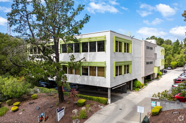
3 Altarinda Rd
Oakland-Fremont-Berkeley, CA
POR RO EL SOBRANTE EX 1/2 MR
260-192-014-9
CONTRA COSTA
Medicalbuilding
California
B and X Area of moderate flood hazard, usually the area between the limits of the 100-year and 500-year floods.
1
2025
1.21 AC
2026
Lamorinda
354002
East Bay/Oakland
15,468 SF
NEARBY LISTINGS FOR SALE OR LEASE
DEMOGRAPHICS near 3 Altarinda Rd
1 mile
3 mile
5 mile
2025 Total Population
5,225
27,797
176,797
2030 Population
5,286
28,031
177,395
Pop Growth 2025-2030
+ 1.17%
+ 0.84%
+ 0.34%
Average Age
45
45
41
2025 Total Households
1,969
10,275
66,833
HH Growth 2025-2030
+ 0.96%
+ 0.77%
+ 0.43%
Median Household Inc
$227,909
$231,347
$160,847
Avg Household Size
2.60
2.70
2.40
2025 Avg HH Vehicles
2.00
2.00
2.00
Median Home Value
$1,134,783
$1,131,728
$1,124,465
Median Year Built
1963
1964
1957
Nearby Places
Map Layers
Map Styles
 Street
 Aerial
Layers
 Traffic
 Biking
Places
Listings with unknown addresses are not visible on the map
- Restaurants
- Banks
- Shops
- Fitness
- Groceries
PUBLIC TRANSPORTATION
TRANSIT/SUBWAY
Orinda Station (Pittsburg/Bay Point - San Francisco International - Bay Area Rapid Transit (BART))
Drive
Walk
Distance
Orinda Station (Pittsburg/Bay Point - San Francisco International - Bay Area Rapid Transit (BART))
1 min
7 min
0.4 mi
COMMUTER RAIL
Drive
Walk
Distance
14 min
7.8 mi
Drive
Walk
Distance
14 min
9.6 mi
AIRPORT
Metro Oakland International
Drive
Walk
Distance
Metro Oakland International
24 min
16.5 mi
San Francisco International
Drive
Walk
Distance
San Francisco International
42 min
28.4 mi
Freight Ports
Port of Oakland
Drive
Walk
Distance
Port of Oakland
14 min
9.3 mi
Nearby Properties
Address
Land Use
TOTAL SIZE
Lot Size
Zoning
Address
Land Use
TOTAL SIZE
Lot Size
Zoning
963.58 AC
A80
Address
Land Use
TOTAL SIZE
Lot Size
Zoning
1,320 SF
27.04 AC
Address
Land Use
TOTAL SIZE
Lot Size
Zoning
16,632 SF
5.71 AC
Address
Land Use
TOTAL SIZE
Lot Size
Zoning
26,885 SF
1.92 AC
Address
Land Use
TOTAL SIZE
Lot Size
Zoning
7,100 SF
10.73 AC
Address
Land Use
TOTAL SIZE
Lot Size
Zoning
63,749 SF
3.86 AC
Address
Land Use
TOTAL SIZE
Lot Size
Zoning
18,015 SF
7.21 AC
Address
Land Use
TOTAL SIZE
Lot Size
Zoning
73,600 SF
1.45 AC
Address
Land Use
TOTAL SIZE
Lot Size
Zoning
82,500 SF
3.56 AC
Address
Land Use
TOTAL SIZE
Lot Size
Zoning
20,600 SF
6.88 AC
Address
Land Use
TOTAL SIZE
Lot Size
Zoning
9,798 SF
9.94 AC
Address
Land Use
TOTAL SIZE
Lot Size
Zoning
7,560 SF
1.26 AC
Address
Land Use
TOTAL SIZE
Lot Size
Zoning
28,153 SF
1.10 AC
Address
Land Use
TOTAL SIZE
Lot Size
Zoning
66,176 SF
41.71 AC
Address
Land Use
TOTAL SIZE
Lot Size
Zoning
9,216 SF
0.82 AC
Address
Land Use
TOTAL SIZE
Lot Size
Zoning
215.95 AC
Address
Land Use
TOTAL SIZE
Lot Size
Zoning
6,744 SF
1.54 AC
Address
Land Use
TOTAL SIZE
Lot Size
Zoning
21.79 AC
Address
Land Use
TOTAL SIZE
Lot Size
Zoning
8,893 SF
13.16 AC
Address
Land Use
TOTAL SIZE
Lot Size
Zoning
15,786 SF
0.97 AC
Address
Land Use
TOTAL SIZE
Lot Size
Zoning
14,904 SF
1.85 AC
Address
Land Use
TOTAL SIZE
Lot Size
Zoning
Address
Land Use
TOTAL SIZE
Lot Size
Zoning
42,689 SF
1.95 AC
Address
Land Use
TOTAL SIZE
Lot Size
Zoning
0.49 AC
Address
Land Use
TOTAL SIZE
Lot Size
Zoning
7,331 SF
10.85 AC
Address
Land Use
TOTAL SIZE
Lot Size
Zoning
9,652 SF
0.55 AC
Address
Land Use
TOTAL SIZE
Lot Size
Zoning
15,260 SF
1.09 AC
Address
Land Use
TOTAL SIZE
Lot Size
Zoning
10,348 SF
0.57 AC
Address
Land Use
TOTAL SIZE
Lot Size
Zoning
7,305 SF
13.19 AC
The World's #1 Commercial Real Estate Marketplace
Connect with us
© 2026 CoStar Group
The information above has been obtained from sources believed reliable. While we do not doubt its accuracy we have not verified it and make no guarantee, warranty or representation about it. It is your responsibility to independently confirm its accuracy and completeness. Any projections, opinions, assumptions, or estimates used are for example only and do not represent the current or future performance of the property. The value of this transaction to you depends on tax and other factors which should be evaluated by your tax, financial, and legal advisors. You and your advisors should conduct a careful, independent investigation of the property to determine to your satisfaction the suitability of the property for your needs.