Property Record
3 Barker Dr, Wallingford, CT 06492

Save to a Folder
{{folder.Name}}
{{folder.ListingIds.length}} Properties
{{folder.ListingIds.length}} Property
Create a New Folder
Property Detail
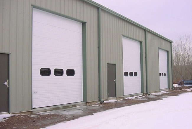
3 Barker Dr
WALL-000015-000000-000009
South Central Ct
Grainelevator
Connecticut
T30
9
AE The base floodplain where base flood elevations are provided. AE Zones are now used on new format FIRMs instead of A1-A30 Zones.
0.93 AC
2025
Wallingford
2025
Westchester/So Connecticut
175400
New Haven, CT
7,800 SF
NEARBY LISTINGS FOR SALE OR LEASE
DEMOGRAPHICS near 3 Barker Dr
1 mile
3 mile
5 mile
2025 Total Population
3,988
58,957
118,430
2030 Population
4,006
59,385
119,700
Pop Growth 2025-2030
+ 0.45%
+ 0.73%
+ 1.07%
Average Age
42
41
42
2025 Total Households
1,607
23,308
46,816
HH Growth 2025-2030
+ 0.31%
+ 0.67%
+ 1.04%
Median Household Inc
$81,066
$75,746
$85,200
Avg Household Size
2.40
2.40
2.40
2025 Avg HH Vehicles
2.00
2.00
2.00
Median Home Value
$254,969
$272,299
$304,706
Median Year Built
1972
1960
1964
Nearby Places
Map Layers
Map Styles
 Street
 Aerial
Layers
 Traffic
 Biking
Places
Listings with unknown addresses are not visible on the map
- Restaurants
- Banks
- Shops
- Fitness
- Groceries
PUBLIC TRANSPORTATION
COMMUTER RAIL
Meriden (Hartford Line - CONN DOT)
Drive
Walk
Distance
Meriden (Hartford Line - CONN DOT)
6 min
2.9 mi
Wallingford (Hartford Line - CONN DOT)
Drive
Walk
Distance
Wallingford (Hartford Line - CONN DOT)
7 min
3.8 mi
AIRPORT
Tweed/New Haven
Drive
Walk
Distance
Tweed/New Haven
32 min
19.7 mi
Freight Ports
Port of New Haven
Drive
Walk
Distance
Port of New Haven
28 min
17.4 mi
Nearby Properties
Address
Land Use
TOTAL SIZE
Lot Size
Zoning
Address
Land Use
TOTAL SIZE
Lot Size
Zoning
63,356 SF
154.26 AC
RM40
Address
Land Use
TOTAL SIZE
Lot Size
Zoning
41.91 AC
RU40
Address
Land Use
TOTAL SIZE
Lot Size
Zoning
2,400 SF
38.29 AC
M-3
Address
Land Use
TOTAL SIZE
Lot Size
Zoning
32.85 AC
RU40
Address
Land Use
TOTAL SIZE
Lot Size
Zoning
276,631 SF
27.60 AC
R-1
Address
Land Use
TOTAL SIZE
Lot Size
Zoning
105,252 SF
9.13 AC
I40
Address
Land Use
TOTAL SIZE
Lot Size
Zoning
34.10 AC
C-3
Address
Land Use
TOTAL SIZE
Lot Size
Zoning
245,122 SF
32.60 AC
R-1
Address
Land Use
TOTAL SIZE
Lot Size
Zoning
44.46 AC
R18
Address
Land Use
TOTAL SIZE
Lot Size
Zoning
329,296 SF
35.55 AC
IX
Address
Land Use
TOTAL SIZE
Lot Size
Zoning
339,844 SF
52.43 AC
M-4
Address
Land Use
TOTAL SIZE
Lot Size
Zoning
291,405 SF
104.81 AC
WI
Address
Land Use
TOTAL SIZE
Lot Size
Zoning
119,598 SF
18.43 AC
RF40
Address
Land Use
TOTAL SIZE
Lot Size
Zoning
23,920 SF
137.43 AC
R18
Address
Land Use
TOTAL SIZE
Lot Size
Zoning
11.02 AC
S-R
Address
Land Use
TOTAL SIZE
Lot Size
Zoning
172,027 SF
18.04 AC
RF40
Address
Land Use
TOTAL SIZE
Lot Size
Zoning
162,601 SF
11.44 AC
R-1
Address
Land Use
TOTAL SIZE
Lot Size
Zoning
72,256 SF
R18
Address
Land Use
TOTAL SIZE
Lot Size
Zoning
13.42 AC
RM6
Address
Land Use
TOTAL SIZE
Lot Size
Zoning
3,952 SF
21.76 AC
R-1
Address
Land Use
TOTAL SIZE
Lot Size
Zoning
26.45 AC
RF40
Address
Land Use
TOTAL SIZE
Lot Size
Zoning
153,180 SF
3.07 AC
TODH
Address
Land Use
TOTAL SIZE
Lot Size
Zoning
1.67 AC
TODP
Address
Land Use
TOTAL SIZE
Lot Size
Zoning
38,735 SF
Address
Land Use
TOTAL SIZE
Lot Size
Zoning
123,730 SF
40.31 AC
R18
Address
Land Use
TOTAL SIZE
Lot Size
Zoning
203,692 SF
21.22 AC
IX
Address
Land Use
TOTAL SIZE
Lot Size
Zoning
18.70 AC
RF40
Address
Land Use
TOTAL SIZE
Lot Size
Zoning
12 AC
RU40
Address
Land Use
TOTAL SIZE
Lot Size
Zoning
9.75 AC
RF40
Address
Land Use
TOTAL SIZE
Lot Size
Zoning
84,919 SF
7.53 AC
C-1
The World's #1 Commercial Real Estate Marketplace
Connect with us
© 2026 CoStar Group
The information above has been obtained from sources believed reliable. While we do not doubt its accuracy we have not verified it and make no guarantee, warranty or representation about it. It is your responsibility to independently confirm its accuracy and completeness. Any projections, opinions, assumptions, or estimates used are for example only and do not represent the current or future performance of the property. The value of this transaction to you depends on tax and other factors which should be evaluated by your tax, financial, and legal advisors. You and your advisors should conduct a careful, independent investigation of the property to determine to your satisfaction the suitability of the property for your needs.